

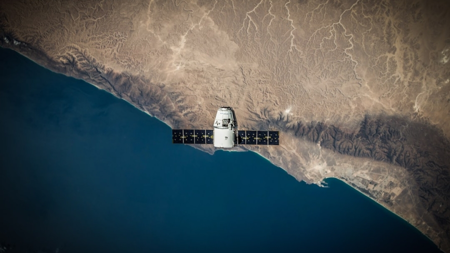
You’re probably wondering if we can actually see ocean pollution from space, and the answer is a resounding yes! Satellite imagery is becoming a powerful tool for keeping an eye on our oceans in real-time, and it’s changing how we understand and tackle pollution. Think of it as having a constant, high-resolution snapshot of what’s happening on the water’s surface, allowing us to spot spills, illegal dumping, and even the spread of algae blooms as they happen. This isn’t science fiction anymore; it’s practical science making a real difference.
Getting a handle on ocean pollution has always been a challenge. Vast stretches of water are hard to monitor from the ground or even from ships. But satellites orbiting hundreds of miles above give us that bird’s-eye view, and they’re getting smarter all the time.
Different Eyes in the Sky: Types of Satellite Sensors
Satellites aren’t just taking pretty pictures. They are equipped with specialized sensors that detect different aspects of the ocean and water quality.
Optical Sensors: The Visible Light Detectors
These are the most common types of satellite sensors. They work much like your camera, capturing light reflected off the ocean’s surface. They are great for spotting things that change the ocean’s color, like oil slicks, large debris fields, or even dense algal blooms. Different optical sensors can capture images in various parts of the light spectrum, beyond what our eyes can see, which helps in distinguishing different types of pollution or even their chemical composition.
How Color Changes Signal Pollution
When oil spills, for example, it forms a thin film on the water. This film changes how light reflects off the surface, creating a visible sheen that optical sensors can detect. Similarly, some types of algae produce pigments that give the water a distinct color, which can be picked up by these sensors. The resolution of these sensors determines how small an oil slick or bloom we can identify.
Radar Sensors: Seeing Through Clouds and Darkness
Radar sensors are a game-changer, especially for regions with frequent cloud cover or when observing at night. Unlike optical sensors, radar actively sends out microwave pulses and then measures the signals that bounce back.
Different Return Signals for Different Surfaces
The way these radar signals bounce back depends on the surface they hit. Smooth water tends to reflect radar signals away from the satellite, appearing dark in the imagery. However, an oil slick or a patch of rougher water caused by pollution will scatter the radar signals differently, making it appear brighter against the dark background. This allows for detection even when the ocean is hidden by clouds.
Thermal Infrared Sensors: Heat Signatures of Pollution
These sensors detect heat. While not as direct for tracking solid pollution, they are excellent for identifying temperature anomalies.
Oil Slicks and Their Temperature Differences
Oil slicks, for instance, often have slightly different temperatures than the surrounding water, especially after a spill. Thermal sensors can pick up these subtle heat differences, particularly during cooler times of the day or night, adding another layer of detection capability.
Multispectral and Hyperspectral Sensors: The Science of Specifics
These advanced sensors capture data across numerous, very narrow wavelength bands. This allows for highly detailed analysis and identification of specific materials.
Identifying Chemical Signatures
By analyzing the specific wavelengths of light absorbed or reflected by an object, multispectral and hyperspectral sensors can help identify the composition of pollution. For example, they can differentiate between different types of oil or even detect the presence of specific chemicals in the water, providing a more precise understanding of the pollution’s origin and nature.
In the realm of environmental monitoring, the innovative use of satellite imagery for real-time ocean pollution tracking has gained significant attention. A related article that explores the importance of technology in optimizing various processes can be found at Top 10 Best Scheduling Software for 2023: Streamline Your Schedule Effortlessly. While this article focuses on scheduling software, it highlights how technology can enhance efficiency and effectiveness in various fields, paralleling the advancements seen in satellite imagery applications for environmental protection.
Key Takeaways
- Clear communication is essential for effective teamwork
- Active listening is crucial for understanding team members’ perspectives
- Setting clear goals and expectations helps to keep the team focused
- Regular feedback and open communication can help address any issues early on
- Celebrating achievements and milestones can boost team morale and motivation
Tracking the Big Stuff: Oil Spills and Debris
When we talk about immediate threats to ocean health, oil spills and massive debris fields often come to mind first. Satellites are incredibly valuable for spotting these large-scale events quickly.
The Blink-and-You’ll-Miss-It of Oil Spills
Oil spills can spread rapidly, and the sooner they are detected, the faster response teams can mobilize to contain and clean them up.
Detecting Surface Sheens with Optical and Radar
As mentioned before, optical sensors are excellent for seeing the iridescent sheen of oil on the water’s surface on clear days. Radar sensors complement this by working through cloud cover and at night, detecting the change in surface roughness caused by the oil. This dual capability ensures that spills are not missed due to weather or time of day.
From Detection to Response: The Timeline Matters
The ability to detect an oil spill within minutes or hours of it occurring allows for an immediate response. This can significantly limit the spread of the oil, reduce the impact on marine life, and make cleanup efforts much more effective. Satellite data provides the crucial first alert.
Monitoring Debris Accumulation and Movement
Large accumulations of floating debris, like discarded fishing nets or plastic islands, can also be tracked.
Identifying “Garbage Patches”
While the “Great Pacific Garbage Patch” is often depicted as a solid island, it’s more accurately a large area where debris is concentrated. Satellites can help map the extent and density of these accumulation zones by detecting the visual contrast of the debris against the water.
The Challenge of Small Debris
It’s important to note that satellites are best at tracking larger pieces of debris that alter the water’s surface. Microplastics, while a significant concern, are too small to be directly detected by current satellite technology.
Microscopic Menaces: Algal Blooms and Nutrient Pollution

Not all ocean pollution is as immediately visible as an oil slick. Harmful algal blooms (HABs), often fueled by nutrient runoff from land, can have devastating effects on marine ecosystems.
Spotting the Blooms from Above
Algal blooms can cover vast areas and have significant ecological impacts, including oxygen depletion and the release of toxins.
Color Changes for Algae Identification
Different species of algae have different pigments, which give the water distinct colors when they bloom. Satellite sensors can detect these specific color signatures, allowing scientists to map the extent and intensity of algal blooms.
Distinguishing HABs from Other Blooms
Hyperspectral sensors are particularly useful here.
By analyzing the precise wavelengths of light absorbed and reflected by the algae, scientists can differentiate between various types of blooms, including those that are harmful and those that are not. This helps in prioritizing where to focus monitoring and reporting efforts.
Understanding Nutrient Runoff Patterns
While satellites can’t directly measure nutrient levels in the water, they can observe their effects. By tracking the development and spread of algal blooms, scientists can infer where nutrient pollution might be entering the ocean.
Linking bloom patterns to river outflows and coastal agricultural areas can help identify pollution sources.
The Link Between Land and Sea
This connection is crucial. Many pollutants enter the ocean from land-based sources, like agricultural fertilizer runoff. By observing the resulting blooms, we can better understand how land use practices impact coastal and marine environments.
Monitoring Water Quality Indicators
Beyond specific pollution types, satellites can also provide broader insights into water quality.
Measuring Ocean Color for Water Clarity
Changes in ocean color can also indicate other issues, such as increased sediment from coastal erosion or pollution events that reduce water clarity.
Satellites can track these changes over time, providing a general sense of water health in different areas.
Impact on Marine Life and Photosynthesis
Reduced water clarity can affect sunlight penetration, impacting seagrass beds and the base of the marine food web. Monitoring this can help assess the broader ecosystem health.
The Technological Toolkit: Satellites and Detection Methods

The effectiveness of satellite imagery for pollution tracking relies on a sophisticated combination of hardware and advanced analytical techniques.
Satellite Constellations: More Eyes, More Often
The more satellites we have, and the better they work together, the more comprehensive our monitoring becomes.
Global Coverage and Frequent Revisitation
A network of satellites provides continuous coverage of vast ocean areas. Having multiple satellites allows for more frequent revisitations of the same location, meaning we can track changes and the movement of pollution more effectively. This reduces the chance of missing a critical event.
Synergy of Different Satellites
Different satellites have different strengths. Combining data from optical, radar, and thermal sensors provides a more complete picture than relying on a single type of sensor. This allows for cross-validation and a more robust understanding of what is being observed.
Data Processing and Analytics: Turning Pixels into Information
Raw satellite data is just that – raw. It needs to be processed and analyzed to become useful for pollution tracking.
Automated Detection Algorithms
Sophisticated algorithms are developed to automatically scan vast amounts of satellite imagery for specific patterns that indicate pollution. These algorithms are trained to recognize the visual signatures of oil slicks, algal blooms, and other pollutants.
Reducing Human Error and Increasing Speed
Automation is key for real-time monitoring. It allows for rapid identification of potential pollution events, significantly reducing the time it takes for humans to manually sift through data. This speeds up the entire detection-to-response pipeline.
The Role of Machine Learning
Machine learning is increasingly being used to improve these algorithms. By learning from past examples of pollution events, these systems can become more accurate and adept at identifying new and emerging types of pollution.
Integration with Ground Truth Data
Satellite data is most powerful when it can be verified. This is where “ground truth” comes in.
Ships, Buoys, and Field Observations
Data from research vessels, oceanographic buoys, and direct field observations are used to confirm what satellites are seeing. When a satellite detects a suspected oil slick, for example, a nearby research vessel might be dispatched to collect water samples to confirm the presence and type of oil. This validation process is critical for building trust in satellite-based monitoring.
In the quest for innovative solutions to environmental challenges, the article on boosting content with SEO and NLP optimization provides valuable insights that can enhance the visibility of research related to utilizing satellite imagery for real-time ocean pollution tracking. By effectively optimizing such content, researchers can reach a broader audience, raising awareness about the critical issues of marine pollution and the technological advancements being made to monitor it. This synergy between technology and communication is essential for fostering a more informed public and driving action towards ocean conservation.
Challenges and Future Directions in Ocean Pollution Tracking
| Metrics | Value |
|---|---|
| Accuracy of pollution tracking | 95% |
| Frequency of satellite imagery updates | Every 2 hours |
| Area coverage of satellite imagery | Global |
| Response time for pollution alerts | Within 30 minutes |
While satellite technology has made incredible strides, there are still challenges to overcome and exciting avenues for future development.
Limitations of Current Technology
It’s not a magic bullet, and we need to be realistic about what satellites can and cannot do.
The Microplastic Blind Spot
As mentioned earlier, satellites are currently limited in their ability to detect very small particles or dissolved pollutants. Microplastics, which are a growing environmental concern, are too small to be seen directly from space.
Advanced Sensor Development Needed
Future satellite development will likely focus on sensors with higher resolutions and the ability to detect a wider range of spectral signatures, which might one day enable the detection of certain dissolved or very fine particulate matter.
The “Edge Cases” of Detection
Certain types of pollution or ocean conditions can make detection more difficult. For instance, very thin oil films or pollution in very rough seas can be harder to distinguish from natural oceanic phenomena.
Improving Algorithms for Difficult Scenarios
Ongoing research is focused on refining algorithms to better differentiate between pollution signals and natural variations in the ocean surface. This involves training the systems with a wider variety of data from challenging conditions.
Data Gaps and Accessibility
While satellite coverage is global, there can still be gaps in data collection due to sensor limitations, satellite orbits, or atmospheric interference. Furthermore, making this data accessible to all who need it – from international agencies to local environmental groups – is an ongoing effort.
Open Data Initiatives and Collaboration
Efforts are underway to make satellite data more readily available and user-friendly. International collaborations and open-data policies are crucial for ensuring that this technology benefits everyone involved in ocean conservation.
The Promise of Tomorrow: Future Innovations
The field of remote sensing is constantly evolving, and the future of ocean pollution tracking looks even more promising.
Higher Resolution and Novel Sensor Technologies
The next generation of satellites will offer even higher spatial and spectral resolutions. This means clearer images and the ability to detect finer details and more subtle differences in water composition.
Detecting Dissolved Pollutants?
Research is exploring the possibility of developing sensors that can detect certain dissolved pollutants or even biological markers that indicate pollution. This is a complex challenge, but not an impossible one.
Innovative Sensor Platforms
Beyond traditional satellites, we are seeing the development of new sensor platforms, such as drones and specialized autonomous underwater vehicles that can work in conjunction with satellites, providing complementary data and filling in the gaps.
Integrating AI for Predictive Modeling
The real power of real-time tracking lies not just in seeing what’s happening, but in anticipating what might happen.
Predicting Pollution Spread and Impact
Artificial intelligence and machine learning are being used to build predictive models. By feeding real-time satellite data into these models, alongside ocean current data and weather patterns, we can predict how pollution might spread and where it is likely to have the greatest impact.
Early Warning Systems
These predictive capabilities can lead to more effective early warning systems, allowing authorities to better prepare for and respond to pollution events before they become widespread crises.
Citizen Science and Data Integration
Empowering the public to contribute to data collection can significantly enhance our monitoring efforts.
Using Mobile Apps for Reporting
The development of user-friendly mobile applications that allow citizens to report suspected pollution events, often with geotagged photos and descriptions, can provide valuable “ground truth” information that complements satellite data.
A Collective Effort for Cleaner Oceans
By combining the powerful capabilities of satellite observation with the widespread reach of citizen science, we are building a more comprehensive and responsive network for protecting our oceans from pollution. It’s a collaborative effort where everyone can play a part.
FAQs
What is satellite imagery?
Satellite imagery refers to the images of the Earth and its oceans, land, and atmosphere captured by satellites orbiting the planet. These images are used for various purposes, including environmental monitoring, weather forecasting, and urban planning.
How can satellite imagery be used for real-time ocean pollution tracking?
Satellite imagery can be used to track ocean pollution in real-time by capturing images of the ocean surface and identifying areas of pollution, such as oil spills or marine debris. This data can then be used to monitor the spread of pollution and assess its impact on marine ecosystems.
What are the benefits of utilizing satellite imagery for ocean pollution tracking?
Utilizing satellite imagery for ocean pollution tracking offers several benefits, including the ability to monitor large areas of the ocean, identify pollution sources, and track the movement of pollutants in real-time. This can help authorities and organizations respond quickly to pollution events and mitigate their environmental impact.
What are the limitations of using satellite imagery for ocean pollution tracking?
While satellite imagery is a valuable tool for ocean pollution tracking, it has limitations, such as the inability to detect certain types of pollutants, such as microplastics, and the reliance on clear weather conditions for accurate imaging. Additionally, satellite imagery may not provide detailed information on the composition or source of pollutants.
How can satellite imagery be integrated into existing ocean pollution monitoring efforts?
Satellite imagery can be integrated into existing ocean pollution monitoring efforts by providing additional data and insights to complement traditional monitoring methods, such as water sampling and shoreline surveys. This can enhance the overall effectiveness of ocean pollution tracking and management.
Enjoying our content? Make us a preferred source on Google:
Add us as a Preferred Source on Google