

So, what exactly is spatial computing beyond gaming? In a nutshell, it’s about using technology that understands and interacts with the three-dimensional world around us, not just for entertainment, but for serious, practical applications in engineering and fieldwork. Think of it as a sophisticated way for machines to perceive, interpret, and manipulate real-world spaces, offering tangible benefits far beyond virtual playgrounds. This article will dive into how this powerful paradigm is transforming industries, providing engineers and field professionals with unprecedented precision, efficiency, and safety.
The Foundation of Spatial Understanding in Engineering
At its core, spatial computing equips engineers with the ability to bridge the gap between digital models and the physical environment. This isn’t just about displaying a CAD drawing on a screen; it’s about overlaying that drawing accurately onto a real-world structure, or capturing precise real-world data to inform a digital twin. The impact on design, analysis, and construction workflows is significant.
Capturing Reality with Advanced Sensing
The ability to accurately and rapidly capture the existing conditions of a site or structure is fundamental to many engineering disciplines. Spatial computing leverages a suite of advanced sensing technologies to achieve this, moving beyond traditional tape measures and manual surveys.
LiDAR and Photogrammetry for Digital Twins
LiDAR (Light Detection and Ranging) systems use pulsed laser light to measure distances, generating highly accurate 3D point clouds of an environment. These point clouds serve as the foundational data for creating detailed digital twins – virtual replicas of physical assets. For structural engineers, this means precise measurements of existing beams, columns, and surfaces, identifying deflections or irregularities that might not be visible to the naked eye. Civil engineers can map vast terrains, understand elevation changes, and plan infrastructure projects with unprecedented accuracy.
Photogrammetry, on the other hand, involves taking multiple overlapping photographs from different angles and processing them to create 3D models. While often less accurate than LiDAR for absolute measurements, it excels at capturing detailed textures and visual information, making it ideal for visual inspections and documenting surface conditions.
Combining LiDAR for geometry and photogrammetry for texture offers a comprehensive reality capture solution.
Imagine inspecting a bridge for cracks; photogrammetry can identify and map them, while LiDAR provides the exact geometric context.
Inertial Measurement Units (IMUs) and GPS for Positioning
For accurate positioning and orientation within a spatial computing environment, Inertial Measurement Units (IMUs) and Global Positioning Systems (GPS) play crucial roles. IMUs, typically comprising accelerometers and gyroscopes, track changes in position and orientation, allowing for continuous localization even when GPS signals are weak or unavailable (e.g., indoors or in urban canyons).
GPS provides absolute positioning, anchoring the spatial data to real-world coordinates. The integration of high-precision GPS (RTK or PPK) with IMUs significantly enhances the accuracy of data collection from mobile platforms like drones or handheld devices. This combination is essential for tasks like mapping large construction sites, tracking equipment movement, or guiding autonomous vehicles in complex environments. Without robust positioning, the digital overlay or data capture loses its real-world relevance.
Bridging Digital Designs with Physical Reality
Once reality is captured, spatial computing then empowers engineers to interact with their digital designs in a far more intuitive and effective way, directly within the physical context. This is where augmented reality (AR) and mixed reality (MR) become powerful tools.
Augmented Reality for On-Site Visualization
Augmented reality overlays digital information onto the real world, enhancing human perception without fully immersing the user in a virtual environment. For engineers, this translates into immediate, contextual information during fieldwork. Imagine a piping engineer on a plant floor, wearing AR glasses. They could see a digital overlay of the proposed new pipe run, checking for clashes with existing infrastructure in real-time. HVAC technicians could visualize airflow patterns or thermal hotspots directly on a building’s exterior.
This capability reduces errors, speeds up decision-making, and minimizes the need to constantly refer back to paper drawings or a laptop screen. It allows for “seeing through” walls or floors to understand buried utilities or structural elements, making complex installations or inspections far more straightforward and safer. It’s about bringing the blueprint directly into the construction zone, dynamically.
Mixed Reality for Interactive Design and Review
Mixed reality takes AR a step further, allowing users to interact with holographic digital objects as if they were physically present in the real world. This goes beyond passive viewing. An architect could walk through a holographic projection of a new building design on an empty plot of land, making real-time adjustments to window placements or façade materials with gestures. A mechanical engineer could virtually assemble complex machinery components in their actual workspace, identifying assembly issues or ergonomic concerns before any physical prototype is built.
MR facilitates collaborative design reviews where multiple stakeholders, even those in different geographical locations, can interact with the same holographic model simultaneously, discussing modifications and making decisions in a shared spatial context. This level of interaction fosters deeper understanding and significantly accelerates the design iteration cycle, reducing costly rework down the line.
Spatial computing has emerged as a transformative technology, extending its applications beyond gaming into practical engineering and precision fieldwork. For instance, the integration of augmented reality (AR) and virtual reality (VR) in engineering allows for enhanced visualization and simulation of complex projects, leading to improved accuracy and efficiency. A related article that discusses the importance of cybersecurity in the digital landscape, which is crucial for protecting sensitive engineering data, can be found here: The Best Antivirus Software in 2023. This highlights the need for robust security measures as spatial computing technologies continue to evolve and integrate into various industries.
Key Takeaways
- The training data includes information and events up to October 2023.
- Insights and knowledge are based on a wide range of sources available until the cutoff date.
- No updates or developments occurring after October 2023 are included in the training.
- Users should verify current information from reliable sources for the latest updates.
- The model’s responses reflect the context and knowledge available up to the specified date.
Precision Fieldwork: Enhancing Efficiency and Safety
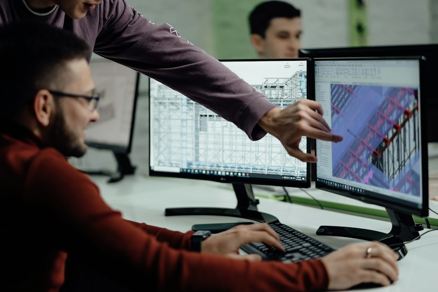
The practical benefits of spatial computing truly shine in fieldwork applications, where accuracy, efficiency, and safety are paramount. From construction sites to remote inspection locations, spatial technologies are redefining how tasks are performed.
Guiding and Validating Construction Progress
Construction is inherently a spatial endeavor, and errors can be incredibly costly. Spatial computing provides powerful tools to guide construction activities and validate progress against design specifications.
Layout and Earthwork Guidance
Traditional construction layout involves painstaking manual measurements and staking. Spatial computing, leveraging precise positioning and AR/MR overlays, can guide workers and machinery directly. Imagine an excavator operator with an AR display in their cab, seeing a real-time overlay of the cut and fill lines directly on the terrain. This dramatically improves grading accuracy, reduces rework, and speeds up earthwork operations.
For building foundations, an AR headset can project precise column gridlines and footing locations onto the ground, allowing construction crews to place rebar and formwork with greater speed and accuracy than traditional string lines and tape measures. This direct digital guidance minimizes human error and ensures that the physical build aligns precisely with the digital model from the very first stages.
Quality Control and Deviation Detection
As construction progresses, continuous quality control is critical. Spatial computing enables rapid and objective comparison between the as-built conditions and the design model. LiDAR scans of newly poured concrete walls can be instantly compared against the BIM (Building Information Model) to detect deviations in plumb, level, or thickness. Any discrepancies are highlighted in real-time, allowing for immediate corrective action before the issues compound.
This proactive approach to quality control significantly reduces the likelihood of costly errors discovered late in the project. It also provides an auditable trail of construction progress and compliance, which is invaluable for project management and dispute resolution. Instead of subjective visual inspections, deviations are quantified and spatially referenced.
Streamlining Inspections and Maintenance
Inspecting complex infrastructure and performing maintenance tasks are often hazardous, time-consuming, and prone to human error. Spatial computing offers safer, more efficient alternatives.
Remote and Automated Inspections
Drones equipped with LiDAR and high-resolution cameras, guided by spatial computing algorithms, can perform automated inspections of structures like bridges, wind turbines, power lines, and even large industrial facilities. These drones capture detailed 3D data and imagery, which can then be analyzed by engineers remotely. This eliminates the need for personnel to work at heights or in dangerous environments, significantly enhancing safety.
Software then processes this captured data, comparing it against previous inspections or digital twins to detect changes, anomalies, or deterioration. Thermal cameras on drones can identify hotspots in electrical infrastructure, while visual cameras can spot cracks, corrosion, or material degradation. This not only makes inspections safer but also more comprehensive and objective.
Digital Work Instructions and Asset Management
When maintenance is required, spatial computing can provide context-aware digital work instructions. A field technician wearing an AR headset could see step-by-step repair procedures overlaid directly onto the machinery they are working on, highlighting specific components, torque settings, or safety warnings. This reduces training time, minimizes errors, and ensures compliance with procedures, particularly for complex or critical equipment.
Furthermore, integrating spatial data with asset management systems creates a powerful digital ecosystem. An AR overlay could pull up a machine’s entire maintenance history, performance data, or parts inventory simply by looking at it. This real-time access to information optimizes maintenance scheduling, predictive maintenance, and overall operational efficiency, transforming reactive maintenance into a more proactive and data-driven process.
Enhancing Safety and Training Protocols
Beyond direct operational benefits, spatial computing also provides profound advantages in enhancing safety and refining training methodologies across various engineering and fieldwork scenarios.
Hazard Identification and Mitigation
Understanding potential hazards in a dynamic worksite is crucial. Spatial computing offers proactive tools for identifying and mitigating risks.
Real-time Danger Zone Visualization
On construction sites, heavy machinery operates in close proximity to personnel. Spatial computing systems can track the real-time positions of both equipment and workers. AR overlays can then visualize “danger zones” – areas around operating machinery where it’s unsafe to enter – directly in the field of view of workers and operators.
If a worker approaches a danger zone, an immediate visual or audio alert can be triggered, preventing accidents.
Similarly, in industrial facilities, AR can highlight areas with high voltage, moving parts, or chemical hazards, providing immediate context-aware safety warnings to field personnel as they navigate the environment. This constant, dynamic awareness greatly reduces the risk of collisions or exposure to hazardous conditions.
Emergency Response and Evacuation Planning
For emergency response, spatial computing offers invaluable tools. First responders could use AR to visualize building layouts, identify safe evacuation routes, locate hazardous materials, or even “see through” smoke to find trapped individuals.
Digital twins of buildings, populated with real-time sensor data (e.g., fire alarms, air quality), can provide incident commanders with a comprehensive, spatially accurate overview of the situation, enabling more informed and effective response strategies.
Simulations based on these spatial models can also be used for advanced evacuation planning, stress-testing different scenarios, and optimizing routes for efficiency and safety before an actual emergency occurs.
Immersive Training and Simulation
Traditional training often involves theoretical instruction or limited hands-on practice. Spatial computing revolutionizes this by offering highly immersive and realistic training environments.
Virtual and Mixed Reality Training Modules
Engineers and field workers can undergo training in virtual reality (VR) or mixed reality (MR) environments that precisely replicate real-world conditions, without the associated risks or costs. For example, a crane operator can practice complex lifts in VR, experiencing different weather conditions and challenging scenarios without ever moving a real crane.
This allows for unlimited practice and skill refinement in a safe, controlled setting.
MR training can combine digital assets with physical tools. A maintenance technician could practice dismantling and reassembling a virtual engine component that is overlaid onto a real, non-functional engine block, receiving real-time feedback and guidance. This blends the theoretical with the practical in a highly effective way, speeding up skill acquisition and improving retention.
Scenario-Based Safety Drills
Spatial computing allows for the creation of realistic, scenario-based safety drills that are difficult or impossible to conduct in the real world.
Trainees can experience and react to simulated equipment failures, gas leaks, or structural compromises. Their actions can be recorded and analyzed, providing valuable insights into their decision-making process under pressure.
This type of training fosters muscle memory for emergency procedures, helping workers instinctively react correctly when real-life situations arise. It moves beyond passive learning to active, experiential engagement, making safety protocols deeply ingrained rather than just theoretical knowledge.
Data Integration and Workflow Optimization
The true power of spatial computing is unleashed when it seamlessly integrates with existing data sources and optimizes workflows, transforming siloed information into actionable intelligence.
Connecting to Building Information Modeling (BIM)
Building Information Modeling (BIM) is a process supported by various tools, technologies, and contracts, involving the generation and management of digital representations of physical and functional characteristics of places. Spatial computing acts as a powerful bridge between the rich data contained within BIM models and the physical world.
Real-time BIM Visualization in the Field
Field personnel can access and visualize detailed BIM data directly on-site using AR/MR devices. Imagine a plumber needing to understand the exact routing of pipes within a wall. Instead of consulting 2D plans, they can look at the wall through an AR headset and see a holographic overlay of the BIM model showing all the hidden utilities. This provides immediate, context-specific information, reducing errors and speeding up installation.
This capability also facilitates on-the-spot clash detection. If an unforeseen field condition arises, the BIM model can be referenced in real-time to identify potential conflicts with other building systems, allowing for immediate resolution before costly rework occurs.
As-Built Data Capture and Model Updating
Spatial computing tools, particularly LiDAR and photogrammetry, are invaluable for capturing as-built conditions – the actual state of construction at various stages. This captured data can then be directly integrated back into the BIM model, creating an accurate and up-to-date digital twin. This is crucial for facility management, future renovations, and accurately reflecting discrepancies between design and construction.
This process ensures that the BIM model remains a living, accurate representation of the asset throughout its lifecycle, transforming it from a static design tool into a dynamic operational asset. It provides a feedback loop that continually refines the digital twin based on real-world progress.
Seamless Data Exchange and Collaboration
Effective engineering and fieldwork rely heavily on seamless data exchange and collaboration among diverse teams and stakeholders. Spatial computing streamlines these interactions.
Cloud-Based Spatial Data Platforms
The large datasets generated by spatial computing (point clouds, 3D models, imagery) are often stored and managed on cloud-based platforms. These platforms enable authorized personnel, regardless of their geographical location, to access, view, and analyze the data collaboratively. An architect in one city can review a contractor’s as-built scan from a construction site across the country, making annotations and providing feedback directly within the shared spatial model.
This centralized data repository ensures everyone is working from the most current and accurate information, reducing version control issues and fostering a common operational picture. It transforms data from a local resource into a globally accessible asset.
Integration with Project Management Systems
By integrating spatial data with project management platforms, insights derived from spatial computing can directly feed into project timelines, resource allocation, and progress tracking. If a spatial scan reveals a significant deviation or delay, that information can automatically update project schedules or trigger alerts to relevant team members.
This integration provides project managers with a more accurate, real-time understanding of project status, enabling more proactive decision-making and better risk management. It connects the physical reality of the worksite directly to the digital management tools, closing the loop between execution and oversight.
In exploring the diverse applications of spatial computing beyond gaming, one can find intriguing insights in a related article that discusses the capabilities of smartwatches, particularly how they allow users to view pictures on them. This functionality can enhance fieldwork by providing engineers and technicians with quick access to visual data while on-site.
For more information on this topic, you can read the full article
5G Innovations (13) Wireless Communication Trends (13) Article (343) Augmented Reality & Virtual Reality (953)
- Metaverse (291)
- Virtual Workplaces (35)
- VR & AR Games (34)
Cybersecurity & Tech Ethics (834)
- Cyber Threats & Solutions (3)
- Ethics in AI (33)
- Privacy Protection (32)
Drones, Robotics & Automation (513)
- Automation in Industry (33)
- Consumer Drones (33)
- Industrial Robotics (33)
EdTech & Educational Innovations (373)
- EdTech Tools (18)
- Online Learning Platforms (4)
- Virtual Classrooms (34)
Emerging Technologies (2,124) FinTech & Digital Finance (477) Frontpage Article (1) Gaming & Interactive Entertainment (411) Health & Biotech Innovations (767)
- AI in Healthcare (3)
- Biotech Trends (4)
- Wearable Health Devices (535)
News (97) Reviews (129) Smart Home & IoT (474)
- Connected Devices (3)
- Home Automation (4)
- Robotics for Home (33)
- SmartPhone (48)
Space & Aerospace Technologies (373)
- Aerospace Innovations (4)
- Commercial Spaceflight (3)
- Space Exploration (62)
Sustainable Technology (837) Tech Careers & Jobs (368) Tech Guides & Tutorials (1,227)
- DIY Tech Projects (3)
- Getting Started with Tech (60)
- Laptop & PC (58)
- Productivity & Everyday Tech Tips (353)
- Social Media (64)
- Software (350)
- Software How-to (3)
Uncategorized (146)