

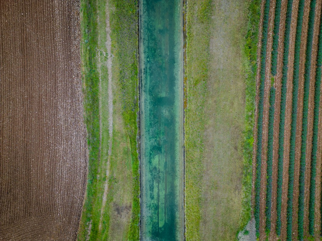
Drones are making a real difference in farming by helping to cut down on chemical runoff and water waste. They do this by giving farmers incredibly precise information about their fields, allowing them to apply exactly what’s needed, where it’s needed, instead of widespread, often wasteful, applications. This isn’t just a niche technology anymore; it’s becoming a crucial tool for more sustainable and efficient agriculture.
The Problem: Traditional Farming’s Environmental Footprint
For a long time, farming practices, while feeding the world, have often been a major contributor to environmental issues. We’re talking about significant problems like chemical pollution and excessive water consumption. These aren’t just abstract concerns; they have tangible impacts on ecosystems and resource availability.
Widespread Chemical Applications and Their Consequences
Historically, the standard approach to pest control and fertilization has involved broadcasting chemicals across entire fields. Imagine a farmer needing to treat a small patch of weeds; often, the whole field would get sprayed. This blanket approach, while seemingly efficient at first glance, has some serious downsides.
One major issue is nutrient runoff. When excess fertilizers, particularly nitrogen and phosphorus, aren’t absorbed by crops, they can wash away with rainwater. This runoff often ends up in rivers, lakes, and oceans, leading to a phenomenon known as eutrophication. Eutrophication causes algal blooms, which deplete oxygen in the water, creating “dead zones” where aquatic life struggles to survive. Think of the Gulf of Mexico’s large dead zone, which is partly a result of agricultural runoff from the Mississippi River basin.
Similarly, pesticide drift is a significant concern. When pesticides are sprayed from traditional equipment, especially in windy conditions, they can easily drift beyond the target crops. This can contaminate nearby water sources, harm beneficial insects (like pollinators), and even affect human health in adjacent communities. The widespread use of herbicides can also contribute to the development of herbicide-resistant weeds, forcing farmers to use even stronger or different chemicals over time, creating a vicious cycle.
These broad applications don’t just impact the environment; they also represent a financial drain for farmers. Every gallon of unused chemical washed away or sprayed unnecessarily is money wasted, directly impacting their bottom line.
Inefficient Water Use in Irrigation
Agriculture is by far the largest consumer of freshwater globally, accounting for roughly 70% of all freshwater withdrawals. Much of this water is used for irrigation, and unfortunately, a significant portion of it is wasted.
Traditional irrigation methods, such as flood irrigation or even many sprinkler systems, often apply water uniformly across large areas, regardless of the specific needs of different parts of the field. A field isn’t a perfectly uniform canvas; different soil types, varying sun exposure, and even slight elevation changes mean that some areas will dry out faster and require more water than others.
When water is applied indiscriminately, several problems arise. Over-irrigation in certain areas can lead to waterlogging, which starves plant roots of oxygen and can promote fungal diseases. It also wastes precious water resources, contributing to aquifer depletion and increased pumping costs for farmers. On the other hand, under-irrigation in other areas can stress crops, leading to reduced yields and quality.
Another significant issue is evaporation and runoff. A considerable amount of water applied through traditional irrigation never reaches the plant roots. It can evaporate before it infiltrates the soil, especially in hot or windy conditions, or it can run off the field if the application rate is too high for the soil to absorb. Both scenarios represent lost resources and reduced efficiency.
The financial implications are substantial too. Water costs, whether from municipal sources or pumping from wells, are a significant operating expense for many farmers. Wasting water directly translates to higher production costs and lower profitability. This is where precision agriculture, powered by drones, steps in to offer a more intelligent and sustainable approach.
In the realm of sustainable farming practices, the article on Precision Agriculture Drones: Slashing Chemical Runoff and Water Usage in Modern Farming highlights the innovative technologies that are transforming agricultural efficiency. For those interested in exploring how technology can enhance various fields, you might find the article on the top astrology software for PC and Mac insightful as well. It discusses the latest tools and applications that can aid in astrological analysis, showcasing the intersection of technology and personal insight. You can read more about it here: Top 10 Best Astrology Software for PC and Mac 2023.
Key Takeaways
- The training data includes information and events up to October 2023.
- Insights and knowledge are based on a wide range of sources available until the cutoff date.
- No updates or developments occurring after October 2023 are included in the training.
- Users should verify current information from reliable sources for the latest updates.
- The model’s responses reflect the context and knowledge available up to the specified date.
Drones: The Eyes in the Sky for Precision Farming
Drones aren’t just toys or tools for pretty aerial photography anymore; they’re becoming sophisticated data collection platforms that revolutionize how farmers understand and manage their fields. Their ability to gather highly detailed, localized information is the cornerstone of precision agriculture.
High-Resolution Imaging and Sensor Technology
The magic of agricultural drones lies in the advanced sensor technology they carry. These aren’t just standard cameras; they’re specialized instruments designed to capture specific types of data that reveal the health and needs of crops.
One of the most common and powerful sensor types is multispectral imaging. While the human eye sees light in the visible spectrum (red, green, blue), multispectral cameras can detect light in several discrete spectral bands, including those invisible to us, such as near-infrared (NIR). Plants reflect NIR light differently depending on their health and chlorophyll content. A healthy, vigorous plant will reflect a lot of NIR, while a stressed or unhealthy plant will absorb more and reflect less. By analyzing these differences, drones can create indices like the Normalized Difference Vegetation Index (NDVI), which provides a quantitative measure of plant health and biomass. Farmers can then see exactly which areas of their fields are thriving and which are struggling.
Beyond multispectral, hyperspectral imaging takes this a step further, capturing hundreds of narrow spectral bands. This allows for even more detailed analysis, potentially identifying specific nutrient deficiencies, pest infestations, or disease outbreaks at very early stages, sometimes even before symptoms are visible to the naked eye.
Thermal cameras are another valuable tool. They detect heat signatures, allowing farmers to identify areas of water stress. Plants that are well-hydrated cool themselves through transpiration, so they appear cooler in thermal imagery. Areas that are warmer indicate plants that are not transpiring effectively, suggesting they are either water-stressed or suffering from a disease that impacts water uptake. This direct insight into plant water status is incredibly useful for targeted irrigation.
Lidar (Light Detection and Ranging) sensors can create highly accurate 3D maps of fields, revealing subtle elevation changes that affect water flow and accumulation. This topographical data is crucial for optimizing irrigation system design and understanding drainage patterns.
These sensors, combined with high-resolution RGB (standard color) cameras, give farmers an unprecedented view of their fields, allowing them to pinpoint issues down to individual plants or small sections rather than relying on broad estimates.
Data Analysis and Actionable Insights
Collecting all this data is just the first step. The real power comes from turning that raw data into actionable insights. This involves sophisticated software and analytical techniques.
Once a drone completes its flight, the images and sensor data are stitched together and processed. Specialized algorithms then analyze the spectral signatures, thermal patterns, and topographical information. The output is usually a highly detailed map, often color-coded, that highlights specific problems or areas of interest.
For instance, an NDVI map might show bright green patches for healthy crops, yellow for moderately stressed areas, and red for severely stressed or bare soil. A thermal map might indicate cooler zones (well-watered) versus warmer zones (water-stressed). These maps aren’t just pretty pictures; they are highly granular prescriptions for action.
The software can identify nutrient deficiencies by correlating specific spectral responses with known nutrient stress signatures. It can detect early signs of pest infestations by identifying changes in plant morphology or color that are characteristic of certain pests. Similarly, disease outbreaks can often be spotted early through subtle changes in plant reflectance or temperature before widespread damage occurs.
Furthermore, drone data can be integrated with other farm management systems. This means that once a problem area is identified, the drone-generated map can be used to create variable-rate application (VRA) prescriptions. These prescriptions are digital maps that tell precision farming equipment (like tractors with specialized sprayers or irrigators) exactly how much fertilizer, pesticide, or water to apply to each specific zone within the field. Instead of applying a uniform amount, the equipment can vary the application rate on the fly, applying more where needed and less (or none) where it’s not. This direct link from data collection to targeted action is what makes drone technology so transformative.
Slashing Chemical Runoff: Targeted Application
The ability of drones to collect hyper-local data and translate it into actionable maps is directly responsible for a significant reduction in chemical runoff. This isn’t just about using less; it’s about using chemicals smarter.
Spot Treatment for Weeds, Pests, and Diseases
One of the most immediate and impactful benefits of drone technology is its capacity to enable highly targeted spot treatments. Instead of spraying an entire field, farmers can now address problems only where they exist.
Imagine a farmer walking a large field; it’s nearly impossible to accurately identify every small patch of weeds or the initial signs of a pest infestation across hundreds of acres.
With traditional methods, if a farmer suspects a problem, the tendency is to treat a much larger area “just in case,” or to wait until the problem is so widespread it’s obvious, by which point significant damage may have already occurred.
Drones change this entirely. By flying over a field with high-resolution multispectral cameras, they can quickly identify specific weed species (in some advanced systems) or simply areas where crop health is declining due to weed competition. Similarly, early signs of pest damage, such as leaf discoloration or chewing marks, can be detected long before they’re visible from the ground on a large scale.
The same applies to plant diseases; many diseases manifest as subtle changes in leaf color or texture that are picked up by drone sensors.
Once these problematic spots are identified and mapped by the drone, the farmer receives a precise “prescription map.” This map outlines the exact coordinates and boundaries of the areas requiring intervention. This information is then fed into variable-rate sprayers mounted on tractors or even smaller, highly agile spraying drones. These smart sprayers are equipped with GPS and can adjust their nozzle output to apply pesticides or herbicides only to the targeted zones.
Some advanced systems can even identify individual weeds and spray them precisely, avoiding the surrounding healthy crops.
The implications are huge. By treating only the affected areas, farmers drastically reduce the total volume of chemicals used across their fields. This directly translates to less chemical runoff into waterways, less pesticide drift onto non-target areas, and significantly reduced exposure for beneficial insects and wildlife.
It’s a fundamental shift from a broad-brush approach to a surgical one.
Optimized Fertilization Strategies
Fertilizer application has historically been another area prone to waste and environmental damage. Fields are rarely uniform in their nutrient needs; variations in soil type, organic matter content, previous crop history, and topography all mean that different parts of a field will require different amounts of nutrients.
Traditional fertilization often involves applying a uniform rate of nitrogen, phosphorus, and potassium (NPK) across the entire field. This inevitably leads to over-fertilization in some areas, where excess nutrients can leach into groundwater or run off into surface water.
In other areas, crops might be under-fertilized, leading to suboptimal growth and reduced yields.
Drones provide the critical data needed to move beyond this uniform approach. Multispectral imagery, particularly NDVI, is incredibly effective at assessing plant vigor and nitrogen status. Healthy, actively growing plants with sufficient nitrogen will have a high NDVI value.
Plants with nitrogen deficiency will show lower NDVI values and characteristic yellowing.
By mapping the NDVI across a field, drones can create a nitrogen variability map. This map pinpoints areas where crops are robust and likely have sufficient nitrogen, and areas where crops are struggling and potentially need more. This information is then used to generate a variable-rate fertilization prescription.
This prescription tells a GPS-enabled variable-rate spreader exactly how much fertilizer to apply to each specific zone.
For example, areas with high NDVI might receive a lower rate of nitrogen, while areas with low NDVI might receive a higher rate. This ensures that every part of the field receives the optimal amount of nutrients needed for healthy growth, without applying excess where it’s not required.
The benefits are twofold. Firstly, farmers save money by purchasing and applying less fertilizer overall.
Secondly, and critically for the environment, significantly less excess nitrogen and phosphorus are available to leach into groundwater or run off into rivers and lakes. This directly reduces the likelihood of eutrophication and groundwater contamination, leading to cleaner waterways and a healthier ecosystem. It’s a smarter, more sustainable way to feed crops.
Cutting Water Usage: Precision Irrigation
Just as drones refine chemical application, they are revolutionizing how farmers manage water, leading to substantial reductions in water usage and more resilient crops. This intelligent approach to irrigation is critical in an era of increasing water scarcity.
Identifying Water-Stressed Areas with Thermal and Multispectral Data
The traditional method of determining when and how much to irrigate often relies on educated guesswork, fixed schedules, or broad soil moisture readings that don’t capture the micro-variations across a field. This can lead to both over-irrigation in some areas and under-irrigation in others, neither of which is optimal for crop health or water conservation.
Drones, equipped with specialized sensors, provide a much more nuanced and accurate picture of a field’s water needs. Thermal cameras are particularly powerful in this regard. Plants cool themselves through a process called transpiration, where water evaporates from their leaves. When a plant is well-hydrated, it transpires efficiently and its leaves are cooler. Conversely, when a plant is stressed due to lack of water, transpiration decreases, and its leaves become warmer. Thermal cameras detect these temperature differences, creating detailed maps that highlight “hot spots” – areas where plants are water-stressed – and “cool spots” – areas where plants are well-hydrated. This gives farmers a direct indication of where water is most needed.
Multispectral imagery, particularly the near-infrared (NIR) band and specific indices like NDVI or more advanced water stress indices, also plays a crucial role. While NDVI primarily indicates plant vigor and biomass, variations can also signal water stress indirectly, as severely stressed plants will show reduced growth and lower photosynthetic activity. More specialized multispectral indices can directly estimate leaf water content.
By combining thermal and multispectral data, drones can create comprehensive water stress maps. These maps clearly delineate zones within a field that are experiencing different levels of water stress. For example, one area might show moderate stress, while another might be severely dehydrated. This highly granular information allows farmers to move beyond a one-size-fits-all irrigation approach.
Variable-Rate Irrigation (VRI) Prescriptions
The detailed water stress maps generated by drones are the foundation for implementing Variable-Rate Irrigation (VRI). This technology enables farmers to apply precisely the right amount of water to each specific zone of their field, according to its actual needs.
Once the drone data highlights areas requiring more or less water, this information is used to create a VRI prescription map.
This digital map is then uploaded to a VRI-enabled irrigation system.
These systems, often center pivots or lateral move irrigators, are equipped with sophisticated controls that can individually manage water application rates for different sections or even individual sprinkler heads along their length.
For example, if a drone map shows that the eastern side of a field is experiencing moderate water stress, while the western side is well-hydrated, the VRI system will automatically increase the water application rate as it passes over the eastern side and reduce it on the western side. This dynamic adjustment ensures that no area is over-watered, preventing waste and waterlogging, and no area is under-watered, preventing crop stress and yield loss.
The benefits of VRI driven by drone data are profound. Firstly, there’s a significant reduction in overall water consumption. Instead of irrigating uniformly, water is only applied where and when it’s genuinely needed. This conserves precious freshwater resources, which is increasingly vital in many agricultural regions facing drought and water scarcity.
Secondly, it leads to healthier and more productive crops. By ensuring optimal hydration across the entire field, crops experience less stress, leading to more consistent growth, higher yields, and improved quality. Farmers also benefit from reduced energy costs associated with pumping less water.
Furthermore, by preventing over-irrigation, VRI also helps to minimize nutrient leaching and runoff. When excess water saturates the soil, it can carry dissolved fertilizers away from the root zone and into waterways.
By applying water precisely, this detrimental effect is significantly reduced, further contributing to environmental protection.
It’s a win-win for both the farm and the environment.
In the realm of sustainable farming practices, the integration of technology has become increasingly vital, as highlighted in the article on Precision Agriculture Drones: Slashing Chemical Runoff and Water Usage in Modern Farming. This innovative approach not only enhances crop yields but also significantly reduces environmental impact. For those interested in exploring additional avenues within the agricultural sector, a related article discusses the best niche for affiliate marketing in 2023, which can provide insights into how technology and marketing intersect in modern agriculture. You can read more about it here.
Beyond Runoff and Water: Additional Drone Benefits
| Metric | Traditional Farming | Precision Agriculture Drones | Improvement |
|---|---|---|---|
| Chemical Runoff (kg/ha/year) | 15 | 5 | 67% Reduction |
| Water Usage (liters/ha) | 10,000 | 6,000 | 40% Reduction |
| Crop Yield (tons/ha) | 3.5 | 4.2 | 20% Increase |
| Application Accuracy (%) | 70 | 95 | 25% Improvement |
| Field Coverage Time (hours/ha) | 4 | 1.5 | 62.5% Faster |
While reducing chemical runoff and water usage are primary environmental advantages, drones bring a host of other benefits to modern farming, enhancing efficiency, sustainability, and overall farm management.
Early Detection of Issues and Proactive Management
One of the most powerful aspects of drone technology is its ability to provide an early warning system for a variety of agricultural problems. Traditional scouting often involves walking fields, which is time-consuming and can easily miss small, localized issues until they become widespread and more difficult to manage.
Drones, with their high-resolution imaging and multispectral sensors, can detect subtle changes in plant health that are invisible to the human eye or too small to be noticed during ground inspections. This means pest infestations can be identified when they are still localized and manageable, before they spread across an entire field. For example, a small cluster of insect damage might show up as a specific spectral signature or a slight drop in NDVI in a concentrated area.
Similarly, plant diseases can often be detected in their incipient stages. Many fungal or bacterial infections cause changes in leaf pigmentation or temperature before visible symptoms like wilting or widespread discoloration appear. Drones can pick up on these early signs, allowing farmers to intervene proactively with targeted treatments. This not only saves crops but also reduces the need for broader, more intensive chemical applications later on.
Early detection also applies to nutrient deficiencies. Before a plant shows severe visual symptoms like yellowing or stunted growth, multispectral data can indicate a lack of essential nutrients. This allows farmers to apply specific micronutrients or fertilizers to correct the deficiency before it significantly impacts yield.
This proactive approach to farm management, enabled by drone data, translates into healthier crops, higher yields, and a reduction in the need for drastic, last-minute interventions. It shifts farming from a reactive model to a predictive and preventative one.
Crop Monitoring and Yield Prediction
Drones provide continuous, high-frequency monitoring capabilities that offer a dynamic view of crop development throughout the growing season. This goes far beyond just identifying problems; it’s about understanding the overall health and progression of the crop.
Regular drone flights can track changes in plant biomass and vigor over time. Farmers can use this data to assess the effectiveness of their planting strategies, fertilizer applications, and irrigation schedules. By comparing successive NDVI maps, they can identify areas where crops are growing vigorously and areas where growth is lagging, allowing for mid-season adjustments.
This consistent monitoring also plays a crucial role in yield prediction. By correlating drone-derived vegetation indices (like NDVI) at various growth stages with historical yield data, farmers can develop more accurate estimates of their potential harvest. This information is invaluable for making informed business decisions, such as marketing strategies, storage planning, and predicting income. For instance, if drone data indicates a strong, healthy crop at pollination, it points towards a good yield, allowing farmers to lock in better prices. Conversely, if stress is detected, they can anticipate a lower yield and adjust their expectations and sales plans accordingly.
Furthermore, drone-based plant counting can provide accurate stand counts shortly after emergence, helping farmers assess germination rates and potential replanting needs. As plants mature, canopy cover analysis from drone imagery can contribute to more precise yield models. This level of insight allows for more precise resource allocation and better overall financial management of the farm.
Soil Analysis and Mapping
While drones can’t directly sample soil, they contribute significantly to more efficient and targeted soil analysis and mapping efforts.
By providing highly detailed topographical maps (using Lidar or photogrammetry), drones can identify subtle elevation changes and drainage patterns that affect soil moisture retention and nutrient distribution. This information helps in understanding where certain soil types might accumulate or where erosion might be more prevalent.
Drone imagery, particularly multispectral data, can also indirectly indicate variations in soil composition. For example, areas with higher organic matter content might show different spectral responses compared to areas with sandy or clay-rich soils, especially when crops are sparse or absent. This helps guide soil sampling efforts, allowing farmers to take samples from representative zones rather than randomly across the field. Instead of taking one sample per 10 acres, a drone map might reveal 5 distinct soil zones, prompting farmers to take targeted samples from each zone, leading to a much more accurate understanding of their soil’s nutrient profile and pH.
This refined approach to soil analysis enables farmers to create more precise soil management zones. Based on these zones, they can then tailor their liming, tilling, and planting strategies to optimize conditions for specific parts of the field. For instance, areas identified as acidic can receive targeted lime applications, or areas prone to compaction can be treated differently.
In essence, drones provide the contextual data that makes soil analysis more meaningful and actionable, leading to healthier soil, more efficient nutrient use, and ultimately, better crop performance. It’s about getting the right information to the right place to make the best decisions for the long-term health of the farm.
FAQs
What are precision agriculture drones?
Precision agriculture drones are unmanned aerial vehicles (UAVs) equipped with advanced sensors and imaging technology that allow farmers to monitor crop health, soil conditions, and overall farm management. These drones collect data that can be analyzed to optimize farming practices, reduce waste, and improve yields.
How do drones help reduce chemical runoff in farming?
Drones enable targeted application of fertilizers and pesticides by providing detailed aerial imagery and data analysis. This precision application minimizes the amount of chemicals used and ensures they are applied only where needed, significantly reducing the risk of runoff into nearby water sources.
What impact do drones have on water usage in agriculture?
By utilizing drones for monitoring and analysis, farmers can better understand their irrigation needs and optimize water usage. Drones can identify areas of the field that require more or less water, allowing for more efficient irrigation practices that conserve water resources while maintaining crop health.
Are precision agriculture drones cost-effective for farmers?
While the initial investment in precision agriculture drones can be significant, they often lead to long-term savings by increasing efficiency, reducing chemical and water usage, and improving crop yields. Many farmers find that the return on investment justifies the cost, especially as technology continues to advance and prices decrease.
What types of sensors are commonly used in precision agriculture drones?
Common sensors used in precision agriculture drones include multispectral cameras, thermal imaging sensors, and LiDAR (Light Detection and Ranging). These sensors provide valuable data on plant health, moisture levels, and topography, enabling farmers to make informed decisions about their farming practices.
Enjoying our content? Make us a preferred source on Google:
Add us as a Preferred Source on Google