


So, what’s the deal with high-precision indoor positioning, and specifically, how do Ultra-Wideband (UWB) systems track multiple users? Simply put, UWB technology offers a highly accurate way to locate things and people indoors, where GPS struggles. It achieves this by sending out very short, low-power radio pulses over a wide range of frequencies. By precisely measuring the “time of flight” – how long it takes for these pulses to travel between devices – UWB can pinpoint locations with centimeter-level accuracy, even when multiple people or objects are moving around in the same space. It’s like a super-precise, tiny radar system for inside buildings, helping us know exactly where everything is at any given moment.
The Indoor Positioning Challenge and UWB’s Solution
Getting an accurate location fix indoors has always been a tough nut to crack. Outside, GPS reigns supreme, but its satellite signals struggle to penetrate buildings, leading to significant inaccuracies or complete signal loss. This “indoor blind spot” has driven the development of various alternative positioning technologies, each with its own strengths and weaknesses. Think Wi-Fi triangulation, Bluetooth Low Energy (BLE) beacons, RFID, or even magnetic field sensing – all have their applications, but often fall short when truly high precision and reliability are needed, especially in dynamic, multi-user environments.
This is where Ultra-Wideband (UWB) steps in as a compelling solution. Unlike narrow-band radio technologies that use a small slice of the radio spectrum, UWB spreads its signal across a very broad frequency range. This isn’t just a technical detail; it’s fundamental to its capabilities. By transmitting extremely short bursts of radio energy – often just a few nanoseconds long – UWB achieves several key advantages. The wide bandwidth allows for very precise time-of-flight measurements, which is the cornerstone of its accuracy. Imagine trying to time a runner with a stopwatch that only ticks once per second versus one that ticks a thousand times per second – the latter will always be more precise. Similarly, UWB’s wide bandwidth enables incredibly fine-grained timing resolution.
Furthermore, the low power spectral density of UWB signals means they’re less susceptible to multipath interference. Multipath is a huge problem indoors, where radio signals bounce off walls, furniture, and people, creating multiple delayed versions of the original signal that confuse traditional receivers. Because UWB pulses are so short, the receiver can often distinguish between the direct path signal and the reflected signals, effectively ignoring the echoes. This robustness against multipath is critical for maintaining accuracy in cluttered indoor spaces.
Limitations of Traditional Indoor Positioning Methods
Before diving deeper into UWB’s mechanics, it’s helpful to understand why other methods often fall short for high-precision, multi-user tracking.
Wi-Fi and Bluetooth Limitations
Wi-Fi positioning typically relies on measuring the Received Signal Strength Indicator (RSSI) from nearby access points. The idea is that the closer you are to an access point, the stronger the signal. However, RSSI is notoriously unreliable for precise localization. It’s heavily influenced by environmental factors like walls, people, and even humidity, leading to fluctuations that make accurate distance estimation difficult.
Imagine trying to guess someone’s distance from you purely by how loud their voice is – it’s hard to be precise if they’re facing away, or if there’s a wall between you.
Accuracy for Wi-Fi positioning is often in the multi-meter range, which is fine for general zone detection but insufficient for applications requiring exact spatial awareness.
Bluetooth Low Energy (BLE) beacons operate on a similar principle, broadcasting unique identifiers and relying on RSSI measurements. While BLE can be more energy-efficient and scalable for certain applications, its precision is similarly limited by RSSI variability, usually offering meter-level accuracy at best. Both Wi-Fi and BLE also struggle with high update rates and tracking multiple fast-moving objects simultaneously without significant processing overhead and potential interference issues.
GPS Challenges Indoors
As mentioned, GPS signals are designed for outdoor line-of-sight communication with satellites. They operate at frequencies that are easily attenuated and reflected by building materials. Even if a faint signal penetrates, multipath effects from internal structures severely degrade accuracy. Trying to use GPS indoors is like trying to navigate by stars during a cloudy day inside a cave – it simply wasn’t designed for that environment. Its fundamental reliance on satellite visibility makes it unsuitable for indoor scenarios.
UWB’s Foundational Principles: Time of Flight
The core principle behind UWB’s high accuracy is its ability to precisely measure the “Time of Flight” (ToF) or “Two-Way Ranging” (TWR) between a transmitting UWB device (a “tag”) and multiple receiving UWB devices (often called “anchors” or “base stations”).
How ToF Measurement Works
Imagine a UWB tag sending a short pulse. Each UWB anchor that receives this pulse records the exact time of arrival. If the anchors also transmit pulses, and the tag records their arrival times, a process called two-way ranging can be employed. The tag sends a pulse, the anchor receives it and sends a response, and the tag measures the round-trip time. By subtracting internal processing delays, the system can accurately determine the time it took for the signal to travel between the two devices. Since radio waves travel at a known speed (the speed of light), this time measurement can be converted directly into a highly accurate distance measurement.
The incredibly short duration of UWB pulses allows for extremely precise time stamping. If a pulse is, say, 1 nanosecond long, you can determine its arrival time with nanosecond-level resolution. Since light travels approximately 30 centimeters in 1 nanosecond, this directly translates to potential centimeter-level distance accuracy. This precision in time measurement is the secret sauce for UWB’s superior performance compared to RSSI-based methods.
High-Precision Indoor Positioning: Ultra-Wideband Systems for Multi-User Spatial Tracking is a fascinating topic that explores the advancements in indoor positioning technologies. For those interested in enhancing their understanding of technology in educational settings, a related article that provides insights on selecting the right PC for students can be found at this link. This resource offers valuable information on choosing the best computing devices that can support various applications, including those that utilize high-precision positioning systems.
Key Takeaways
- The training data includes information and events up to October 2023.
- Insights and knowledge are based on a wide range of sources available until the cutoff date.
- No updates or developments occurring after October 2023 are included in the training.
- Users should verify current information from reliable sources for the latest updates.
- The model’s responses reflect the context and knowledge available up to the specified date.
System Architecture for Multi-User Tracking
A UWB positioning system capable of tracking multiple users isn’t just a collection of UWB chips; it’s a carefully orchestrated network of hardware and software components. The architecture typically involves a distributed network of stationary anchor nodes, mobile tags worn by users or attached to assets, and a central processing unit that collects data and calculates positions.
At its most basic, you have:
- UWB Anchors: Fixed, reference points with known locations. These are usually mounted on walls or ceilings throughout the indoor environment.
- UWB Tags: Mobile devices attached to the people or objects being tracked.
- Location Engine/Software: A central server or embedded system that processes the ranging data from anchors and tags to compute the precise position of each tag.
Anchor Network Deployment
The placement and density of UWB anchors are crucial for system performance. To achieve robust 2D or 3D positioning, a tag needs to be “seen” by a minimum number of anchors. For 2D positioning (x, y coordinates), at least three anchors are generally required. For 3D positioning (x, y, z coordinates), at least four anchors are needed. More anchors provide redundancy, improve accuracy, and help mitigate line-of-sight blockages.
Anchors need to be strategically placed to ensure good coverage across the desired tracking area, minimizing “dead zones” where tags might not have enough anchor visibility. This often involves careful site surveying and planning. They also need a reliable power source and a communication link back to the central location engine, which can be wired Ethernet, Wi-Fi, or even another UWB link for backhaul.
Mobile Tags and Wearables
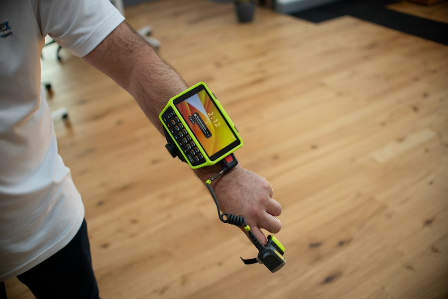
UWB tags are the devices carried by the entities being tracked. These can be integrated into badges, wristbands, asset trackers, or even embedded directly into other devices. Modern UWB chips are highly integrated, small, and power-efficient, making them suitable for wearable applications where size and battery life are critical. Each tag has a unique identifier, allowing the system to distinguish between multiple users or assets.
For multi-user tracking, each person or asset simply carries a UWB tag. The system doesn’t differentiate between users in terms of its core ranging mechanism; it just tracks each tag individually. The software then associates a tag ID with a specific user or asset.
The Role of the Location Engine
The location engine is the brain of the operation. It performs several critical functions:
Data Aggregation and Synchronization
The location engine receives ranging measurements (ToF data) from all anchors, often simultaneously or in rapid succession. Precise time synchronization across all anchors is paramount for accurate positioning. If anchors aren’t perfectly synchronized, timing errors will translate directly into distance errors, skewing the calculated position. Some systems use wired connections for synchronization, while others employ wireless over-the-air synchronization protocols.
Positioning Algorithms (Trilateration/Multilateration)
Once the ranging data is collected, the location engine applies positioning algorithms, primarily trilateration or multilateration. This process is essentially solving a geometric problem: given the known positions of multiple anchors and the measured distance from a tag to each anchor, what is the unknown position of the tag?
Imagine drawing circles around each anchor, with the radius of each circle being the measured distance to the tag. In an ideal 2D scenario, the tag’s position is where these circles intersect. With three anchors, there will ideally be one unique intersection point. For 3D, you’re looking at the intersection of spheres. The more anchors available, the more robust and accurate the position calculation, as the system can average out minor measurement errors or account for non-line-of-sight conditions.
Filtering and Smoothing
Raw ranging data can be noisy due to environmental factors, tag movement, or temporary signal blockages. The location engine often employs advanced filtering techniques, such as Kalman filters or particle filters, to smooth out these inaccuracies and provide a more stable and reliable position estimate. These filters consider previous position estimates, velocity, and acceleration to predict the tag’s next position, reducing jitter and providing more realistic movement trajectories.
Real-time Data Processing
For true real-time multi-user tracking, the location engine must process incoming data and compute positions with very low latency. This is crucial for applications where immediate feedback on location is required, such as guiding autonomous vehicles, tracking athletes in sports, or ensuring worker safety in hazardous environments. The processing power and network bandwidth of the location engine are critical factors here.
Achieving High Precision and Robustness
The “high-precision” aspect of UWB isn’t just about raw distance measurements; it’s about the system’s overall ability to consistently deliver accurate location data even in challenging environments. Several factors contribute to this and techniques are employed to maintain robustness.
Centimeter-Level Accuracy
The primary enabler of centimeter-level accuracy, as discussed, is the wide bandwidth of UWB signals allowing for incredibly precise ToF measurements. However, achieving this in practice requires careful system design and calibration.
Antenna design on both tags and anchors plays a critical role, as directional properties or imperfections can introduce errors. Environmental factors, though mitigated by UWB, can still have an impact.
For example, a slight delay in signal processing at one anchor versus another can introduce a bias. This is why proper system calibration, ensuring all components are synchronized and performing optimally, is essential for maintaining the stated accuracy levels.
Mitigating Multipath and Non-Line-of-Sight (NLoS) Issues
While UWB is inherently more resistant to multipath than narrow-band systems, it’s not immune.
When the direct line-of-sight (LoS) path between a tag and an anchor is completely blocked by a thick wall or large metal object, the signal may only reach the anchor via reflections. This is known as Non-Line-of-Sight (NLoS) propagation. Since the reflected path is longer than the direct path, an NLoS measurement will overestimate the distance, leading to position errors.
Sophisticated algorithms are employed to detect and mitigate NLoS conditions.
These might include:
- Statistical analysis: Comparing multiple ranging measurements from different anchors. If one anchor consistently reports a significantly longer distance than expected relative to others, it might indicate an NLoS condition.
- Angle of Arrival (AoA) techniques: Some advanced UWB systems can also determine the angle from which a signal arrives. If the AoA suggests the signal is coming from a direction inconsistent with the direct path, it could indicate NLoS.
- Anchor Redundancy: Having many anchors deployed helps.
If one anchor experiences NLoS, the system can potentially exclude its data or weight it less, relying on other LoS anchors for a more accurate fix.
- Machine Learning: Training models to recognize NLoS signatures in the UWB pulse shape itself.
System Calibration and Synchronization
Calibration is a critical step during system deployment.
It involves precisely measuring the exact coordinates of all fixed anchors within the building.
This is often done using surveying tools or by taking a known reference tag and systematically moving it to known points to allow the system to self-calibrate anchor positions.
Time synchronization across all anchors is equally vital. Even a tiny timing offset of a few nanoseconds between anchors can translate into significant position errors. This is typically achieved through either wired synchronization signals (for highest precision) or robust wireless synchronization protocols that account for varying propagation delays between anchors.
Ensuring all clocks are perfectly aligned allows for accurate time-of-flight comparisons.
Antenna Design and Placement
The design and quality of the UWB antennas on both tags and anchors have a direct impact on performance. Antennas should be designed to be omnidirectional (or have specific patterns if AoA is used) and efficient over the wide UWB spectrum. Careful placement of anchors, considering potential obstructions and desired coverage areas, is also essential.
For example, mounting anchors high on walls or ceilings often provides better line-of-sight to mobile tags. The orientation of antennas can also play a role, and some systems may use multiple antennas per anchor to improve signal diversity and robustness.
Multi-User Spatial Tracking Capabilities
One of UWB’s standout features is its ability to track many individual tags concurrently and distinguish between them. This is what makes it so powerful for multi-user scenarios.
Distinguishing Between Multiple Tags
Each UWB tag transmits unique pulses or uses unique sequences that allow the anchor network to differentiate it from other tags. While multiple tags might be transmitting within the same area, the UWB system typically uses a combination of time-division multiple access (TDMA) or code-division multiple access (CDMA) like schemes, or a blend of both, to manage transmissions.
In a TDMA approach, each tag is allocated a specific, very short time slot to transmit its pulse. The anchors listen for pulses in these designated slots. With CDMA-like systems, tags might use different pseudo-random codes to spread their signals, allowing multiple signals to exist simultaneously and be separated by the receiver. Regardless of the specific access scheme, the underlying principle is that the system can correctly attribute each received pulse and its time-of-flight measurement to the correct transmitting tag.
High Update Rates and Real-time Tracking
UWB systems can achieve very high update rates – often tens or even hundreds of position updates per second for each tag. This capability is critical for tracking fast-moving objects or for applications requiring very low latency feedback. The short pulse duration and efficient ranging protocols allow for rapid successive measurements.
This real-time capability means that the system isn’t just telling you where something was a few seconds ago, but where it is right now. For applications like augmented reality, sports analytics, or autonomous robot navigation, this immediacy is invaluable.
Scalability for Large Deployments
Scaling a UWB system to track hundreds or even thousands of tags across a large facility involves careful planning but is generally feasible. The core challenge lies in managing the communication bandwidth and processing power of the location engine, as well as ensuring adequate anchor coverage.
- Anchor Density: Larger areas require more anchors to maintain coverage and accuracy.
- Network Infrastructure: The backhaul network connecting anchors to the location engine needs to handle the increased data traffic.
- Location Engine Capacity: The central processing unit must be powerful enough to run positioning algorithms for all active tags in real-time.
- Collision Avoidance: Protocols are designed to minimize “collisions” where multiple tags try to transmit at the exact same moment, which could lead to missed measurements. These protocols become more complex with a higher tag count.
However, the low power and short duration of UWB pulses, combined with sophisticated channel access methods, mean that multiple UWB devices can operate in close proximity without significantly interfering with each other. This inherent resilience to interference helps in scaling up.
Examples of Multi-User Applications
The ability to accurately track multiple users simultaneously unlocks a wide range of applications across various industries:
- Manufacturing and Logistics: Tracking the location of individual tools, components, autonomous guided vehicles (AGVs), and workers on a factory floor. This optimizes workflows, improves safety, and helps locate misplaced items.
- Healthcare: Monitoring patients and staff within hospitals, tracking critical medical equipment, and ensuring asset visibility. This can improve patient flow, enhance security, and reduce search times for vital equipment.
- Sports and Entertainment: High-precision tracking of athletes during training and games for performance analysis (e.g., speed, acceleration, distance covered, player separation). This data is invaluable for coaching and broadcasting. In entertainment, UWB can enable interactive experiences in theme parks or precise control of performers’ movements for special effects.
- Safety and Security: Worker tracking in hazardous environments (e.g., mines, construction sites) to monitor their presence, ensure social distancing, or quickly locate them in emergencies. It can also be used for access control and preventing unauthorized entry into sensitive zones.
- Retail and Warehousing: Tracking shopping carts, personnel, and inventory in large stores or warehouses to optimize stocking, improve customer service, and prevent theft.
- Augmented Reality (AR): Providing highly accurate real-time position and orientation data for AR devices, allowing virtual objects to be precisely anchored to physical locations and interacting seamlessly with the real world.
High-Precision Indoor Positioning has gained significant attention, particularly with the advancements in Ultra-Wideband systems that enable multi-user spatial tracking. These technologies are crucial for applications ranging from logistics to augmented reality. For those interested in exploring related topics, a recent article discusses the best laptops for SolidWorks in 2023, which can be beneficial for professionals working with complex design software that may integrate such positioning systems. You can read more about it here.
The Future of UWB and High-Precision Tracking
| Metric | Description | Typical Value | Unit |
|---|---|---|---|
| Positioning Accuracy | Average error in location estimation | 10-30 | cm |
| Update Rate | Frequency of position updates per second | 10-100 | Hz |
| Number of Users Supported | Maximum simultaneous tracked devices | 50-100 | Users |
| Operating Frequency | Frequency band used by UWB system | 3.1-10.6 | GHz |
| Range | Maximum effective distance between anchors and tags | 10-50 | meters |
| Latency | Delay between measurement and position output | 10-50 | milliseconds |
| Anchor Density | Number of anchors per square meter for optimal coverage | 0.05-0.1 | anchors/m² |
| Power Consumption | Average power usage per tag device | 50-150 | mW |
UWB technology is not static; it’s continually evolving, becoming more integrated, more capable, and more accessible. Its inherent strengths position it well for many emerging applications, especially as the demand for precise spatial awareness grows across industries.
Integration with Other Technologies
While powerful on its own, UWB’s true potential is often realized when integrated with other complementary technologies.
Sensor Fusion
Combining UWB ranging data with data from Inertial Measurement Units (IMUs – accelerometers, gyroscopes, magnetometers) worn by users can significantly enhance tracking performance, especially in challenging environments where UWB signals might be momentarily blocked. IMUs can provide dead reckoning (estimating position based on movement from a known starting point), and UWB can periodically correct the accumulated drift of the IMU, leading to smoother, more accurate, and more robust tracking. This “sensor fusion” approach creates a more resilient positioning system.
Similarly, integrating with vision-based systems (cameras) or LiDAR can provide rich contextual data, allowing for advanced applications like simultaneous localization and mapping (SLAM) in environments where UWB anchors are not densely deployed or for highly dynamic scene understanding.
Wi-Fi and Bluetooth Coexistence
UWB can also work alongside Wi-Fi and Bluetooth for different purposes. While UWB provides precision, Wi-Fi or Bluetooth might be used for broader zone detection, backhaul communication for anchors, or providing internet connectivity to the UWB tags themselves. Modern chipsets are increasingly designed to support multiple wireless technologies to simplify integration into a single device.
Miniaturization and Power Efficiency
UWB chips are becoming smaller, more energy-efficient, and cheaper. This miniaturization allows UWB capabilities to be embedded into an ever-wider array of devices, from smartphones and smartwatches to industrial sensors and small robots. Increased power efficiency means longer battery life for mobile tags, reducing maintenance overhead for large deployments. These advancements are critical for widespread adoption and consumer product integration.
Evolving Standards and Ecosystem Growth
The UWB ecosystem is maturing rapidly. Standards bodies like the FiRa Consortium are working to ensure interoperability between different manufacturers’ UWB devices, which is essential for broad market adoption. This standardization drives innovation, reduces development costs, and builds confidence in the technology.
As more companies integrate UWB into their products, the developer community grows, leading to more sophisticated software, easier deployment tools, and a wider array of off-the-shelf solutions. This virtuous cycle further accelerates UWB’s expansion into new markets and applications.
Emerging Applications
Beyond current uses, UWB is poised to enable entirely new capabilities:
- Enhanced Human-Robot Collaboration: Precisely tracking workers and robots in shared workspaces to ensure safety and optimize collaborative tasks.
- Advanced Smart Home and Building Automation: Granular knowledge of people and object locations within a home or office can enable truly intelligent automation – lights turning on precisely where you are, climate control adapting to occupancy, or security systems tracking unusual movements with high fidelity.
- Seamless Digital Twin Integration: UWB data can feed into digital twins of physical spaces, providing real-time positional updates for all assets and personnel within the virtual model, enabling advanced simulations, predictive maintenance, and operational optimization.
- Contact Tracing and Social Distancing: In scenarios requiring close contact monitoring, UWB offers a far more accurate and reliable method than Bluetooth, able to detect proximity with centimeter accuracy and distinguish between actual close contact versus simply being in the same general area.
In essence, UWB is moving beyond niche industrial applications and into mainstream consumer and enterprise solutions. Its combination of high precision, robustness, and multi-user capability makes it a foundational technology for a future where indoor location awareness is as ubiquitous and reliable as GPS is outdoors. The journey from specialized technology to integrated functionality continues, promising a more spatially aware and intelligent world.
FAQs
What is ultra-wideband (UWB) technology?
Ultra-wideband (UWB) technology is a radio technology that uses a wide frequency spectrum to transmit data over short distances. It operates over a bandwidth greater than 500 MHz and is known for its high precision in location tracking, making it suitable for applications such as indoor positioning systems.
How does UWB improve indoor positioning accuracy?
UWB improves indoor positioning accuracy by utilizing time-of-flight measurements to determine the distance between devices. Its ability to transmit signals across a wide frequency range allows for better resolution and reduced multipath interference, resulting in positioning accuracy within centimeters.
What are the key benefits of using UWB for multi-user spatial tracking?
The key benefits of using UWB for multi-user spatial tracking include high accuracy, low latency, and the ability to track multiple users simultaneously without significant interference. This makes UWB ideal for environments where precise location data is critical, such as in warehouses, hospitals, and smart buildings.
What are some common applications of UWB indoor positioning systems?
Common applications of UWB indoor positioning systems include asset tracking in logistics, navigation assistance in large venues, personnel tracking in healthcare facilities, and enhanced user experiences in retail environments. These systems can also be integrated into smart home devices for improved automation.
Are there any limitations to UWB technology?
While UWB technology offers many advantages, it does have limitations, such as a shorter range compared to other wireless technologies and potential challenges with signal penetration through walls and obstacles. Additionally, UWB devices may require more power than traditional Bluetooth devices, which can impact battery life in portable applications.
Enjoying our content? Make us a preferred source on Google:
Add us as a Preferred Source on Google