

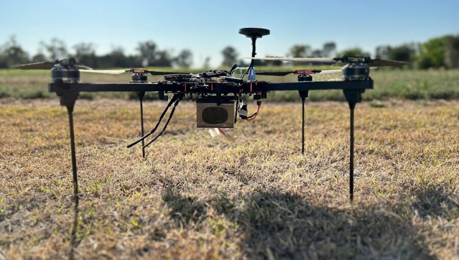
Precision agriculture drones, specifically those equipped with multispectral imaging, offer a fantastic way to boost crop yields by giving farmers incredibly detailed insights into their fields. Essentially, these drones act as high-tech scouts, seeing things the human eye can’t, allowing for more precise and timely interventions. This leads directly to healthier plants, less waste, and ultimately, bigger harvests.
The Drone Advantage: More Than Just a Bird’s-Eye View
Traditional methods of assessing crop health often involve walking fields, taking soil samples, or relying on satellite imagery. While these have their place, they’re either time-consuming, labor-intensive, or lack the fine-grained detail needed for truly precise farming. Drones bridge this gap, offering a flexible, cost-effective, and highly detailed solution.
Speed and Efficiency in Field Scouting
Imagine being able to survey hundreds of acres in a single afternoon. That’s the kind of efficiency drones bring to the table. Instead of spending days walking fields to spot potential issues, a drone can quickly fly over, collect data, and highlight problem areas. This dramatically reduces the time farmers spend in the field on manual inspections, freeing them up for other critical tasks. Plus, they can cover areas that might be difficult or impossible to access on foot, like densely planted fields or areas with challenging terrain. This quick turnaround is crucial when issues like pest infestations or nutrient deficiencies can spread rapidly.
Unparalleled Detail and Resolution
Satellite imagery, while useful for large-scale trends, often has a resolution that’s too coarse for pinpointing specific issues within a field. You might see a “red patch” indicating stress, but you won’t know if it’s an isolated plant, a small cluster, or a wider area. Drones, flying at lower altitudes, can capture images with resolutions down to a few centimeters per pixel. This level of detail allows farmers to identify individual stressed plants, localized weed outbreaks, or precise areas of waterlogged soil. It’s like going from a blurry photograph to a crystal-clear, high-definition image of your field.
Flexibility and On-Demand Data Collection
Unlike satellites, which operate on fixed orbits and schedules, drones offer on-demand data collection. If a sudden weather event occurs, or a specific concern arises, a drone can be deployed almost immediately to assess the situation. This flexibility means farmers aren’t waiting days or weeks for their next satellite pass; they can get current, relevant data whenever they need it. This responsiveness is invaluable for making timely decisions, especially when dealing with fast-developing plant diseases or pest outbreaks. You can tailor flight paths and timing to specific needs, rather than relying on a generic schedule.
In the realm of precision agriculture, the integration of drones equipped with multispectral imaging technology is revolutionizing the way farmers optimize crop yields.
For a deeper understanding of how emerging marketing technologies are influencing various industries, including agriculture, you can explore the article on marketing innovations for 2023. This resource highlights the intersection of technology and agriculture, showcasing how advancements like precision agriculture drones are becoming essential tools for modern farming practices. To read more, visit this article.
Key Takeaways
- The training data includes information and events up to October 2023.
- Insights and knowledge are based on a wide range of sources available until the cutoff date.
- No updates or developments occurring after October 2023 are included in the training.
- Users should verify current information from reliable sources for the latest updates.
- The model’s responses reflect the context and knowledge available up to the specified date.
Seeing the Unseen: How Multispectral Imaging Works
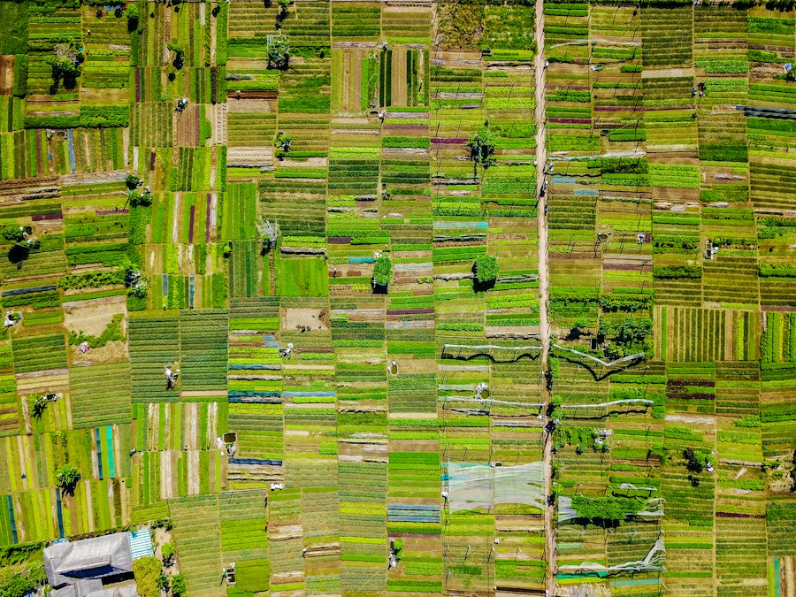
This is where the real magic happens. While a regular camera captures light in the visible spectrum (what our eyes can see), multispectral cameras go beyond that, capturing light in specific, non-visible bands. These additional bands reveal crucial information about plant health that would otherwise be invisible.
Understanding Light and Plant Health
Plants interact with light in fascinating ways. Healthy plants, for example, absorb a lot of red and blue light for photosynthesis but reflect a significant amount of near-infrared (NIR) light. Stressed or unhealthy plants, on the other hand, tend to reflect more visible red light and less NIR. Multispectral cameras are designed to specifically measure these subtle differences in light reflectance. By capturing data in specific bands like blue, green, red, red edge, and near-infrared, we can create indices that correlate directly with plant vigor, chlorophyll content, and moisture levels.
Precision agriculture drones are revolutionizing the way farmers monitor and manage their crops, particularly through the use of multispectral imaging to optimize crop yields. This innovative technology allows for detailed analysis of plant health and soil conditions, enabling farmers to make informed decisions that enhance productivity. For further insights on how these advancements are shaping the agricultural landscape, you can explore a related article that delves into the broader implications of drone technology in farming practices. Check it out here for more information.
The Role of Specific Light Bands
Each light band captured by a multispectral sensor tells a different story:
- Blue and Red Bands: These are strongly absorbed by chlorophyll for photosynthesis. Low absorption in these bands can indicate chlorophyll deficiency, often a sign of stress or nutrient issues.
- Green Band: Healthy plants reflect more green light, which is why we perceive them as green.
- Red-Edge Band: This band is particularly sensitive to changes in chlorophyll content and is excellent for detecting early signs of plant stress, even before visible symptoms appear. It sits right at the transition point between red and near-infrared light.
- Near-Infrared (NIR) Band: This is arguably the most crucial band for plant health. Healthy plants with robust cell structures strongly reflect NIR light. A drop in NIR reflectance is a clear indicator of cellular damage, dehydration, or disease.
Calculating Vegetation Indices
Once the drone collects multispectral images, specialized software processes this data to create what are called vegetation indices. These are mathematical formulas that combine the reflectance values from different light bands to produce a single value that correlates with specific plant characteristics.
Normalized Difference Vegetation Index (NDVI)
NDVI is perhaps the most well-known and widely used vegetation index. It’s calculated using the red and near-infrared bands: NDVI = (NIR - Red) / (NIR + Red). High NDVI values (closer to 1) indicate dense, healthy vegetation with high photosynthetic activity. Low values (closer to -1 or 0) can signify bare soil, dead vegetation, or stressed plants. NDVI maps are incredibly useful for quickly identifying areas of varying plant health across a field.
Other Useful Indices
While NDVI is great, other indices offer different insights:
- NDRE (Normalized Difference Red Edge): Similar to NDVI but uses the red-edge band instead of the red band. NDRE is more sensitive to chlorophyll content in the upper canopy and can detect stress earlier than NDVI, especially in mature crops. It’s also less prone to saturation in very dense vegetation.
- SAVI (Soil Adjusted Vegetation Index): Designed to minimize the influence of soil brightness on vegetation index values, making it more accurate in fields with sparse vegetation or where soil is visible between plants.
- MSAVI (Modified Soil Adjusted Vegetation Index): Another soil-adjusted index, often preferred for very early growth stages or fields with low vegetation cover.
- GNDVI (Green Normalized Difference Vegetation Index): Uses the green and NIR bands, providing sensitivity to nitrogen content and water stress.
By utilizing a combination of these indices, farmers get a comprehensive picture of their crop’s health, allowing for more nuanced decision-making.
Practical Applications for Optimized Yields
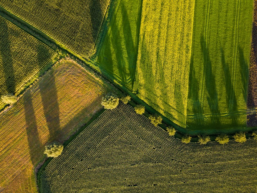
So, how does all this fancy data translate into better yields on the ground? It’s all about making informed decisions and acting precisely.
Early Detection of Stress and Disease
One of the biggest advantages of multispectral drones is their ability to spot problems before they become visible to the human eye. By detecting subtle changes in chlorophyll content or cell structure (via the red-edge and NIR bands), drones can identify nutrient deficiencies, water stress, pest infestations, or early-stage diseases days or even weeks before symptoms manifest as yellowing leaves or stunted growth.
This early warning system allows farmers to intervene much sooner, preventing problems from spreading and causing significant yield losses.
Precise Nutrient Management
Traditional fertilization often involves applying a uniform amount of fertilizer across an entire field. However, soil conditions, previous cropping history, and even microclimates within a field mean that nutrient needs can vary significantly. Multispectral data, especially indices like NDRE or GNDVI, can highlight areas with low nitrogen or other nutrient deficiencies.
This allows for variable-rate fertilization, where fertilizer is applied only where and in the amounts needed, rather than blindly spreading it everywhere. This not only optimizes nutrient uptake and plant health but also reduces fertilizer costs and minimizes environmental impact by preventing over-application.
Targeted Irrigation Strategies
Water is a precious resource, and efficient irrigation is key. Drones equipped with multispectral sensors can help identify areas of water stress or over-irrigation. Plants under water stress will show changes in their spectral signature, particularly in the NIR band. This information can be used to create precise irrigation maps, allowing farmers to deliver water only to the areas that need it most.
This conserves water, reduces energy costs associated with pumping, and prevents waterlogging in other areas, which can lead to root rot and nutrient leaching. Thermal cameras on drones can also directly measure plant temperature, which is another excellent indicator of water stress.
Weed Mapping and Targeted Herbicide Application
Weeds compete with crops for resources like water, nutrients, and sunlight, significantly impacting yields. Multispectral drones can distinguish between weeds and crops based on their unique spectral signatures. This allows for the creation of detailed weed maps, identifying the exact locations and densities of weed infestations. With this information, farmers can implement targeted herbicide application, spraying only the patches where weeds are present, rather than broadcast spraying the entire field.
This drastically reduces herbicide use, lowers costs, minimizes chemical exposure to the environment and desirable plants, and helps prevent herbicide resistance.
Yield Prediction and Analysis
By monitoring crop health and growth throughout the season, multispectral data can contribute to more accurate yield predictions. Consistent monitoring allows farmers to track how their crops are responding to various interventions and environmental factors. This data, combined with historical yield data and other agricultural models, can provide a more reliable estimate of the final harvest.
Post-harvest, the same data can be analyzed to understand correlations between specific field conditions and yield variations, providing valuable insights for future planning and continuous improvement.
Overcoming Challenges and Looking Ahead
While drone technology for agriculture is incredibly powerful, it’s not without its considerations.
Data Processing and Interpretation
Collecting the data is only the first step. The sheer volume of multispectral images can be daunting, and interpreting that data requires specialized software and a certain level of expertise. Raw images need to be stitched together, geo-referenced, and then processed into meaningful vegetation indices and maps. Understanding what those maps are telling you about your field is crucial. This often involves working with agricultural consultants or investing in user-friendly software that automates much of the processing and provides actionable insights.
Initial Investment and Operating Costs
Drones capable of carrying multispectral sensors represent a significant initial investment. The cost of the drone itself, the multispectral camera, software subscriptions, and potentially training can add up. While the return on investment (ROI) can be substantial through increased yields and reduced input costs, it’s a factor farmers need to carefully consider. Operating costs include battery replacements, potential repairs, and ongoing software licenses. However, as the technology matures and becomes more widespread, prices are likely to become more accessible.
Regulatory Hurdles and Skill Requirements
Operating drones commercially, even for agricultural purposes, comes with regulatory requirements. This often includes pilot certification, flight restrictions, and adherence to local aviation laws. Farmers or their operators need to be properly trained and licensed to ensure safe and legal drone operations. Furthermore, understanding drone flight planning, data collection best practices, and the basics of multispectral imaging interpretation requires a new set of skills that many traditional farmers may not possess. Access to training and support networks is essential.
The Future: AI, Automation, and Swarms
The future of precision agriculture drones is incredibly exciting. We’re already seeing advancements in:
- Artificial Intelligence (AI) and Machine Learning: AI algorithms are being developed to automatically analyze multispectral data, identify patterns, and even predict potential issues before human eyes can. This will make data interpretation faster and more accurate.
- Increased Automation: Fully autonomous drone flights, including take-off, mission execution, and landing, are becoming more common. Drones will eventually integrate even more seamlessly with farm management systems.
- Drone Swarms: Imagine multiple drones working together to survey vast fields more quickly and efficiently. This “swarm intelligence” could dramatically reduce data collection times for large agricultural operations.
- Integration with Robotics and Ground-Based Sensors: Drones are just one piece of the puzzle. Integrating drone data with ground-based sensors (for soil moisture, temperature) and robotic systems (for automated spraying or harvesting) will create truly holistic and intelligent farm management systems.
- Hyper-spectral Imaging: Beyond multispectral, hyperspectral cameras capture hundreds of narrow spectral bands, offering even more detailed insights into plant biochemistry and health. As these become more affordable, they will unlock even greater precision.
In conclusion, precision agriculture drones with multispectral imaging are revolutionizing how farmers manage their crops. By providing an unprecedented view into plant health, these technologies empower farmers to make smarter, more timely decisions, leading to healthier plants, reduced waste, and ultimately, a more productive and sustainable agricultural future. While challenges exist, the rapid advancements in technology and the clear benefits suggest that drones will become an increasingly indispensable tool in the modern farmer’s arsenal.
FAQs
What is precision agriculture?
Precision agriculture is a farming management concept that uses technology to optimize crop yields while minimizing resources such as water, fertilizer, and pesticides.
How do drones contribute to precision agriculture?
Drones equipped with multispectral imaging cameras can provide farmers with detailed data about their crops, including information on plant health, soil conditions, and pest infestations. This data allows for targeted interventions and more efficient use of resources.
What is multispectral imaging?
Multispectral imaging is a technology that captures images at specific wavelengths across the electromagnetic spectrum. In agriculture, multispectral cameras on drones can detect variations in crop health that are not visible to the naked eye, helping farmers make informed decisions about their fields.
How can drones help farmers increase crop yields?
By providing real-time data on crop health and environmental conditions, drones enable farmers to identify areas of their fields that require attention, such as irrigation or pest control. This targeted approach can lead to increased yields and improved crop quality.
Are there any regulations or restrictions on using drones for precision agriculture?
Yes, there are regulations that govern the use of drones in agriculture, including restrictions on flying near airports, over crowds, or beyond the operator’s line of sight. Farmers must also comply with privacy laws when collecting data with drones.
Enjoying our content? Make us a preferred source on Google:
Add us as a Preferred Source on Google