

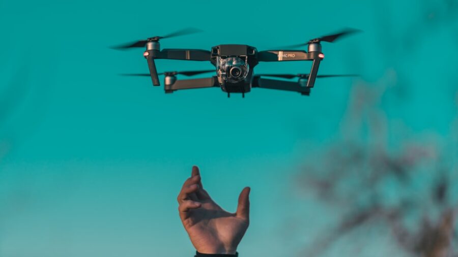
In short, 5G-enabled drones are transforming real-time infrastructure inspections by allowing faster, more reliable data transmission from the drone to the ground. This means inspection teams can get high-quality visual and sensor data almost instantly, making decisions quicker and improving safety and efficiency. No more waiting for data to download or dealing with dropped connections – it’s all about getting the right information to the right people, right when they need it.
Inspecting critical infrastructure like bridges, power lines, pipelines, and cell towers has always been a time-consuming and often dangerous task. Traditional methods involve sending human inspectors into hazardous environments, which is inherently risky and can disrupt operations.
Drones have already significantly improved this process, offering a safer and more efficient alternative.
However, even with drones, there’s been a bottleneck: getting the massive amounts of data they collect back to the analysis teams quickly enough for truly “real-time” decision-making.
That’s where 5G comes in.
The Limitations of Previous Generations
Before 5G, drones typically relied on Wi-Fi or older cellular networks for data transmission.
- Wi-Fi’s Range and Interference: While good for short distances, Wi-Fi has limited range and is susceptible to interference, making it unsuitable for large-scale or remote infrastructure inspections. Imagine trying to inspect a 10-mile pipeline with a drone that needs to stay within Wi-Fi range of a ground station – it’s just not practical.
- 4G’s Latency and Bandwidth: 4G cellular networks were an improvement, offering broader coverage. However, their latency (the delay before data transfer begins) and bandwidth (the amount of data that can be transferred over a period) often weren’t sufficient for truly real-time, high-definition video streaming or large sensor data uploads. This meant that while drones could collect data, there was still a noticeable lag in getting that data into the hands of the analysts.
- Offline Data Transfer: Many drone operations still involve landing the drone, removing an SD card, and then physically transferring the data to a computer. This adds significant time and introduces potential delays, especially when critical decisions need to be made immediately, such as assessing damage after a storm.
The Urgent Call for Instant Insights
Think about a critical scenario: a power line goes down during a hurricane, or a crack appears on a bridge after an earthquake. In these situations, every second counts. Engineers need to quickly assess the damage, understand the extent of the problem, and dispatch repair crews. Waiting hours or even minutes for drone footage to download and be analyzed can have severe consequences, from prolonged power outages to structural failures. Real-time data means real-time understanding and, crucially, real-time action.
In exploring the transformative impact of technology on various sectors, a related article discusses the broader implications of advancements in the tech industry, including the role of 5G in enhancing operational efficiency. This article highlights how innovations like 5G-enabled drones are revolutionizing real-time infrastructure inspections, allowing for more accurate data collection and faster response times. For further insights into the diverse topics covered in the tech sector, you can read more in this article: Hacker Noon Covers a Range of Topics Across the Tech Sector.
Key Takeaways
- Clear communication is essential for effective teamwork
- Active listening is crucial for understanding team members’ perspectives
- Setting clear goals and expectations helps to keep the team focused
- Regular feedback and open communication can help address any issues early on
- Celebrating achievements and milestones can boost team morale and motivation
5G: The Game Changer for Drone Inspections
5G isn’t just a slightly faster version of 4G; it’s a fundamental leap forward in wireless technology. Its core capabilities directly address the limitations that previously hindered truly real-time drone inspections.
Unpacking 5G’s Key Features
What makes 5G so powerful for this specific application?
- High Bandwidth: 5G can transmit significantly more data per second than previous generations. This is crucial for drones carrying high-resolution cameras (think 4K or even 8K video), thermal imaging sensors, LiDAR (Light Detection and Ranging), and other sophisticated payloads. More bandwidth means smoother, higher-quality live video feeds and faster uploads of large data files.
- Low Latency: This is perhaps the most critical advantage for real-time operations. Latency is the delay between when a signal is sent and when it is received. 5G boasts ultra-low latency, often measured in single-digit milliseconds. For drone inspections, this translates to:
- Responsive Control: Operators can control the drone with much greater precision, as their commands are executed almost instantly.
- Immediate Feedback: If a drone detects an anomaly, the ground team sees it instantly, allowing for immediate redirection of the drone for closer inspection or further data collection.
- Massive Connectivity (mMTC): 5G is designed to connect a vast number of devices simultaneously. While a single drone might not utilize this fully, it’s important for future applications where multiple drones might operate concurrently or where numerous ground sensors are also integrated into the inspection ecosystem.
- Network Slicing: This advanced 5G feature allows network operators to create virtual, isolated networks tailored to specific applications. For drone inspections, this means a dedicated “slice” of the 5G network could be allocated, guaranteeing specific levels of bandwidth, latency, and reliability, even during peak network usage. This ensures mission-critical drone operations aren’t impacted by other network traffic.
How 5G Elevates Drone Data Transmission
With 5G, the drone essentially becomes a mobile, high-definition data collection platform that is always connected to the command center.
- Live HD Video Streaming: Instead of choppy, low-resolution feeds, inspection teams can watch smooth, high-definition video in real-time, as if they were right there with the drone. This significantly improves the ability to identify subtle defects or changes.
- Instant Sensor Data Uploads: Data from thermal cameras, multispectral sensors, or LiDAR scanners can be uploaded continuously. This allows for immediate processing and analysis, rather than waiting for the drone to land and offload its data.
- Edge Computing Integration: 5G’s low latency facilitates edge computing – processing data closer to the source (i.e., at the network’s edge, often near the drone itself). This means initial analysis, like identifying potential anomalies using AI, can happen on the fly, reducing the amount of raw data that needs to be transmitted back to a central server. Only the critical insights or flagged areas might then be sent, further optimizing bandwidth.
Beyond Visuals: The Power of Integrated Sensors

While visual inspection is fundamental, modern infrastructure inspection drones are equipped with a suite of sophisticated sensors. 5G‘s ability to handle high volumes of diverse data streams unlocks the full potential of these tools for real-time analysis.
Thermal Imaging for Hidden Issues
Thermal cameras detect heat signatures, making them invaluable for:
- Electrical Infrastructure: Identifying overheating components in power lines, substations, or solar panels before they fail. Real-time thermal data allows for immediate repairs, preventing costly outages.
- Pipeline Inspections: Detecting leaks in oil and gas pipelines, as escaping fluids can cause temperature anomalies.
- Building Inspections: Finding insulation gaps or moisture intrusion in walls and roofs by revealing temperature differences.
- Bridge Decks: Identifying areas of delamination or water ingress in concrete bridge decks.
With 5G, thermal video can be streamed live, allowing experts on the ground to pinpoint issues as they emerge and guide the drone for closer examination without delay.
LiDAR for Precise 3D Mapping
LiDAR technology uses pulsed lasers to measure distances, creating highly accurate 3D point clouds of scanned environments.
- Structural Integrity: Generating precise 3D models of bridges, buildings, or towers to detect subtle deformations, cracks, or erosion over time.
This data is critical for structural engineers.
- Vegetation Management: Mapping vegetation encroachment around power lines or pipelines, allowing for proactive trimming to prevent outages or damage.
- Volumetric Calculations: Accurately measuring stock piles (e.g., gravel, coal) at industrial sites.
5G’s bandwidth is crucial for transmitting these massive LiDAR point clouds in near real-time, enabling immediate model generation and analysis. This means engineers can identify critical structural changes or hazards much faster.
Hyperspectral and Multispectral Cameras for Material Analysis
These advanced cameras capture light across many different spectral bands, revealing information invisible to the human eye.
- Material Degradation: Identifying early signs of material fatigue, corrosion, or chemical degradation in infrastructure components. Different materials reflect and absorb light differently across the spectrum.
- Pollution Detection: Identifying specific pollutants or leaks based on their unique spectral signatures.
- Vegetation Health: Assessing the health of vegetation around infrastructure, which can be an indicator of environmental stress or damage.
Processing and transmitting hyperspectral data is incredibly data-intensive.
5G makes it feasible to stream this complex data for real-time analysis by specialized software and human experts, opening up new possibilities for predictive maintenance and early warning systems.
Operational Advantages: Safety, Efficiency, and Cost Savings

The shift to 5G-enabled drone inspections isn’t just about better data; it fundamentally changes how inspections are conducted, leading to significant operational benefits.
Enhanced Safety for Personnel
This is arguably the most impactful benefit.
- Removing Humans from Harm’s Way: By conducting inspections remotely with drones, personnel are no longer required to climb tall structures, navigate confined spaces, or work in precarious environments. This drastically reduces the risk of falls, electrical shocks, exposure to hazardous materials, or other industrial accidents.
- Reduced Time in Dangerous Zones: Even when human presence is eventually required for repairs, drones can quickly provide a detailed assessment of the hazard, allowing crews to plan safer approaches and minimize their time in dangerous areas.
- Improved Situational Awareness: Real-time drone feeds give ground teams and emergency responders an immediate, high-definition view of a situation, such as a damaged bridge after a flood or an industrial accident, allowing them to make informed decisions without putting themselves at risk.
Significant Efficiency Gains
Beyond safety, efficiency is a massive driver for adopting 5G drone technology.
- Faster Inspection Cycles: What might have taken days or weeks with traditional methods can now be accomplished in hours or even minutes. A drone can rapidly cover large areas, and with 5G, the data is instantly available for review.
- Reduced Downtime: For critical infrastructure, shutting down operations for inspection is costly. Drones can often perform inspections without significant disruption. With real-time data, decisions can be made faster, further minimizing any necessary downtime for repairs.
- Optimized Resource Allocation: Knowing exactly where and what the problem is in real-time allows maintenance crews to be dispatched precisely where they’re needed, with the right tools and materials. This avoids wasted time and resources.
- Remote Expert Collaboration: With high-quality, real-time video and sensor data, subject matter experts can be anywhere in the world and still provide immediate guidance and analysis to the drone operator and ground crew. This democratizes expertise and speeds up decision-making.
Long-Term Cost Reduction
While the initial investment in 5G infrastructure and advanced drones might seem substantial, the long-term cost savings are compelling.
- Lower Labor Costs: Fewer personnel are needed for hazardous inspections, and those involved can be more productive.
- Reduced Equipment Costs (Indirect): Proactive maintenance identified through real-time inspections can prevent catastrophic failures, which are far more expensive to repair than minor issues.
- Avoided Penalties and Liabilities: Minimizing downtime, preventing environmental incidents, and ensuring structural integrity can help avoid regulatory penalties and potential liabilities from failures.
- Extended Asset Lifespan: Regular, detailed, and real-time inspections allow for timely maintenance and repairs, extending the operational life of expensive infrastructure assets.
As industries increasingly adopt advanced technologies, the role of 5G-enabled drones in real-time infrastructure inspections is becoming more prominent. These drones are revolutionizing how we monitor and maintain critical structures, ensuring safety and efficiency. For those interested in exploring the intersection of technology and performance, a related article discusses the best laptops for gaming, which can also be essential tools for processing and analyzing the data collected by these drones. You can read more about it here.
Challenges and the Road Ahead
| Application | Benefits |
|---|---|
| Infrastructure Inspections | Real-time data collection |
| Energy Sector | Improved efficiency and safety |
| Telecommunications | Enhanced network performance monitoring |
| Transportation | Reduced downtime and maintenance costs |
While 5G-enabled drones offer immense potential, their widespread adoption isn’t without hurdles. Addressing these challenges is crucial for realizing the technology’s full promise.
Regulatory Landscape
The skies are becoming increasingly crowded, and operating drones, especially beyond visual line of sight (BVLOS), requires careful regulation.
- BVLOS Permissions: For many large-scale infrastructure inspections (e.g., long pipelines, expansive power grids), drones need to fly beyond the operator’s visual line of sight. Regulatory bodies are still developing and refining the frameworks for safely and legally allowing BVLOS operations, especially in national airspace.
- Airspace Integration: Integrating autonomous and semi-autonomous drones into existing manned aircraft airspace is a complex task requiring robust air traffic management systems and communication protocols.
- Privacy Concerns: Drones equipped with high-resolution cameras flying over public or private property can raise privacy concerns. Regulations need to balance inspection needs with individual privacy rights.
5G Coverage Limitations
While 5G networks are expanding rapidly, pervasive coverage, especially in rural or remote areas where much critical infrastructure is located, is still a work in progress.
- Geographical Gaps: Many pipelines, long-distance power lines, and remote communication towers are situated in areas with limited or no 5G connectivity. Until these gaps are filled, the full benefits of 5G-enabled drones won’t be realized in these specific locations.
- Infrastructure Rollout Speed: Building out 5G infrastructure, particularly mid-band and millimeter-wave (mmWave) frequencies which offer the highest speeds but have shorter ranges, takes time and significant investment.
- Hybrid Solutions: In areas without continuous 5G, hybrid approaches might be necessary, combining intermittent 5G connectivity with onboard data storage and later upload, or reliance on private 5G networks or satellite communication where feasible.
Cybersecurity Risks
Connecting drones directly to cellular networks, especially for transmitting sensitive infrastructure data, introduces new cybersecurity vulnerabilities.
- Data Interception: The real-time stream of high-resolution video and sensor data could be intercepted by malicious actors if not properly encrypted and secured.
- Drone Hijacking: An unsecure connection could potentially allow an unauthorized party to take control of the drone, leading to data theft, operational disruption, or even physical damage.
- Network Vulnerabilities: The 5G network itself, or the cloud platforms used for data storage and analysis, must be robustly secured against cyberattacks.
Robust encryption, secure authentication protocols, intrusion detection systems, and regular security audits are essential to mitigate these risks.
AI and Data Processing Demands
While 5G facilitates data transfer, the sheer volume of data collected by advanced drone sensors still requires sophisticated processing and analysis.
- Real-time AI at the Edge: To fully leverage 5G’s low latency, much of the initial data analysis needs to happen “at the edge” – either on the drone itself or at a nearby local server. This requires powerful, compact AI processing units that can operate efficiently on the drone.
- Scalable Cloud Infrastructure: For deeper analysis, long-term trend tracking, and historical comparison, massive cloud computing resources are still needed to store and process the vast datasets generated over time.
- Skilled Workforce: There’s a growing need for professionals who not only understand drone operation but also possess expertise in data science, AI/machine learning, and infrastructure engineering to interpret and act upon the complex data generated.
The advancements in technology are not only reshaping the way we conduct infrastructure inspections but also influencing various fields, including software development. A related article discusses the best laptops for coding and programming, which are essential tools for developers working on applications that leverage 5G-enabled drones for real-time data analysis. As these drones become more integrated into inspection processes, the need for powerful computing devices grows, making it crucial for programmers to stay updated on the latest hardware options. For more insights, you can check out the article on best laptops for coding and programming.
The Future: Autonomous Flights and Digital Twins
As 5G networks mature and drone technology advances, we’re looking at a future where infrastructure inspections are even more sophisticated, autonomous, and integrated.
Fully Autonomous and Swarm Inspections
The future envisions drones operating with minimal human intervention.
- Pre-programmed Routes: Drones will follow pre-programmed flight paths, automatically collecting data. 5G’s reliable connectivity ensures that these missions can be monitored remotely and adjusted if necessary.
- AI-Powered Anomaly Detection: Onboard AI, powered by 5G’s edge computing capabilities, will be able to detect anomalies in real-time, immediately alerting human operators or even initiating closer inspection protocols autonomously.
- Drone Swarms: For extremely large or complex infrastructure (e.g., massive solar farms, sprawling industrial complexes), swarms of drones could work collaboratively, covering vast areas simultaneously. 5G’s massive connectivity will be crucial for coordinating these swarms and transmitting their combined data streams.
Integration with Digital Twins
Digital twins are virtual replicas of physical assets, updated in real-time with data from various sources.
- Real-time Model Updates: 5G-enabled drones will feed continuous streams of inspection data (visual, thermal, LiDAR, etc.) directly into the digital twin of an infrastructure asset. This keeps the digital model constantly updated, reflecting its current physical state.
- Predictive Maintenance: By analyzing the real-time data within the digital twin, AI algorithms can predict potential failures before they occur. For example, by tracking subtle structural deformations or temperature changes over time, maintenance can be scheduled proactively.
- Simulation and Planning: Engineers can use the highly accurate, real-time digital twin to simulate various scenarios, plan maintenance activities, and test design modifications in a virtual environment before implementing them in the physical world. This minimizes risks and optimizes resource allocation.
- Enhanced Asset Management: The digital twin becomes a comprehensive, living record of the asset’s health and history, providing invaluable insights for long-term asset management strategies.
Towards a Predictive Maintenance Paradigm
Ultimately, the goal is to shift from reactive maintenance (fixing things after they break) to predictive maintenance.
- Continuous Monitoring: Drones, leveraging 5G, enable continuous or very frequent monitoring of infrastructure, providing a detailed historical record of its condition.
- AI-Driven Insights: Machine learning algorithms can analyze vast datasets from drone inspections, sensor data, and environmental factors to identify patterns and predict future issues.
- Optimized Maintenance Schedules: Instead of fixed maintenance schedules, repairs and upkeep can be timed precisely when they are needed, extending asset life, reducing costs, and preventing catastrophic failures.
This fusion of drone technology, 5G connectivity, advanced sensors, AI, and digital twins is not just about making inspections better; it’s about fundamentally reshaping how we manage and maintain the critical infrastructure that underpins our modern world.
FAQs
What is 5G-enabled drone technology?
5G-enabled drone technology refers to the use of drones equipped with 5G connectivity, allowing them to transmit real-time data and high-definition video feeds with minimal latency. This technology enables drones to perform more advanced and complex tasks, such as real-time infrastructure inspections, with greater efficiency and accuracy.
How are 5G-enabled drones transforming real-time infrastructure inspections?
5G-enabled drones are transforming real-time infrastructure inspections by providing faster and more reliable data transmission, enabling real-time monitoring and analysis of infrastructure assets. This allows for quicker identification of potential issues, more efficient maintenance, and improved overall safety and reliability of critical infrastructure.
What are the benefits of using 5G-enabled drones for infrastructure inspections?
The benefits of using 5G-enabled drones for infrastructure inspections include improved efficiency, reduced inspection times, enhanced data accuracy, and increased safety for inspectors. Additionally, 5G-enabled drones can access hard-to-reach or hazardous areas, providing a more comprehensive and detailed inspection of infrastructure assets.
What types of infrastructure inspections can be performed using 5G-enabled drones?
5G-enabled drones can be used to perform a wide range of infrastructure inspections, including but not limited to, inspections of bridges, roads, railways, power lines, pipelines, and buildings. These drones can capture high-resolution images and videos, as well as collect various sensor data to assess the condition and integrity of infrastructure assets.
What are the future implications of 5G-enabled drones for infrastructure inspections?
The future implications of 5G-enabled drones for infrastructure inspections are vast, including the potential for autonomous drone fleets, AI-powered data analysis, and predictive maintenance capabilities. This technology has the potential to revolutionize the way infrastructure inspections are conducted, leading to more proactive and cost-effective asset management strategies.
Enjoying our content? Make us a preferred source on Google:
Add us as a Preferred Source on Google