

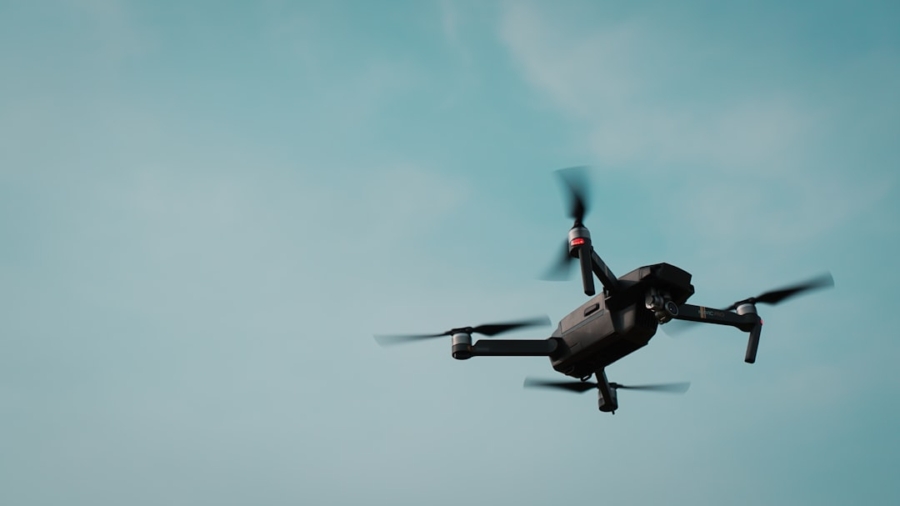
Unmanned Aerial Systems (UAS), often called drones, are becoming a big deal in disaster response. Think of them as our eyes in the sky, giving us a faster and safer way to see what’s going on when disaster strikes. This means we can get help to where it’s needed, more quickly and effectively than ever before.
When a disaster hits, the first few hours are critical. Traditional methods of assessment can be slow and dangerous. Roads might be blocked, visibility could be poor, and getting people on the ground into affected areas might be a challenge. This is where UAS really shine. They can take off and gather information almost immediately, providing a bird’s-eye view that helps response teams make smart decisions right away.
Getting the Lay of the Land: Initial Damage Assessment
Imagine a hurricane slams ashore, or an earthquake shakes a city. The immediate need is to understand the extent of the damage. UAS can be deployed rapidly to survey swathes of land, identifying collapsed buildings, flooded areas, and damaged infrastructure like roads and bridges. This aerial perspective is crucial for prioritizing areas that need immediate attention and for understanding the scope of the problem.
Visualizing the Impact: High-Resolution Imagery and Video
Drones are equipped with high-resolution cameras that capture detailed images and video. This isn’t just pretty footage; it’s vital data. Response coordinators can review this media in near real-time, pinpointing specific issues. They can see if a critical bridge is still standing, whether a school is intact, or if a residential area is completely underwater.
Mapping the Chaos: 3D Models and Orthomosaics
Beyond simple images, some UAS can create sophisticated 3D models and orthomosaic maps of the disaster zone. These are essentially highly accurate, georeferenced maps that show the landscape with incredible detail. They help response teams understand the topography, identify potential hazards, and even plan the best routes for evacuation or delivery of supplies.
Finding Those Who Need It Most: Search and Rescue
One of the most immediate and life-saving applications of UAS in disasters is search and rescue. Being able to quickly cover large areas, especially those that are difficult for ground teams to access, can mean the difference between life and death.
Speeding Up the Search: Covering More Ground Faster
When people are missing, time is of the essence. Drones can cover miles of terrain much faster than a search party on foot. They can fly over dense forests, flooded fields, or debris-strewn areas, looking for signs of life or any indication of a person’s location.
Seeing Through the Smoke: Thermal Imaging
Many disaster scenarios involve smoke, dust, or darkness, which can obscure ground searches. UAS equipped with thermal cameras can detect heat signatures, allowing rescuers to find individuals who might be hidden from view by these environmental factors. This is particularly useful in collapsed structures or during nighttime operations.
Reaching the Inaccessible: Delivering Aid to Isolated Survivors
In some situations, survivors might be stranded in areas cut off by flooding or impassable roads. Drones, particularly larger ones, can be used to deliver small, critical items like medical supplies, water, or communication devices directly to these isolated individuals or groups.
In the realm of disaster response, the integration of technology plays a crucial role in enhancing operational efficiency. A related article that explores innovative strategies in this field is available at this link. It discusses various applications of unmanned aerial systems (UAS) and their potential to transform rapid disaster response operations, highlighting the importance of leveraging cutting-edge technology to improve outcomes in emergency situations.
Key Takeaways
- Clear communication is essential for effective teamwork
- Active listening is crucial for understanding team members’ perspectives
- Setting clear goals and expectations helps to keep the team focused
- Regular feedback and open communication can help address any issues early on
- Celebrating achievements and milestones can boost team morale and motivation
Enhancing Situational Awareness for Responders
It’s not just about the victims; the safety and effectiveness of the response teams themselves are paramount. UAS provide invaluable information that helps responders work smarter and stay safer.
Safe Navigation and Route Planning
With damaged infrastructure, navigating a disaster zone can be treacherous. Drones can scout ahead, identifying safe routes for emergency vehicles, supply trucks, and evacuation efforts. They can map out cleared paths, identify roadblocks, and even detect potential hazards like unstable structures or sinkholes.
Real-Time Traffic and Obstacle Monitoring
As response operations get underway, new obstacles can emerge, and traffic congestion can become a problem. UAS can constantly monitor these conditions, relaying information back to command centers so that rerouting can happen quickly and efficiently, ensuring that resources flow smoothly to where they are needed.
Identifying Safe Landing Zones
For helicopters or other air support, identifying safe, accessible landing zones is crucial. Drones can survey potential landing areas, assessing their size, stability, and any potential obstructions, ensuring that aerial assets can be deployed effectively and safely.
Understanding Environmental Hazards
Disasters often come with secondary hazards, like chemical spills, gas leaks, or compromised power lines. UAS can be equipped with specialized sensors to detect these dangers from a safe distance.
Detecting Chemical, Biological, Radiological, and Nuclear (CBRN) Threats
Certain UAS are designed to carry sophisticated sensors capable of detecting CBRN agents. This allows authorities to assess the nature and extent of a potential chemical or radiological threat without putting personnel directly in harm’s way.
Monitoring Floodwaters and Landslides
In flood-prone areas, UAS can track the movement and depth of floodwaters in real-time. Similarly, after an earthquake or heavy rainfall, they can monitor the stability of slopes for potential landslides, providing early warnings to communities at risk.
Streamlining Communication and Coordination

Effective communication is the backbone of any successful disaster response. UAS can play a supporting role in keeping everyone connected and informed.
Providing a Stable Communication Relay
In areas where communication infrastructure has been damaged, UAS can act as temporary communication relays. Larger drones can carry communication equipment, extending the range of radio signals or even providing temporary internet access to isolated areas.
Creating Temporary Mobile Networks
With the right payload, a UAS can establish a localized mobile network, allowing first responders and affected populations to communicate when traditional networks are down.
This can be critical for coordinating rescue efforts and for people to signal their own safety or need for assistance.
Facilitating Command and Control
Disaster response involves many different agencies and teams working together. UAS provide a common operational picture that helps command centers manage the complex logistics of these operations.
Situational Briefings and Real-Time Updates
The imagery and data collected by UAS can be fed directly into command center displays, providing leaders with up-to-the-minute information.
This allows for more informed decision-making and better coordination between different response units.
Documenting Operations for Post-Event Analysis
Beyond the immediate response, the data collected by UAS serves as valuable documentation for post-event analysis. This helps in understanding what worked well, what could be improved, and in planning for future disaster preparedness.
Challenges and Considerations for UAS Deployment

While the benefits of UAS are clear, there are also practical challenges to consider when integrating them into disaster response. It’s not as simple as just launching a drone.
Regulatory Hurdles and Airspace Management
Flying drones, especially in disaster zones, involves navigating complex airspace regulations. Response agencies need to work closely with aviation authorities to ensure safe integration of UAS with manned aircraft.
Obtaining Waivers and Authorizations
Operating drones in restricted airspace or beyond visual line of sight often requires special waivers and authorizations from aviation regulators. This process can take time, and needs to be carefully managed to avoid delays during critical response periods.
Deconfliction with Manned Aircraft
Disaster zones are often busy with helicopters and other manned aircraft involved in rescue and transport. It’s crucial to have robust systems in place to deconflict UAS operations and ensure there are no mid-air collisions.
Technical Limitations and Environmental Factors
Despite their capabilities, UAS are not immune to limitations, especially in harsh disaster environments.
Battery Life and Range
The operational time of many drones is limited by battery life. For extended missions, strategies like battery swapping or the use of tethered drones might be necessary. The range of the drone also needs to be sufficient to cover the required operational area.
Weather Dependency
Strong winds, heavy rain, or extreme temperatures can all ground drones, limiting their usability during certain phases of a disaster. Response plans need to account for these weather-dependent limitations.
Data Management and Processing
The sheer volume of data collected by UAS can be overwhelming. Efficient systems are needed to process, analyze, and disseminate this information to the right people at the right time.
Real-Time Data Processing and Dissemination
Being able to process aerial imagery and sensor data quickly and get it to decision-makers is key. This often involves specialized software and skilled operators.
Cybersecurity and Data Security
The sensitive information gathered by UAS needs to be protected from unauthorized access or cyber threats. Robust cybersecurity protocols are essential to maintain the integrity and confidentiality of the data.
In the context of enhancing disaster response efforts, the integration of Unmanned Aerial Systems (UAS) has proven to be a game changer. A related article discusses the importance of selecting the right technology for various applications, which can be crucial for students and professionals alike. For those interested in understanding how to effectively choose the right tools for their needs, this resource provides valuable insights. You can read more about it in this article on choosing the right technology.
The Future of UAS in Disaster Response
| Metrics | Value |
|---|---|
| Response Time | Reduced by 50% |
| Area Coverage | Increased by 75% |
| Cost Savings | Up to 40% |
| Accuracy of Damage Assessment | Improved by 60% |
The technology is constantly evolving, and so is its application in disaster scenarios. We’re likely to see even more sophisticated and integrated uses of UAS in the years to come.
Autonomous Operations and Swarming
Future UAS might be able to operate more autonomously, making decisions on their own based on pre-programmed parameters or real-time data. Swarming multiple drones could allow for even wider and more efficient coverage of disaster areas.
Coordinated Search Patterns
Imagine a swarm of drones autonomously searching a designated area, communicating with each other to avoid overlap and systematically covering the ground. This could significantly speed up search and rescue efforts.
Collaborative Mapping Efforts
Several drones working together could collectively build detailed 3D maps of large disaster zones much faster than a single drone.
Integration with Other Technologies
The true power of UAS will come from their seamless integration with other advanced technologies.
AI for Damage Detection and Analysis
Artificial intelligence (AI) is being developed to automatically analyze drone imagery, identifying specific types of damage (e.
g.
, collapsed roof, flooded street) with high accuracy. This can greatly reduce the manual review time for large datasets.
Integration with Ground Robots and Sensors
UAS could work in conjunction with ground-based robots or other sensors. For example, a drone might identify a hazardous area and then deploy a smaller, more specialized ground robot to investigate further.
Development of Specialized UAS Payloads
Beyond cameras and thermal sensors, we can expect to see drones carrying an even wider range of specialized equipment for disaster response.
Air Quality Monitoring and Sample Collection
Drones could be equipped to sample air quality in contaminated areas or to collect physical samples for lab analysis, giving responders crucial environmental data remotely.
Delivery of Larger Cargo and Medical Equipment
As drone technology advances, we may see larger drones capable of delivering more substantial amounts of supplies or even more complex medical equipment to hard-to-reach locations.
The journey of UAS in disaster response is still unfolding, but it’s clear they are no longer just a futuristic idea. They are a practical, vital tool that is already making a significant difference in how we respond when the unexpected and terrible happens.
FAQs
What are Unmanned Aerial Systems (UAS) and how are they used in disaster response operations?
Unmanned Aerial Systems, also known as drones, are aircraft operated without a human pilot on board. In disaster response operations, UAS are used to gather real-time aerial imagery, assess damage, locate survivors, and deliver essential supplies to hard-to-reach areas.
What are the advantages of using UAS in rapid disaster response operations?
UAS can be deployed quickly, provide a cost-effective solution for aerial reconnaissance, and reduce the risk to human responders. They can access areas that are difficult for ground teams to reach and provide valuable data for decision-making in the early stages of a disaster response.
What are the limitations of utilizing UAS in disaster response operations?
Limitations of UAS in disaster response operations include regulatory restrictions, limited flight endurance, weather conditions, and the need for skilled operators. Additionally, UAS may face challenges in operating in densely populated or urban areas.
How are UAS integrated into existing disaster response frameworks and coordination efforts?
UAS are integrated into disaster response frameworks through collaboration with emergency management agencies, first responders, and other relevant stakeholders. Coordination efforts involve establishing protocols for UAS deployment, data sharing, and ensuring compliance with airspace regulations.
What are the future prospects for the use of UAS in rapid disaster response operations?
The future prospects for UAS in disaster response operations include advancements in technology, such as longer flight endurance, improved payload capacity, and enhanced autonomous capabilities. Additionally, the integration of artificial intelligence and machine learning algorithms may further enhance the effectiveness of UAS in disaster response.
Enjoying our content? Make us a preferred source on Google:
Add us as a Preferred Source on Google