

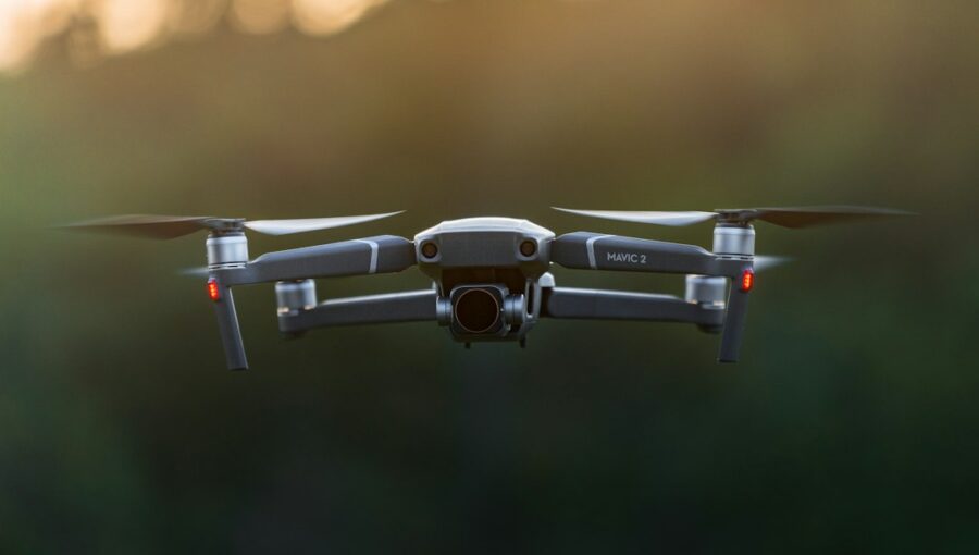
You’ve probably heard about digital twins – those incredibly detailed virtual replicas of real-world objects or environments. They’re popping up everywhere, from manufacturing floors to entire cities. But when it comes to building a super accurate digital twin of terrain, especially for things like infrastructure planning, land surveying, or even environmental monitoring, there’s a powerful tool making waves: LiDAR-equipped drones.
So, can LiDAR drones create high-accuracy digital twin terrain models? Absolutely. In fact, they’re becoming the go-to for getting that level of detail and precision.
Forget the old ways of painstakingly measuring every inch; drones with LiDAR are changing the game, offering speed, safety, and an unprecedented level of accuracy.
Let’s dive into how they do it and why it matters.
LiDAR, which stands for Light Detection and Ranging, is the core technology here. Think of it as an advanced laser scanner that a drone carries. It works by firing millions of tiny laser pulses down towards the ground. When these pulses hit something – a tree, a building, the bare earth – they bounce back to the drone.
How LiDAR Pulses Work
The drone measures the exact time it takes for each pulse to travel out and back. Since light travels at a known, constant speed, this time measurement directly translates into a precise distance. By doing this thousands or even millions of times per second, the drone builds up a massive collection of 3D points, each representing a surface it encountered.
Penetrating the Canopy: A Key Advantage
One of the biggest hurdles in creating accurate terrain models is vegetation. Traditional aerial photography can only show you what’s on top of the leaves and branches. LiDAR, however, has a remarkable ability to penetrate dense foliage. Some of the laser pulses will bounce off leaves, but others will pass through gaps and hit the ground, trees, or other features underneath. This means you get a much clearer picture of the actual ground surface, not just the top layer of the forest. This is crucial for understanding the true topography, identifying hidden obstacles, or planning construction projects where ground conditions are paramount.
LiDAR-equipped drones have revolutionized the field of terrain modeling by providing high-accuracy digital twin representations of landscapes, which are essential for various applications such as urban planning, environmental monitoring, and disaster management. For those interested in exploring advanced tools that can enhance digital modeling and data analysis, a related article discusses the best group-buy SEO tools available, which can be beneficial for professionals looking to optimize their digital presence. You can read more about these tools in the article found here: 2023 Best Group Buy SEO Tools Provider.
Key Takeaways
- The training data includes information and events up to October 2023.
- Insights and knowledge are based on a wide range of sources available until the cutoff date.
- No updates or developments occurring after October 2023 are included in the training.
- Users should verify current information from reliable sources for the latest updates.
- The model’s responses reflect the context and knowledge available up to the specified date.
Why Drones are the Perfect Platform for LiDAR
While LiDAR technology itself is impressive, putting it on a drone unlocks a whole new level of practicality and efficiency for terrain modeling. Drones offer a unique combination of mobility, accessibility, and cost-effectiveness that ground-based or manned aircraft systems just can’t match.
Reaching the Inaccessible
Drones can go places that are difficult or dangerous for humans to access. Steep slopes, dense forests, active construction sites, or even areas prone to natural hazards can all be surveyed safely and efficiently from the air. This not only protects surveyors but also allows for data collection in environments previously deemed too challenging.
Speed and Efficiency Gains
Compared to traditional ground surveying, which can take weeks or months for large areas, LiDAR drones can collect vast amounts of data in a matter of days or even hours. The automated flight paths and rapid data acquisition mean you get your results much faster, allowing for quicker decision-making and project turnaround times. This is a massive advantage in time-sensitive projects.
Cost-Effectiveness
While the initial investment in a LiDAR drone system can be significant, the long-term cost savings are substantial. Reduced labor requirements, faster project completion, and the ability to perform surveys more frequently make LiDAR drones a more economical choice for many applications, especially for recurring surveys or projects requiring detailed, up-to-date information.
The Data: From Point Clouds to Digital Twins

The raw output from a LiDAR scanner is a “point cloud” – a massive collection of individual 3D points. Each point has X, Y, and Z coordinates, giving it a precise location in space. This point cloud is the foundation of your digital twin terrain model.
Understanding Point Clouds
Imagine a blizzard of tiny, perfectly positioned dots.
That’s essentially what a point cloud looks like initially. These points represent every surface the LiDAR laser encountered: the ground, trees, buildings, vehicles, and anything else in the surveyed area. The density of the point cloud – the number of points per square meter – is a key indicator of the detail and accuracy of the data.
Higher density means more information and a more refined model.
Processing and Filtering for Clarity
A raw point cloud, while informative, can be quite noisy. It contains points from everything, including vegetation and man-made structures. To create a true terrain model, this data needs to be processed.
This involves filtering out points that don’t represent the bare earth. Algorithms are used to identify and remove points belonging to trees, buildings, power lines, and other objects, leaving behind only the ground surface. This filtering process is critical for ensuring that your digital twin accurately reflects the underlying topography.
Creating Digital Elevation Models (DEMs) and Digital Surface Models (DSMs)
Once the point cloud is filtered, it can be used to generate different types of models. A Digital Elevation Model (DEM) represents the bare earth surface, without any vegetation or structures. This is essential for understanding the natural landscape and planning for earthworks or drainage.
A Digital Surface Model (DSM), on the other hand, includes the elevation of all surfaces, including buildings, trees, and other objects. The distinction is important, as each model serves different purposes in digital twin applications.
High Accuracy: What Sets LiDAR Drones Apart

The term “high accuracy” is key when discussing LiDAR drones for terrain modeling. It’s not just about having a 3D representation; it’s about having one that you can trust for critical decisions. LiDAR’s inherent properties, combined with advancements in drone technology and processing, lead to exceptional accuracy.
The Precision of Laser Measurement
LiDAR systems are engineered for precision. The laser pulses are incredibly narrow, and the timing mechanisms are highly sophisticated. This allows for centimeter-level accuracy in distance measurements. When these precise measurements are combined with the drone’s highly accurate GPS and IMU (Inertial Measurement Unit) data, the resulting point cloud is georeferenced with remarkable accuracy. This means each point in your model is tied to its exact real-world geographic location.
Reducing Errors Through Automation
Manual surveying is prone to human error. Even with the best intentions, surveyors can make mistakes in measurement, transcription, or positioning. LiDAR drones automate much of this process, significantly reducing the potential for human error. The flight paths are pre-programmed, and the data is collected automatically, ensuring consistency and reliability. This automation is a major contributor to the “high accuracy” that LiDAR drones deliver.
Integration with Ground Control Points (GCPs)
While LiDAR drones are inherently accurate, their precision can be further enhanced by integrating Ground Control Points (GCPs). These are precisely surveyed points on the ground that are visible in the drone’s imagery and recorded by the LiDAR system. By matching the drone’s data to these known, highly accurate ground points, the overall accuracy of the resulting model can be further refined, often down to the millimeter level for specific applications. This is a common practice for projects where the absolute highest level of accuracy is required.
LiDAR-equipped drones have revolutionized the field of terrain modeling, enabling the creation of high-accuracy digital twins that are essential for various applications, from urban planning to environmental monitoring. A related article discusses the innovative multimedia efforts in technology, highlighting how advancements like these drones are shaping the future of digital landscapes. For more insights, you can read the article here.
Applications: Where High-Accuracy Digital Twin Terrain Models Shine
| Metric | Value | Unit | Description |
|---|---|---|---|
| LiDAR Sensor Range | 1200 | meters | Maximum effective distance for terrain scanning |
| Point Cloud Density | 1500 | points/m² | Number of LiDAR points captured per square meter |
| Horizontal Accuracy | ±5 | cm | Positional accuracy in the horizontal plane |
| Vertical Accuracy | ±3 | cm | Positional accuracy in the vertical plane |
| Flight Time | 45 | minutes | Maximum continuous flight duration per battery charge |
| Data Acquisition Speed | 10 | km/h | Typical drone speed during terrain scanning |
| Digital Twin Resolution | 2 | cm | Minimum feature size accurately represented in the model |
| Processing Time per Hectare | 30 | minutes | Time required to process raw LiDAR data into a digital twin |
| Maximum Terrain Slope | 35 | degrees | Maximum slope angle the drone can effectively scan |
| GNSS RTK Accuracy | ±2 | cm | Real-time kinematic GPS accuracy for georeferencing |
The ability to create highly accurate digital twin terrain models with LiDAR drones opens up a wide range of practical applications across various industries. The detail and precision offered by this technology are transforming how we plan, build, and manage our environment.
Infrastructure Development and Management
For civil engineers and urban planners, accurate terrain models are non-negotiable.
- Design and Planning: When designing roads, bridges, pipelines, or any other infrastructure, engineers need to understand the existing terrain to optimize designs, minimize earthwork, and ensure proper drainage. A high-accuracy DEM derived from LiDAR data provides this crucial information.
- Construction Monitoring: During construction, drones can provide regular updates on progress and compare the as-built conditions to the original design. This helps identify any deviations early on and ensures the project stays on track and within budget.
- Asset Management: For existing infrastructure, digital twins created from LiDAR data can be invaluable for maintenance and management. Identifying areas prone to erosion, subsidence, or flooding allows for proactive interventions and helps extend the lifespan of assets.
Environmental Monitoring and Management
Understanding the earth’s surface is vital for environmental stewardship.
- Landslide and Flood Risk Assessment: High-resolution terrain models can identify subtle changes in elevation or drainage patterns that might indicate a risk of landslides or increased susceptibility to flooding. This allows for better planning and mitigation strategies.
- Forestry and Agriculture: LiDAR can map forest canopy heights, biomass, and terrain characteristics, aiding in forest management, wildfire risk assessment, and sustainable logging. In agriculture, it can help optimize irrigation, identify soil variations, and monitor crop health.
- Coastal Erosion Monitoring: Drones can repeatedly survey coastlines to accurately measure erosion rates, providing critical data for coastal defense planning and management.
Surveying and Mapping
The traditional surveying industry has been revolutionized by LiDAR drones.
- Large-Scale Surveying: For large land parcels, LiDAR drones offer a significantly faster and more cost-effective way to acquire detailed topographic data compared to traditional methods.
- Volumetric Calculations: Whether it’s stockpiles of materials on a construction site or the volume of earth to be moved for a new development, LiDAR-derived models allow for highly accurate volumetric calculations.
- As-Built Surveys: After a project is completed, an as-built survey using LiDAR drones can capture the final state of the construction with high accuracy, providing an essential record for future reference and maintenance.
Mining and Resource Exploration
The mining industry relies on precise topographical data for a multitude of operations.
- Mine Planning and Design: LiDAR helps in designing open-pit mines, planning haul roads, and calculating volumes of extracted material.
- Reclamation Monitoring: After mining operations cease, LiDAR can be used to monitor the success of land reclamation efforts and ensure the site is returning to its intended state.
- Geological Surveys: While not a direct replacement for geological expertise, LiDAR can reveal surface features and geological formations that might inform further exploration and analysis.
In conclusion, LiDAR-equipped drones are not just a futuristic concept; they are a practical, powerful tool delivering tangible results. By providing fast, safe, and remarkably accurate data, they are enabling the creation of sophisticated digital twin terrain models that are essential for informed decision-making across a diverse array of fields. As the technology continues to evolve, its impact on how we understand and interact with our physical world will only grow.
FAQs
What is LiDAR technology?
LiDAR stands for Light Detection and Ranging, which is a remote sensing method that uses light in the form of a pulsed laser to measure variable distances to the Earth.
How do LiDAR-equipped drones work for terrain modeling?
LiDAR-equipped drones use laser pulses to measure distances to the ground surface, creating highly accurate 3D models of terrain by capturing millions of data points.
What are the advantages of using LiDAR-equipped drones for terrain modeling?
LiDAR-equipped drones provide high-accuracy data, even in challenging terrains, and can cover large areas quickly and efficiently compared to traditional surveying methods.
What are some applications of LiDAR-equipped drones in terrain modeling?
LiDAR-equipped drones are used in various industries such as agriculture, forestry, urban planning, and infrastructure development for tasks like flood modeling, vegetation analysis, and construction planning.
Are there any limitations to using LiDAR-equipped drones for terrain modeling?
Some limitations of LiDAR-equipped drones include high costs associated with equipment and data processing, as well as the need for skilled operators to ensure accurate data collection and analysis.
Enjoying our content? Make us a preferred source on Google:
Add us as a Preferred Source on Google