

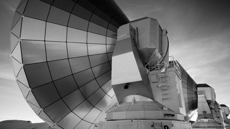
Synthetic Aperture Radar (SAR) is dramatically enhancing our ability to monitor climate change in near real-time from Low Earth Orbit (LEO). Unlike optical sensors that rely on sunlight and clear skies, SAR uses its own radar pulses, allowing it to “see” through clouds and darkness, providing a consistent stream of data critical for understanding rapid environmental shifts. This capability is fundamentally changing how scientists track everything from melting ice sheets to deforestation and even subtle ground deformation, offering a more complete and timely picture of our planet’s evolving climate.
One of the biggest hurdles in traditional Earth observation, especially for climate monitoring, has always been weather. Optical satellites are fantastic when the sun is shining and the skies are clear, but we know from experience that those conditions aren’t constant. This is where Synthetic Aperture Radar (SAR) really shines. It’s a different way of looking at the Earth, and it fundamentally bypasses the limitations of visible light.
How SAR Works: A Quick Overview
Think of SAR as a highly sophisticated radar system mounted on a satellite. Instead of passively capturing reflected sunlight, it actively sends out microwave pulses towards the Earth’s surface. These pulses interact with whatever they hit – oceans, forests, buildings, glaciers – and some of that energy bounces back to the satellite. The satellite then records this backscattered signal.
The “Synthetic Aperture” Magic
The “synthetic aperture” part is where the clever engineering comes in. As the satellite moves along its orbit, it collects these radar signals from slightly different positions. By coherently combining these multiple measurements, the system can create a much higher-resolution image than a single radar pulse would allow. It’s like simulating a much larger antenna than what’s physically on board, hence “synthetic aperture.” This allows for incredibly detailed imaging, even from hundreds of kilometers above.
What Makes It “Real-Time”?
While the term “real-time” in satellite data can be a bit nuanced, SAR is getting us closer than ever. Because SAR can collect data day or night, regardless of cloud cover, satellites equipped with it can revisit the same areas much more frequently. This means that instead of waiting for a lucky clear-sky pass, scientists can receive updated information on a particular region multiple times a week, or even daily with constellations of SAR satellites. This rapid data acquisition is crucial for monitoring dynamic processes like floods, volcanic activity, or rapid ice melt, where understanding changes as they happen is paramount.
In addition to exploring how Synthetic Aperture Radar (SAR) is revolutionizing real-time climate monitoring from Low Earth Orbit (LEO), readers may find it interesting to examine the broader implications of technology in media and communication. A related article that discusses the latest trends in digital content creation and consumption can be found at Top Trends on YouTube 2023. This piece highlights how advancements in technology are shaping the way we engage with information, which parallels the transformative impact of SAR on environmental observation and data analysis.
Key Takeaways
- Clear communication is essential for effective teamwork
- Active listening is crucial for understanding team members’ perspectives
- Setting clear goals and expectations helps to keep the team focused
- Regular feedback and open communication can help address any issues early on
- Celebrating achievements and milestones can boost team morale and motivation
Revolutionizing Ice Monitoring
The Earth’s ice sheets and glaciers are incredibly sensitive indicators of climate change. Their melting contributes directly to sea-level rise, and understanding the rate and patterns of this melt is a top priority. SAR is proving to be an indispensable tool for this critical work.
Tracking Glacier Flow and Thinning
One of the most significant contributions of SAR is its ability to precisely measure the velocity of glaciers. By comparing SAR images taken at different times, scientists can track how quickly ice is moving towards the sea. This is vital for understanding mass loss. Furthermore, SAR can detect subtle changes in surface topography that indicate thinning ice. This provides a detailed, pixel-by-pixel map of ice loss, far more comprehensive than previously possible.
Interferometric SAR (InSAR) for Elevation Change
A specific SAR technique, Interferometric SAR (InSAR), is particularly powerful for measuring elevation changes. By processing two SAR images taken from slightly different positions or at different times, InSAR can detect tiny shifts in the ground surface, down to millimeter accuracy. When applied to glaciers and ice sheets, this allows us to measure how much the ice surface is rising or falling, giving us direct insight into thickening or thinning.
Monitoring Sea Ice Extent and Thickness
For polar regions, sea ice is another critical climate indicator. SAR’s ability to penetrate clouds means it can provide continuous monitoring of sea ice extent, even during the long polar winters or periods of persistent cloud cover. This data is crucial for understanding how changing temperatures are affecting Arctic and Antarctic sea ice, which in turn influences global weather patterns and ocean circulation.
Differentiating Ice Types
Beyond just extent, SAR can also help differentiate between various types of sea ice. Different ice types – such as first-year ice, multi-year ice, and refrozen melt ponds – have different radar backscatter properties. This allows scientists to map the age and characteristics of the ice pack, which is important for understanding its stability and its role in the climate system.
Detecting Ice Calving Events
Large icebergs breaking off from glaciers and ice shelves, known as calving, are a dramatic sign of ice sheet instability. SAR can detect these events by spotting the new waterline and the presence of large icebergs in the surrounding waters. This provides a more accurate count and size estimation of calving events, feeding directly into models of ice sheet mass balance.
Uncovering Deforestation and Land Use Changes

Forests play a vital role in the global carbon cycle, acting as significant carbon sinks. Monitoring deforestation and changes in land use is therefore essential for understanding and mitigating climate change. SAR’s all-weather capability makes it ideal for this task, especially in tropical regions that are often shrouded in clouds.
Mapping Forest Cover and Biomass
SAR can penetrate forest canopies to some extent, allowing it to provide information about forest structure and biomass.
By analyzing how the radar signal interacts with the trees, scientists can estimate forest density and even the volume of wood present. This is crucial for calculating how much carbon is stored in forests and how much is released when they are cleared.
SAR’s Penetration Depth
The specific wavelength of the radar used influences how deeply it can penetrate the forest canopy. Shorter wavelengths are more sensitive to leaves and branches, while longer wavelengths can reach further down to the trunks and the forest floor.
By using different SAR sensors or by processing data in specific ways, researchers can gain insights into different layers of the forest.
Identifying Areas of Illegal Logging
The real-time or near real-time nature of SAR data is a game-changer for combating illegal logging. By comparing recent SAR imagery with historical data, authorities can quickly identify new clearings that appear in remote forest areas. This allows for rapid intervention, potentially preventing illegal logging operations before they cause extensive damage.
Monitoring Agricultural Expansion and Land Degradation
Beyond forests, SAR is also used to monitor agricultural expansion, changes in crop types, and signs of land degradation.
This helps track how land is being used for food production, which can have significant implications for greenhouse gas emissions (e.g., from fertilizer use or livestock) and the overall health of ecosystems.
Observing Ocean Dynamics and Coastal Changes

The oceans are massive heat and carbon reservoirs, and their behavior is intimately linked to climate change. SAR provides unique insights into ocean surface conditions, currents, and the impact of rising sea levels.
Tracking Ocean Surface Currents and Eddies
SAR can detect subtle variations in the ocean surface roughness caused by underwater currents and ocean eddies. By observing these patterns, scientists can map the flow of ocean currents in unprecedented detail. This is vital for understanding heat transport, nutrient distribution, and the overall health of marine ecosystems, all of which are influenced by climate change.
Wave Patterns and Wind Influence
SAR can also capture information about ocean waves and their relationship to surface winds. This data helps researchers understand how wind patterns are changing due to climate shifts and how these changes are impacting ocean dynamics.
Monitoring Oil Spills and Marine Pollution
While not directly climate monitoring, SAR’s ability to detect slicks on the ocean surface is crucial for rapid response to oil spills and other forms of marine pollution. These events can have devastating impacts on coastal environments and marine life, and timely detection is key to mitigation.
Observing Coastal Erosion and Inundation
As sea levels rise, coastal erosion and inundation become more pressing concerns. SAR can map changes in coastlines, identify areas prone to erosion, and monitor the extent of flooding during storm surges. This information is critical for coastal planning and adaptation strategies.
As advancements in technology continue to enhance our understanding of the environment, the role of Synthetic Aperture Radar (SAR) in real-time climate monitoring from Low Earth Orbit (LEO) has become increasingly significant. For those interested in exploring the intersection of technology and environmental observation, a related article discusses the innovative features of the Samsung Galaxy Book Odyssey, which highlights how portable computing devices can support data analysis in the field. You can read more about it here. This synergy between cutting-edge technology and climate science is paving the way for more effective monitoring and response strategies.
Detecting Ground Deformation and Natural Hazards
| Metrics | Data |
|---|---|
| Resolution | High-resolution images captured for detailed analysis |
| Accuracy | Precise measurements of surface deformation and changes in ice and vegetation |
| Frequency | Frequent monitoring of Earth’s surface for real-time updates |
| Weather Independence | Unaffected by weather conditions, allowing continuous monitoring |
| Global Coverage | Ability to capture data from any location on Earth |
Changes in the Earth’s surface, even those that are imperceptible to the human eye, can be indicative of underlying geological processes and climate-related impacts. SAR, particularly through InSAR, is a powerful tool for detecting these subtle movements.
Monitoring Volcanic Activity and Subsidence
InSAR can detect ground deformation associated with volcanic activity, such as the swelling of a volcano as magma rises. It can also monitor subsidence, the sinking of the ground, which can be caused by groundwater depletion, the extraction of oil and gas, or the thawing of permafrost. These processes are often exacerbated by climate change.
Precursory Signals for Volcanic Eruptions
Small ground movements can be early warning signs of volcanic eruptions. By continuously monitoring these subtle deformations, SAR data can provide valuable lead time for evacuations and hazard mitigation efforts, saving lives and property.
Tracking Earthquake Effects and Landslides
SAR can map ground displacement caused by earthquakes, providing crucial data for seismic research and hazard assessment. It can also identify areas prone to landslides by detecting subtle ground movements that indicate instability. Climate change can indirectly contribute to landslides through changes in rainfall patterns and permafrost thawing.
Assessing Flood Extent and Impact
During flood events, SAR can penetrate cloud cover to map the extent of inundation accurately and quickly. This information is vital for emergency response, damage assessment, and understanding the long-term impacts of increased flooding frequency and intensity, which are linked to climate change.
The Future of SAR in Climate Monitoring
The current capabilities of SAR are already impressive, but the future holds even more promise.
As technology advances and constellations of SAR satellites grow, our ability to monitor our planet in near real-time will only increase.
Advancements in SAR Technology
Future SAR systems are expected to offer even higher resolutions, greater sensitivity, and more advanced processing capabilities. This will allow for more detailed analysis of environmental changes and the detection of even subtler phenomena. New radar frequencies and polarizations may also unlock new types of information.
Growing SAR Constellations
The trend towards building larger constellations of SAR satellites, often operated by multiple agencies and commercial entities, means that revisit times will continue to decrease. This will provide more frequent and comprehensive data coverage globally, ensuring that critical climate events are captured as they unfold.
Integration with Other Data Sources
The true power of SAR data will be amplified when it is integrated with other Earth observation data, such as optical imagery, atmospheric soundings, and ground-based measurements. This multi-sensor approach will provide a more holistic and robust understanding of complex climate processes.
Machine Learning and AI for Data Analysis
The sheer volume of SAR data being generated will necessitate the use of advanced analytical techniques. Machine learning and artificial intelligence will play a crucial role in automating the detection of changes, classifying features, and extracting meaningful insights from this massive dataset, enabling faster and more efficient climate monitoring.
FAQs
What is Synthetic Aperture Radar (SAR) and how does it work?
Synthetic Aperture Radar (SAR) is a remote sensing technology that uses radar to create high-resolution images of the Earth’s surface. It works by transmitting microwave signals towards the Earth and then receiving and processing the signals that are reflected back.
How is Synthetic Aperture Radar (SAR) being used for real-time climate monitoring from Low Earth Orbit (LEO)?
SAR is being used for real-time climate monitoring from LEO by providing detailed information about changes in the Earth’s surface, such as ice melt, deforestation, and urbanization. This data can help scientists and researchers track and understand the impact of climate change.
What are the advantages of using Synthetic Aperture Radar (SAR) for real-time climate monitoring from LEO?
Some advantages of using SAR for real-time climate monitoring from LEO include its ability to capture high-resolution images regardless of weather conditions or time of day, its wide coverage area, and its ability to detect subtle changes in the Earth’s surface.
What are some of the challenges associated with using Synthetic Aperture Radar (SAR) for real-time climate monitoring from LEO?
Challenges associated with using SAR for real-time climate monitoring from LEO include the need for advanced data processing and analysis techniques, the high cost of satellite deployment and maintenance, and the potential for data overload due to the large amount of information collected.
How is Synthetic Aperture Radar (SAR) expected to impact future climate monitoring efforts from Low Earth Orbit (LEO)?
Synthetic Aperture Radar (SAR) is expected to improve future climate monitoring efforts from LEO by providing more accurate and timely data, which can help inform policy decisions, support disaster response efforts, and contribute to a better understanding of the Earth’s changing climate.
Enjoying our content? Make us a preferred source on Google:
Add us as a Preferred Source on Google