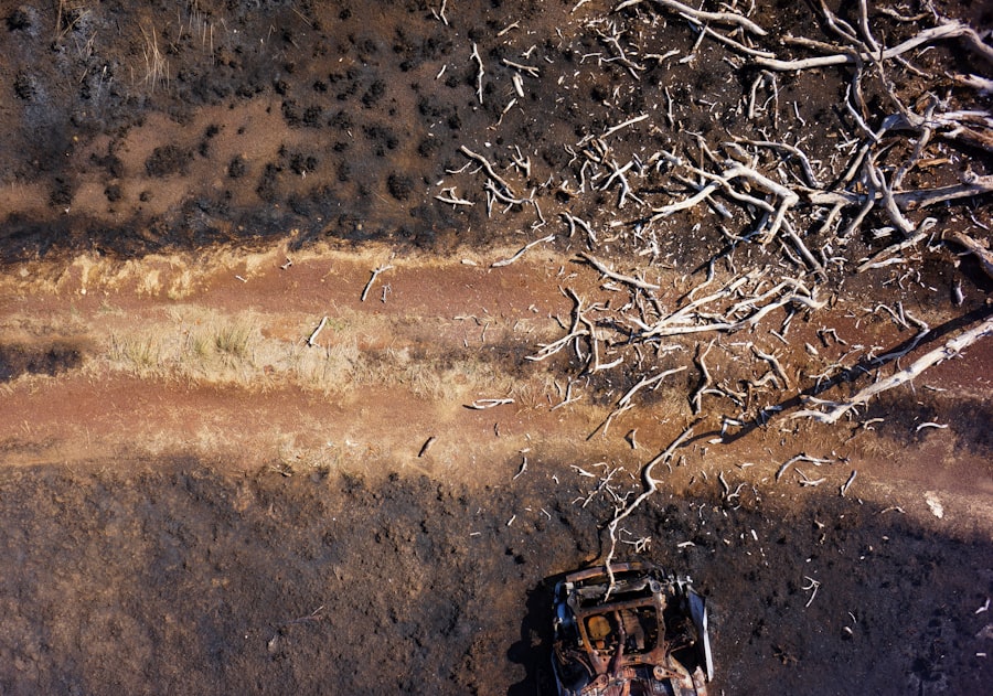
Drone mapping, a rapidly evolving technology, has transformed the way we visualize and analyze geographical data. Utilizing unmanned aerial vehicles (UAVs), this method captures high-resolution images and data from above, allowing for detailed mapping of landscapes, urban environments, and infrastructure. The advent of drone technology has democratized access to aerial imagery, making it more affordable and accessible than traditional methods such as manned aircraft or satellite imagery.
As a result, various sectors, including urban planning, agriculture, and environmental monitoring, have begun to harness the power of drone mapping to enhance their operations. The process of drone mapping involves several key steps: planning the flight path, capturing images, processing the data, and generating maps or 3D models. Drones equipped with advanced sensors and cameras can cover large areas in a fraction of the time it would take conventional methods.
The data collected can be processed using specialized software to create orthomosaics, digital elevation models, and other geospatial products.
Key Takeaways
- Drone mapping is a technology that uses unmanned aerial vehicles (UAVs) to capture aerial imagery and create detailed maps of an area.
- Advantages of drone mapping for urban planning include the ability to quickly and accurately survey large areas, identify potential development sites, and monitor changes over time.
- Drone mapping offers high levels of accuracy and precision, allowing for detailed analysis and measurement of features such as building heights, land use, and infrastructure.
- The cost-effectiveness of drone mapping is evident in its ability to reduce the time and resources required for traditional surveying methods, while still providing high-quality data.
- While drone mapping offers many benefits for urban planning, it also raises concerns about its environmental impact, including noise pollution and potential disruption to wildlife habitats.
Advantages of Drone Mapping for Urban Planning
One of the most significant advantages of drone mapping in urban planning is its ability to provide real-time data collection. Urban planners often face the challenge of keeping up with rapid changes in city landscapes due to construction, development, and natural events. Drones can be deployed quickly to capture current conditions, allowing planners to make timely decisions based on the most up-to-date information.
This immediacy is particularly beneficial in dynamic urban environments where conditions can change overnight.
By providing high-quality visualizations of proposed projects or changes in land use, stakeholders—including community members—can better understand the implications of planning decisions.
This transparency fosters engagement and collaboration among various parties, leading to more inclusive planning processes. For instance, when a city proposes a new park or public space, drone imagery can help visualize how it will fit into the existing urban fabric, enabling residents to provide feedback based on a clear understanding of the project.
Accuracy and Precision of Drone Mapping

The accuracy and precision of drone mapping are critical factors that contribute to its effectiveness in urban planning. Drones equipped with high-resolution cameras and advanced sensors can capture images with remarkable detail, often achieving ground sampling distances (GSD) as low as 1-2 centimeters. This level of detail allows urban planners to analyze features such as building heights, road widths, and vegetation cover with unprecedented accuracy.
Furthermore, the use of GPS technology in drones ensures that the geospatial data collected is precisely georeferenced, which is essential for integrating this information into existing geographic information systems (GIS). In addition to high-resolution imagery, drone mapping can also produce 3D models that provide a comprehensive view of urban environments. These models can be used for various analyses, such as assessing sightlines for new developments or evaluating the impact of proposed infrastructure on surrounding areas.
The ability to visualize urban spaces in three dimensions enhances planners’ understanding of spatial relationships and potential challenges, ultimately leading to more informed decision-making.
Cost-effectiveness of Drone Mapping
Cost-effectiveness is another compelling reason for the growing adoption of drone mapping in urban planning. Traditional aerial surveying methods often involve significant expenses related to aircraft operation, pilot fees, and equipment rental. In contrast, drones offer a more economical solution by reducing labor costs and minimizing the time required for data collection.
A single drone flight can cover large areas quickly, allowing planners to gather extensive data without incurring prohibitive costs. Additionally, the decreasing price of drone technology has made it accessible to a wider range of organizations, including smaller municipalities and private firms. Many urban planners now have the option to invest in their own drones or contract services from specialized companies at competitive rates.
This affordability enables more frequent data collection and updates, which is particularly advantageous in fast-paced urban environments where conditions are constantly evolving.
Environmental Impact of Drone Mapping
The environmental impact of drone mapping is an important consideration in urban planning. Drones are generally more environmentally friendly than traditional surveying methods because they consume less fuel and produce fewer emissions. This reduction in carbon footprint is particularly relevant in urban areas where air quality is a concern.
By utilizing drones for mapping purposes, cities can minimize their environmental impact while still obtaining the necessary data for effective planning. Moreover, drone mapping can play a crucial role in environmental monitoring and conservation efforts within urban settings. For instance, drones can be employed to assess green spaces, monitor wildlife habitats, or track changes in land use over time.
By providing detailed imagery and data on these aspects, urban planners can make more sustainable decisions that prioritize ecological health alongside development goals. This integration of environmental considerations into urban planning processes is essential for creating resilient cities that can adapt to climate change and other challenges.
Integration of Drone Mapping with Geographic Information Systems (GIS)

The integration of drone mapping with Geographic Information Systems (GIS) represents a significant advancement in urban planning methodologies. GIS technology allows planners to analyze spatial data in conjunction with various layers of information—such as demographics, infrastructure, and zoning regulations—enabling a comprehensive understanding of urban dynamics. When drone-collected data is incorporated into GIS platforms, it enhances the analytical capabilities available to planners.
For example, by overlaying drone imagery with existing GIS data layers, planners can identify areas that may be suitable for new developments or infrastructure improvements based on factors such as population density or proximity to public transportation. This synergy between drone mapping and GIS not only streamlines the planning process but also improves the accuracy of analyses conducted by urban planners. The ability to visualize complex datasets in an integrated manner allows for more informed decision-making that considers multiple variables simultaneously.
Challenges and Limitations of Drone Mapping in Urban Planning
Despite its numerous advantages, drone mapping does face several challenges and limitations within the context of urban planning. One significant concern is regulatory compliance; many countries have strict regulations governing drone flights, particularly in urban areas where airspace is congested. Navigating these regulations can be complex and may limit the ability of planners to deploy drones effectively.
Additionally, obtaining necessary permits for flights over populated areas can be time-consuming and may delay projects. Another challenge lies in data processing and analysis. While drones can capture vast amounts of data quickly, processing this information into usable formats requires specialized software and expertise.
Urban planners may need to invest in training or hire skilled personnel to manage this aspect effectively. Furthermore, ensuring data accuracy during processing is crucial; errors in image stitching or georeferencing can lead to misleading results that could adversely affect planning decisions.
Future Implications of Drone Mapping for Urban Planning
Looking ahead, the future implications of drone mapping for urban planning are promising and multifaceted. As technology continues to advance, we can expect improvements in drone capabilities—such as longer flight times, enhanced sensor technology, and greater automation in data collection processes. These advancements will likely lead to even more detailed and accurate mapping products that can inform urban planning decisions at an unprecedented scale.
Moreover, the integration of artificial intelligence (AI) with drone mapping holds significant potential for enhancing analytical capabilities. AI algorithms could automate data processing tasks, identify patterns within large datasets, and even predict future urban trends based on historical data. This synergy between AI and drone technology could revolutionize how urban planners approach their work, enabling them to make proactive decisions that anticipate future challenges rather than merely reacting to current conditions.
In conclusion, as cities continue to grow and evolve, the role of drone mapping in urban planning will become increasingly vital. By providing accurate data quickly and cost-effectively while minimizing environmental impact, drones are poised to reshape how we understand and design our urban environments. The ongoing development of this technology will undoubtedly lead to innovative solutions that address the complexities of modern urban living.
Drone mapping has revolutionized urban planning by providing accurate, real-time data that enhances decision-making processes. This technology allows urban planners to create detailed maps and models, facilitating better infrastructure development and land use planning. A related article that explores the impact of technology on creative industries is Best Software for 2D Animation. This article delves into how advancements in software have transformed animation, much like how drone mapping is transforming urban planning, by offering innovative tools that streamline workflows and improve outcomes.
FAQs
What is drone mapping?
Drone mapping is the process of using unmanned aerial vehicles (UAVs) equipped with cameras and other sensors to capture aerial imagery and data of a specific area. This data is then used to create highly detailed and accurate maps and 3D models of the terrain and infrastructure.
How is drone mapping a breakthrough for urban planning?
Drone mapping provides urban planners with a cost-effective and efficient way to gather detailed and up-to-date information about a city or urban area. This data can be used to assess infrastructure, monitor changes in land use, and plan for future development in a way that was not possible with traditional methods.
What are the benefits of using drone mapping for urban planning?
Some of the benefits of using drone mapping for urban planning include the ability to quickly and accurately survey large areas, the ability to capture high-resolution imagery and data, and the ability to access hard-to-reach or dangerous areas. Additionally, drone mapping can be more cost-effective and less disruptive than traditional surveying methods.
What are some of the challenges of using drone mapping for urban planning?
Challenges of using drone mapping for urban planning include regulatory restrictions, privacy concerns, and the need for specialized skills and equipment to operate drones and process the data they capture. Additionally, weather conditions and airspace restrictions can impact the feasibility of using drones for mapping in urban areas.
How is drone mapping being used in urban planning today?
Drone mapping is being used in urban planning to create detailed 3D models of cities, assess the condition of infrastructure such as roads and buildings, monitor changes in land use and vegetation, and support disaster response and recovery efforts. It is also being used to improve the accuracy and efficiency of traditional surveying and mapping tasks.

