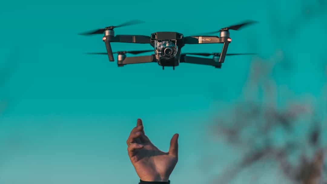
The advent of drone technology has revolutionized various sectors, and environmental monitoring is no exception. Drones, or unmanned aerial vehicles (UAVs), have emerged as powerful tools for collecting data and conducting assessments in a range of ecological contexts. Their ability to access hard-to-reach areas, gather high-resolution imagery, and operate with minimal human intervention makes them particularly valuable in environmental monitoring.
In recent years, the application of drones has expanded significantly, especially in the realm of pollution monitoring, where they provide innovative solutions to pressing environmental challenges. Drones equipped with advanced sensors and imaging technology can capture real-time data on air and water quality, vegetation health, and wildlife populations. This capability is especially crucial in coastal areas, where pollution poses significant threats to marine ecosystems and human health.
By leveraging drone technology, researchers and environmental agencies can enhance their monitoring efforts, enabling more effective responses to pollution events and better-informed policy decisions. The integration of drones into environmental monitoring frameworks represents a paradigm shift that promises to improve our understanding of ecological dynamics and the impacts of human activity on natural systems.
Key Takeaways
- Drones offer a valuable tool for monitoring pollution in coastal areas due to their accessibility and real-time data collection.
- Coastal pollution monitoring is critical for protecting marine ecosystems and public health.
- While drones provide advantages like cost-effectiveness and detailed imaging, they face challenges such as limited flight time and regulatory restrictions.
- Successful case studies demonstrate drones’ effectiveness in detecting and tracking pollution sources along coastlines.
- Future advancements and integration with other monitoring technologies will enhance drones’ role in comprehensive coastal pollution management.
The Importance of Monitoring Pollution in Coastal Areas
Coastal areas are among the most biodiverse ecosystems on the planet, serving as critical habitats for a wide array of marine life. However, these regions are also highly susceptible to pollution from various sources, including industrial discharges, agricultural runoff, and urban development. Monitoring pollution in coastal areas is essential for several reasons.
First and foremost, it helps protect marine biodiversity by identifying harmful contaminants that can disrupt ecosystems and threaten species survival. For instance, pollutants such as heavy metals and microplastics can accumulate in the food chain, leading to detrimental effects on both marine organisms and human populations that rely on these resources for sustenance. Moreover, coastal pollution has far-reaching implications for human health and economic stability.
Many coastal communities depend on fishing, tourism, and recreation for their livelihoods.
Regular monitoring allows for timely interventions to mitigate pollution impacts, ensuring that communities can continue to thrive while safeguarding their natural resources.
Additionally, understanding pollution trends over time can inform policymakers and stakeholders about the effectiveness of regulatory measures and conservation efforts.
Advantages of Using Drones for Pollution Monitoring

The use of drones in pollution monitoring offers numerous advantages that traditional methods often cannot match. One of the most significant benefits is the ability to cover large areas quickly and efficiently. Drones can fly over extensive coastal regions in a fraction of the time it would take ground-based teams, allowing for comprehensive data collection without the logistical challenges associated with manned surveys.
This rapid assessment capability is particularly valuable during pollution events, such as oil spills or algal blooms, where timely information is crucial for effective response efforts. In addition to speed, drones provide high-resolution imagery and data collection capabilities that enhance the quality of monitoring efforts. Equipped with multispectral or hyperspectral sensors, drones can detect subtle changes in water quality parameters such as chlorophyll concentration or turbidity levels.
This level of detail enables researchers to identify pollution sources more accurately and assess the extent of contamination. Furthermore, drones can be deployed in challenging environments where human access is limited or dangerous, such as rocky shorelines or areas affected by hazardous materials. This versatility makes drones an indispensable tool for environmental scientists and conservationists working to protect coastal ecosystems.
Challenges and Limitations of Using Drones for Pollution Monitoring
Despite their many advantages, the use of drones for pollution monitoring is not without challenges and limitations. One significant hurdle is regulatory compliance. In many countries, drone operations are subject to strict regulations governing airspace use, flight altitude, and operational safety.
Navigating these regulations can be complex and may limit the ability of researchers to deploy drones in certain areas or under specific conditions. Additionally, obtaining necessary permits can be time-consuming, potentially delaying critical monitoring efforts. Another challenge lies in the technical limitations of drone technology itself.
While drones are capable of collecting vast amounts of data, processing and analyzing this information can be resource-intensive. High-resolution imagery requires sophisticated software for interpretation, which may not always be readily available or affordable for all research teams. Furthermore, environmental conditions such as wind speed, precipitation, and temperature can affect drone performance and data quality.
For instance, strong winds may limit flight stability or lead to inaccurate readings from sensors. Addressing these challenges requires ongoing advancements in drone technology as well as collaboration among researchers, policymakers, and industry stakeholders.
Case Studies of Successful Drone Monitoring in Coastal Areas
| Metric | Description | Typical Values | Impact on Pollution Monitoring |
|---|---|---|---|
| Flight Duration | Average time a drone can operate per flight | 20 – 60 minutes | Determines area coverage and frequency of monitoring |
| Sensor Types | Types of sensors equipped on drones for pollution detection | Gas sensors, Optical sensors, Thermal cameras, Hyperspectral sensors | Enables detection of various pollutants like oil spills, chemical leaks, and air quality |
| Spatial Resolution | Detail level of data collected (meters per pixel) | 0.1 – 5 meters | Higher resolution allows precise identification of pollution sources |
| Data Transmission Range | Maximum distance for real-time data transmission | 1 – 5 kilometers | Enables timely response and remote monitoring capabilities |
| Pollutant Detection Limit | Minimum concentration of pollutants detectable | Parts per billion (ppb) to parts per million (ppm) | Determines sensitivity and effectiveness in early pollution detection |
| Coverage Area per Flight | Area monitored during a single drone flight | 1 – 10 square kilometers | Influences monitoring efficiency and resource allocation |
| Cost per Flight | Operational cost including maintenance and energy | Varies widely based on drone type and sensors | Impacts feasibility and frequency of monitoring missions |
Several case studies illustrate the successful application of drones in monitoring coastal pollution. One notable example comes from the Gulf of Mexico, where researchers utilized drones to assess the impact of the Deepwater Horizon oil spill on marine ecosystems. By deploying drones equipped with thermal imaging cameras and multispectral sensors, scientists were able to map oil distribution across vast stretches of coastline quickly.
This data was instrumental in guiding cleanup efforts and assessing long-term ecological impacts. Another compelling case study occurred in the Chesapeake Bay region, where drones were employed to monitor nutrient runoff from agricultural fields into nearby waterways. Researchers used drones to capture high-resolution images that revealed patterns of nutrient loading during rainfall events.
This information allowed them to identify critical areas contributing to water quality degradation and develop targeted strategies for reducing runoff through best management practices. These examples underscore the potential of drone technology to enhance our understanding of coastal pollution dynamics and inform effective management strategies.
Future Potential and Developments in Drone Technology for Pollution Monitoring

The future potential of drone technology in pollution monitoring is vast and continually evolving. Ongoing advancements in sensor technology are expected to enhance the capabilities of drones further. For instance, the development of miniaturized sensors that can detect a wider range of pollutants at lower concentrations will enable more precise monitoring efforts.
Additionally, improvements in battery life and flight endurance will allow drones to cover larger areas without needing frequent recharging or maintenance. Moreover, the integration of artificial intelligence (AI) and machine learning algorithms into drone operations holds promise for automating data analysis processes. By leveraging AI-driven analytics, researchers can quickly identify patterns and anomalies in large datasets collected by drones, facilitating faster decision-making in response to pollution events.
The combination of enhanced sensor technology and AI capabilities could lead to a new era of proactive environmental monitoring, where potential pollution sources are identified before they escalate into significant issues.
Collaboration and Integration of Drones with Other Monitoring Methods
To maximize the effectiveness of drone-based pollution monitoring, collaboration with other monitoring methods is essential. Traditional approaches such as ground-based sampling and satellite imagery can complement drone data by providing additional context and validation for findings. For example, ground truthing—where researchers collect samples from specific locations to verify drone data—can enhance the accuracy of assessments and build confidence in results.
Furthermore, integrating drones into existing environmental monitoring frameworks can facilitate more comprehensive assessments of coastal ecosystems. Collaborative efforts among government agencies, research institutions, and local communities can lead to more robust data collection initiatives that leverage the strengths of various monitoring techniques. By fostering partnerships that combine expertise from different fields—such as ecology, remote sensing, and data science—stakeholders can develop innovative solutions to address coastal pollution challenges more effectively.
The Role of Drones in Improving Coastal Pollution Monitoring
Drones have emerged as transformative tools in the field of environmental monitoring, particularly concerning coastal pollution assessment. Their ability to collect high-resolution data quickly and efficiently positions them as invaluable assets for researchers and policymakers alike. As we continue to grapple with the complexities of pollution in coastal areas—where human activity intersects with fragile ecosystems—the role of drones will only become more pronounced.
The ongoing advancements in drone technology promise to enhance our capacity for real-time monitoring and proactive management of coastal environments. By embracing collaboration across disciplines and integrating drone data with traditional methods, we can develop a more comprehensive understanding of pollution dynamics and their impacts on marine ecosystems.
In exploring the innovative applications of technology in environmental monitoring, the article on the best software for video editing in 2023 provides insights into how visual data captured by drones can be effectively utilized to create compelling narratives about pollution in coastal areas. By combining aerial footage with advanced editing software, researchers and activists can raise awareness and drive action against environmental degradation.
FAQs
What are drones and how are they used in monitoring pollution?
Drones are unmanned aerial vehicles equipped with sensors and cameras that can collect data from various environments. In monitoring pollution, drones capture real-time information on air and water quality, detect pollutants, and provide visual evidence of contamination in coastal areas.
Why are drones effective for monitoring pollution in coastal areas?
Drones can access hard-to-reach coastal regions quickly and safely, covering large areas with high precision. They provide timely data, reduce the need for manual sampling, and can be equipped with specialized sensors to detect specific pollutants such as oil spills, chemical contaminants, and plastic debris.
What types of pollution can drones detect in coastal environments?
Drones can detect various types of pollution including oil spills, chemical runoff, plastic waste accumulation, harmful algal blooms, and changes in water quality parameters like turbidity, temperature, and pH levels.
How do drones contribute to environmental protection and management?
By providing accurate and timely data, drones help authorities identify pollution sources, assess environmental damage, and monitor the effectiveness of cleanup efforts. This information supports informed decision-making and promotes proactive measures to protect coastal ecosystems.
Are there any limitations to using drones for pollution monitoring?
Yes, drones have limitations such as limited flight time due to battery life, weather dependency, regulatory restrictions, and the need for specialized equipment and trained operators. Additionally, drones may not replace traditional methods but rather complement them.
What advancements are improving the use of drones in pollution monitoring?
Advancements include improved sensor technology, longer battery life, enhanced data processing capabilities, and integration with artificial intelligence for better analysis. These improvements increase the accuracy, efficiency, and scope of pollution monitoring in coastal areas.
Can drones be used for continuous monitoring of pollution?
While drones are excellent for periodic surveys and targeted monitoring, continuous monitoring typically requires stationary sensors or satellite data. However, drones can be deployed regularly to supplement continuous monitoring systems.
How do drones compare to traditional pollution monitoring methods?
Drones offer faster data collection, access to difficult locations, and lower operational costs compared to traditional methods like boat sampling or manual surveys. They provide high-resolution spatial data but may need to be used alongside traditional techniques for comprehensive monitoring.
What regulations govern the use of drones in coastal pollution monitoring?
Drone operations are subject to national and local aviation regulations, which may include restrictions on flight altitude, no-fly zones, privacy considerations, and requirements for operator certification. Compliance with environmental laws is also necessary when conducting pollution monitoring.
How can communities benefit from drone-based pollution monitoring?
Communities gain from improved environmental awareness, early detection of pollution events, and enhanced ability to advocate for clean-up and conservation efforts. Drones can empower local stakeholders by providing accessible and transparent environmental data.