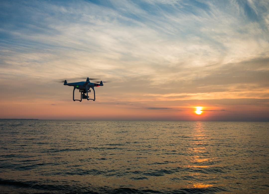
Drones, or unmanned aerial vehicles (UAVs), have revolutionized various industries by providing innovative solutions for data collection and analysis.
One of the most significant applications of drone technology is in the realm of 3D mapping.
This process involves capturing high-resolution images and data from the air, which can then be processed to create detailed three-dimensional representations of landscapes, structures, and other features. The integration of drones with advanced imaging technologies has transformed traditional mapping methods, allowing for greater accuracy, efficiency, and accessibility. The evolution of 3D mapping has been significantly influenced by advancements in drone technology.
Traditionally, creating accurate maps required extensive ground surveys, which were time-consuming and labor-intensive. However, with the advent of drones equipped with sophisticated sensors and cameras, the mapping process has become more streamlined. Drones can cover large areas in a fraction of the time it would take ground crews, capturing high-resolution imagery that can be processed into 3D models.
This shift not only enhances the quality of the data collected but also reduces costs and minimizes the environmental impact associated with traditional surveying methods.
Key Takeaways
- Drones are revolutionizing the field of 3D mapping by providing a cost-effective and efficient way to capture high-precision data from the air.
- The use of drones for 3D mapping offers advantages such as rapid data collection, high accuracy, and the ability to access hard-to-reach areas.
- The technology behind drones and 3D mapping involves advanced sensors, GPS, and software for data processing and analysis.
- Drones are being used in various applications such as construction, agriculture, environmental monitoring, and disaster management for high-precision 3D mapping.
- Challenges and limitations of using drones for 3D mapping include regulatory restrictions, weather conditions, and the need for skilled operators.
The Advantages of Using Drones for High-Precision 3D Mapping
Enhanced Safety in Hazardous Environments
Drones can operate in environments that pose safety risks to human surveyors, such as landslide-prone areas or contaminated zones. By mapping these hazardous sites from the air, drones minimize the risk to personnel and enable safe data collection.
Rapid Data Collection in Emergency Situations
Drones can be deployed quickly and efficiently, enabling rapid data collection in emergency situations, such as natural disasters. This agility allows for timely decision-making based on accurate and up-to-date information.
Accurate Decision-Making with Up-to-Date Information
The ability of drones to provide rapid and accurate data collection enhances safety and enables informed decision-making. With drones, industries can make timely decisions based on the latest information, leading to more effective planning and execution.
The Technology Behind Drones and 3D Mapping

The technology that underpins drone-based 3D mapping is a combination of advanced hardware and sophisticated software. Drones are typically equipped with high-resolution cameras, LiDAR (Light Detection and Ranging) sensors, and GPS systems that work in tandem to capture precise geospatial data. The cameras can take overlapping images from different angles, which are essential for creating accurate 3D models through photogrammetry—a technique that uses multiple photographs to reconstruct three-dimensional objects.
LiDAR technology further enhances the capabilities of drones in mapping applications. By emitting laser pulses towards the ground and measuring the time it takes for the light to return, LiDAR systems can generate highly accurate elevation data. This is particularly useful in densely vegetated areas where traditional imaging methods may struggle to penetrate foliage.
The combination of LiDAR and photogrammetry allows for the creation of detailed digital elevation models (DEMs) that provide insights into terrain features, vegetation density, and other critical factors.
Applications of Drones in High-Precision 3D Mapping
The applications of drones in high-precision 3D mapping are vast and varied, spanning multiple sectors. In agriculture, for instance, farmers utilize drone technology to monitor crop health, assess soil conditions, and optimize irrigation practices. By generating detailed maps that highlight variations in crop growth or soil moisture levels, farmers can make informed decisions that enhance productivity and sustainability.
In the construction industry, drones are employed for site surveys, progress monitoring, and project management. High-resolution 3D maps allow project managers to visualize site layouts, track changes over time, and ensure compliance with design specifications. This capability not only improves communication among stakeholders but also helps identify potential issues before they escalate into costly problems.
Environmental monitoring is another critical application of drone-based 3D mapping. Researchers use drones to assess changes in ecosystems, track wildlife populations, and monitor natural resources. For example, drones equipped with thermal imaging cameras can detect temperature variations in water bodies, providing valuable data for studying aquatic ecosystems.
Similarly, drones can be used to map deforestation or habitat loss, enabling conservationists to develop strategies for protecting vulnerable species.
Challenges and Limitations of Using Drones for 3D Mapping
Despite their numerous advantages, the use of drones for high-precision 3D mapping is not without challenges. One significant limitation is the regulatory landscape surrounding drone operations. Many countries have strict regulations governing drone flights, particularly in urban areas or near airports.
These regulations can restrict flight altitudes, require permits for commercial use, and mandate specific safety protocols. Navigating this complex regulatory environment can pose challenges for organizations looking to leverage drone technology for mapping purposes. Another challenge lies in the technical limitations of drone hardware and software.
While advancements have been made in battery life and payload capacity, many drones still face restrictions on flight duration and range. This can limit their ability to cover large areas in a single flight or necessitate multiple flights to gather sufficient data for comprehensive mapping projects. Additionally, adverse weather conditions such as high winds or rain can hinder drone operations, affecting data quality and reliability.
Regulations and Ethics in Drone-Based 3D Mapping

The regulatory framework governing drone operations is critical to ensuring safety and privacy while promoting innovation in drone-based 3D mapping. In many jurisdictions, regulatory bodies such as the Federal Aviation Administration (FAA) in the United States have established guidelines that dictate how drones can be used commercially. These regulations often include requirements for pilot certification, airspace restrictions, and operational limitations designed to minimize risks associated with drone flights.
Ethical considerations also play a significant role in drone-based mapping initiatives. The ability to capture high-resolution imagery from above raises concerns about privacy invasion and data security. Organizations must navigate these ethical dilemmas by implementing best practices that respect individuals’ rights while still leveraging the benefits of drone technology.
For instance, obtaining consent before conducting aerial surveys over private property or anonymizing data collected during mapping projects can help address privacy concerns.
Future Developments and Trends in Drone-Based 3D Mapping
As technology continues to evolve, the future of drone-based 3D mapping looks promising. One emerging trend is the integration of artificial intelligence (AI) and machine learning algorithms into drone operations. These technologies can enhance data processing capabilities by automating tasks such as image analysis and feature extraction from 3D models.
This automation not only speeds up the mapping process but also improves accuracy by reducing human error. Another trend is the development of hybrid drones that combine fixed-wing and multi-rotor designs. These hybrid models offer extended flight ranges while maintaining the maneuverability needed for detailed mapping tasks.
Furthermore, as public acceptance of drone technology grows, we may see an increase in collaborative efforts between government agencies, private companies, and research institutions to develop standardized protocols for drone-based mapping initiatives. Such collaborations could lead to more efficient data sharing practices and improved methodologies for conducting aerial surveys across various sectors.
The Impact of Drones on High-Precision 3D Mapping
The impact of drones on high-precision 3D mapping is profound and far-reaching. By providing a means to capture detailed geospatial data quickly and efficiently, drones have transformed traditional mapping practices across multiple industries. Their ability to operate safely in challenging environments while delivering high-quality imagery has opened new avenues for research, planning, and decision-making.
As technology continues to advance and regulatory frameworks adapt to accommodate these innovations, the potential applications of drone-based 3D mapping will only expand further. From enhancing agricultural productivity to improving urban planning efforts, drones are poised to play an increasingly vital role in shaping our understanding of the world around us through high-precision mapping techniques.
A related article to The Role of Drones in Enabling High-Precision 3D Mapping is “The Best Antivirus Software in 2023.” This article discusses the importance of cybersecurity in today’s digital age and highlights the top antivirus software options available to protect your devices from online threats. To learn more about the best antivirus software for 2023, you can check out the article here.
FAQs
What are drones?
Drones, also known as unmanned aerial vehicles (UAVs), are aircraft that are operated without a human pilot on board. They can be controlled remotely by a human operator or autonomously by onboard computers.
How are drones used in 3D mapping?
Drones are equipped with high-resolution cameras and other sensors that can capture detailed imagery and data of the terrain below. This data is then used to create accurate 3D maps of the area, which can be used for various applications such as urban planning, land surveying, and environmental monitoring.
What are the advantages of using drones for 3D mapping?
Drones can access hard-to-reach or dangerous areas, making it possible to capture data from places that would be difficult or unsafe for humans to reach. They are also cost-effective and can cover large areas in a relatively short amount of time, making them an efficient tool for 3D mapping.
What is high-precision 3D mapping?
High-precision 3D mapping refers to the creation of highly accurate and detailed 3D maps of an area. This level of precision is achieved through the use of advanced sensors and technology, such as LiDAR (Light Detection and Ranging), which can capture precise elevation and terrain data.
What are some applications of high-precision 3D mapping enabled by drones?
High-precision 3D mapping enabled by drones has a wide range of applications, including infrastructure planning, disaster response, agriculture, forestry management, and archaeology. It can also be used for creating 3D models for virtual reality simulations and gaming.