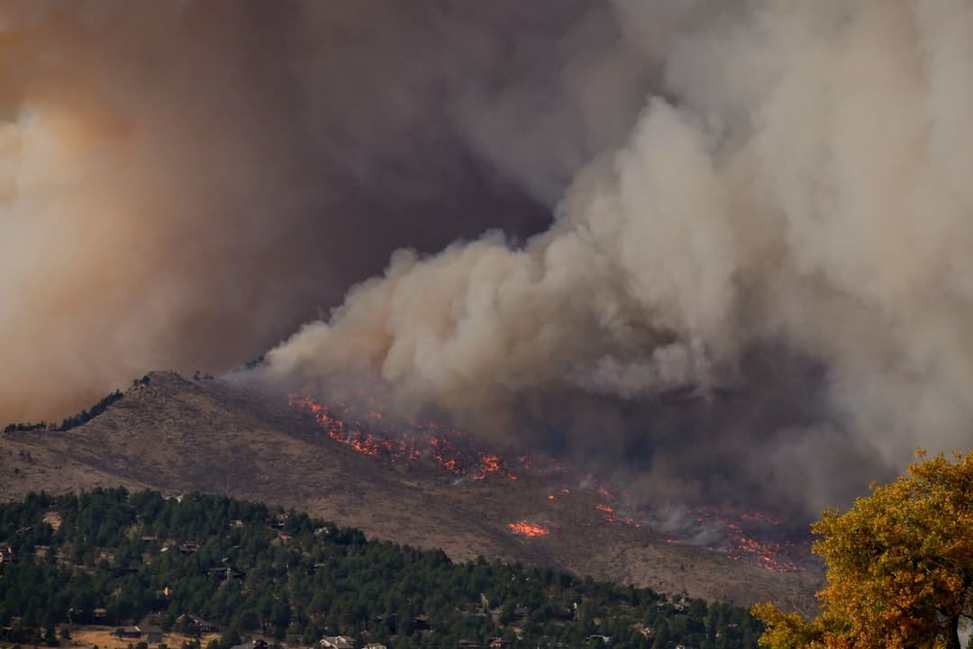
Forest fires, often referred to as wildfires, are uncontrolled blazes that occur in forested areas, grasslands, and other natural landscapes. These fires can arise from various sources, including lightning strikes, human activities, and even spontaneous combustion under certain conditions. The impact of forest fires is profound and multifaceted, affecting not only the immediate environment but also the broader ecological balance, air quality, and human health.
The destruction of vast tracts of forest can lead to habitat loss for countless species, disrupt carbon storage capabilities, and contribute to climate change through the release of stored carbon dioxide. The aftermath of a forest fire can be devastating. Ecosystems take years, if not decades, to recover from the destruction caused by intense heat and flames.
Soil erosion becomes a significant concern as vegetation that stabilizes the soil is lost, leading to increased runoff and potential flooding in nearby areas. Additionally, the smoke produced by forest fires can travel long distances, impacting air quality and posing health risks to populations far removed from the fire’s origin. The economic implications are also considerable; firefighting efforts can strain local and national resources, while tourism and recreation industries may suffer due to damaged landscapes.
Key Takeaways
- Forest fires cause significant environmental and economic damage, necessitating effective detection and management strategies.
- Traditional methods rely on human observation and basic tools, which can be slow and less accurate.
- Modern technology, including drones, satellites, AI, and machine learning, enhances early detection and prediction of forest fires.
- GIS and GPS integration improves coordination and resource allocation during fire management efforts.
- Future challenges include improving technology integration, real-time data sharing, and addressing climate change impacts on fire frequency.
Traditional Methods of Forest Fire Detection and Management
Historically, forest fire detection relied heavily on human observation and ground-based patrols. Fire lookout towers were strategically placed in remote areas, manned by observers who would scan the horizon for signs of smoke or flames. This method, while effective in some respects, was limited by visibility conditions and the availability of personnel.
Ground crews would often be dispatched to investigate reports of smoke or fire sightings, which could lead to delays in response times, especially in rugged terrain. In addition to lookout towers, traditional methods included controlled burns and firebreaks as preventive measures. Controlled burns involve intentionally setting small fires under controlled conditions to reduce fuel loads in a forested area.
This practice helps mitigate the risk of larger, uncontrolled wildfires by removing excess vegetation that could otherwise serve as fuel. Firebreaks, on the other hand, are cleared strips of land devoid of vegetation that act as barriers to slow or stop the spread of fire. While these methods have been foundational in wildfire management, they often require significant manpower and resources, making them less effective in the face of increasingly severe fire seasons exacerbated by climate change.
Advancements in Technology for Forest Fire Detection

The advent of technology has revolutionized the way forest fires are detected and managed. One of the most significant advancements has been the development of remote sensing technologies that allow for real-time monitoring of vast areas. Satellite imagery has become a critical tool for detecting changes in land cover and identifying potential fire outbreaks before they escalate.
Satellites equipped with thermal imaging sensors can detect heat signatures associated with wildfires, providing early warnings that enable quicker response times. Moreover, advancements in meteorological technology have improved our understanding of fire weather conditions. Weather stations equipped with sophisticated sensors can monitor temperature, humidity, wind speed, and precipitation levels—factors that significantly influence fire behavior.
The combination of satellite data and ground-based meteorological information creates a comprehensive picture that enhances situational awareness for firefighting teams.
Use of Drones and Satellites for Forest Fire Monitoring
Drones have emerged as a game-changing tool in forest fire monitoring and management. Equipped with high-resolution cameras and thermal imaging capabilities, drones can provide real-time aerial views of fire-affected areas. They can be deployed quickly to assess the extent of a fire, identify hotspots, and monitor changes in fire behavior without putting human lives at risk.
This aerial perspective allows incident commanders to make informed decisions about resource allocation and firefighting strategies. Satellites continue to play a crucial role in large-scale forest fire monitoring. For instance, NASA’s MODIS (Moderate Resolution Imaging Spectroradiometer) satellite provides daily images that help track active fires across the globe.
These images are invaluable for understanding fire spread patterns and assessing damage after a wildfire has occurred. Furthermore, satellite data can be used to analyze long-term trends in wildfire frequency and intensity, contributing to research on climate change impacts on forest ecosystems.
Artificial Intelligence and Machine Learning in Forest Fire Prediction
| Technology | Application | Impact on Detection | Impact on Management | Example Metrics |
|---|---|---|---|---|
| Satellite Imaging | Real-time monitoring of large forest areas | Early detection of smoke and heat signatures | Improved resource allocation and fire tracking | Detection time reduced by up to 50% |
| Drones | Close-range surveillance and hotspot identification | High-resolution imagery for precise fire location | Targeted firefighting and damage assessment | Response time improved by 30% |
| AI and Machine Learning | Predictive modeling and risk assessment | Identification of high-risk zones before fires start | Optimized deployment of firefighting resources | Accuracy of fire risk prediction up to 85% |
| IoT Sensors | Environmental monitoring (temperature, humidity, smoke) | Continuous real-time data for early fire alerts | Faster emergency response and evacuation planning | Alert time improved by 40% |
| Geographic Information Systems (GIS) | Mapping and analysis of fire spread patterns | Visualization of fire progression and hotspots | Strategic planning for containment and recovery | Containment efficiency increased by 25% |
Artificial intelligence (AI) and machine learning (ML) are increasingly being integrated into forest fire prediction models to enhance accuracy and efficiency. By analyzing vast datasets that include historical fire occurrences, weather patterns, vegetation types, and topographical features, AI algorithms can identify patterns that may not be immediately apparent to human analysts. These predictive models can forecast potential fire outbreaks with greater precision, allowing for proactive measures to be taken before a fire ignites.
For example, researchers have developed machine learning models that utilize satellite imagery combined with meteorological data to predict where fires are likely to occur based on current conditions.
The integration of AI into fire management systems not only aids in prediction but also optimizes resource allocation during firefighting efforts by identifying areas that may require more attention based on predicted fire behavior.
Integration of GIS and GPS for Efficient Forest Fire Management

Geographic Information Systems (GIS) and Global Positioning Systems (GPS) have become indispensable tools in modern forest fire management. GIS technology allows for the mapping and analysis of spatial data related to forests, including vegetation types, topography, and historical fire occurrences. This information is crucial for understanding how fires may spread across different landscapes and for planning effective firefighting strategies.
GPS technology enhances this capability by providing precise location data for firefighting crews and equipment. During an active wildfire event, GPS devices enable teams to navigate challenging terrains efficiently while coordinating their efforts with incident command centers. The integration of GIS and GPS facilitates real-time tracking of fire progression and resource deployment, ensuring that firefighting efforts are both timely and effective.
This synergy between spatial analysis and location tracking is vital for minimizing the impact of wildfires on both human communities and natural ecosystems.
Communication and Coordination Tools for Firefighters and Emergency Response Teams
Effective communication is paramount during wildfire incidents where rapid decision-making can mean the difference between containment and disaster. Modern communication tools have transformed how firefighters and emergency response teams coordinate their efforts on the ground. Mobile applications designed specifically for incident management allow teams to share real-time updates on fire status, resource availability, and safety concerns.
Additionally, platforms that integrate social media can provide valuable situational awareness by aggregating information from various sources, including eyewitness reports and local news updates. This information can be crucial for incident commanders who need to make informed decisions about evacuation orders or resource allocation. Furthermore, interoperability between different agencies—such as local fire departments, state forestry services, and federal agencies—has improved through standardized communication protocols and shared platforms that facilitate collaboration during large-scale wildfire events.
Future Trends and Challenges in Forest Fire Detection and Management
As climate change continues to alter weather patterns and increase the frequency of extreme weather events, the challenges associated with forest fire detection and management are likely to intensify. Future trends may include further advancements in technology that enhance predictive capabilities and improve response times. For instance, the development of more sophisticated AI algorithms could lead to even more accurate predictions regarding when and where fires are likely to ignite.
However, these advancements come with challenges. The increasing reliance on technology raises concerns about data privacy and security, particularly when using drones or satellite imagery that may capture sensitive information about private lands or communities. Additionally, as urban areas expand into wildland-urban interfaces (WUIs), the risk of human-caused fires increases, necessitating more comprehensive public education campaigns about fire safety.
Moreover, funding for wildfire management programs remains a critical issue as governments grapple with budget constraints while facing escalating costs associated with firefighting efforts. Balancing resource allocation between prevention measures—such as controlled burns—and reactive firefighting strategies will be essential for effective forest fire management in the future. In conclusion, while advancements in technology have significantly improved our ability to detect and manage forest fires, ongoing challenges related to climate change, funding, and public safety will require continued innovation and collaboration among stakeholders at all levels.
The future of forest fire management will depend on our ability to adapt to these challenges while leveraging new technologies to protect both natural ecosystems and human communities from the devastating impacts of wildfires.
In recent years, advancements in technology have significantly enhanced the methods used for forest fire detection and management, leading to more effective responses and better resource allocation. For a deeper understanding of how innovative solutions are being applied in various sectors, you might find the article on sustainable energy particularly insightful, as it explores the intersection of technology and environmental stewardship.
FAQs
What technologies are commonly used in forest fire detection?
Technologies commonly used in forest fire detection include satellite imaging, drones equipped with thermal cameras, remote sensing sensors, and artificial intelligence algorithms that analyze data to identify early signs of fire.
How do satellites help in detecting forest fires?
Satellites provide real-time or near-real-time images of large forested areas, allowing for early detection of smoke and heat signatures. They can monitor remote and inaccessible regions continuously, improving the speed and accuracy of fire detection.
What role do drones play in forest fire management?
Drones are used to survey affected areas, assess fire spread, and gather detailed thermal and visual data. They can access hard-to-reach locations, provide real-time information to firefighting teams, and help in planning containment strategies.
How does artificial intelligence improve forest fire detection?
Artificial intelligence (AI) analyzes large datasets from satellites, sensors, and weather reports to predict fire risks, detect anomalies, and provide early warnings. AI models can improve accuracy and reduce false alarms by learning from historical fire data.
Can technology help in managing forest fires once they start?
Yes, technology aids in managing forest fires by providing real-time monitoring, mapping fire perimeters, predicting fire behavior, and optimizing resource allocation. Tools like geographic information systems (GIS) and communication networks enhance coordination among firefighting teams.
Are there any environmental benefits to using technology in forest fire management?
Using technology can lead to quicker detection and more efficient firefighting, which helps minimize forest damage, reduce carbon emissions from fires, and protect wildlife habitats. Early intervention also reduces the overall environmental impact of forest fires.
Is technology alone sufficient to manage forest fires effectively?
While technology significantly improves detection and management, it is most effective when combined with traditional firefighting methods, community awareness, and proper forest management practices. Human expertise and decision-making remain crucial components.
How has technology evolved in recent years to improve forest fire detection?
Recent advancements include higher-resolution satellite imagery, more affordable and capable drones, improved sensor technology, and sophisticated AI algorithms. These developments have enhanced the speed, accuracy, and coverage of fire detection systems.
What challenges exist in implementing technology for forest fire detection?
Challenges include high costs, limited infrastructure in remote areas, data processing complexities, and the need for trained personnel to operate and interpret technological tools. Additionally, environmental factors like weather can affect sensor performance.
How can communities benefit from improved forest fire detection technology?
Improved detection technology enables earlier warnings, allowing communities to evacuate safely and protect property. It also supports better resource planning and reduces the risk of large-scale fires, contributing to overall public safety and environmental conservation.