The advent of drone technology has revolutionized various industries, with surveying and mapping standing out as one of the most significantly impacted fields. Drones, or unmanned aerial vehicles (UAVs), have transformed traditional methods of data collection, offering unprecedented efficiency, accuracy, and cost-effectiveness. Historically, surveying relied heavily on ground-based methods, which were often time-consuming and labor-intensive.
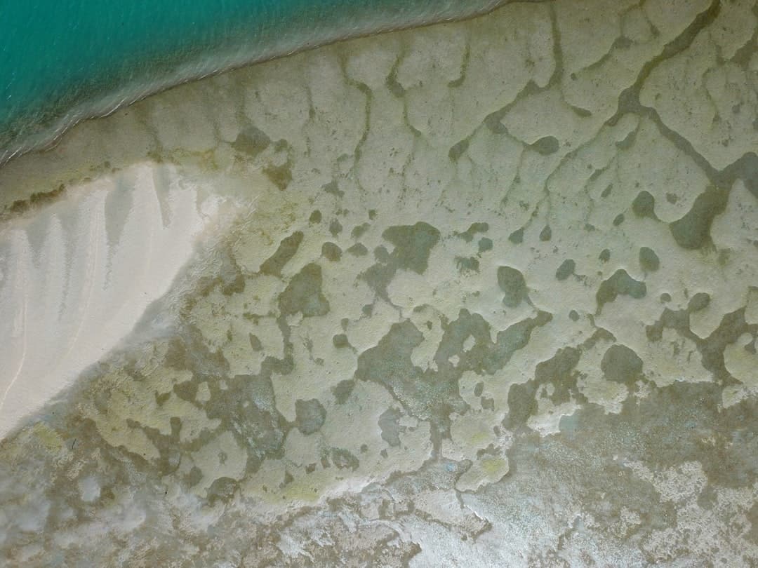
The integration of drones into this domain has not only streamlined processes but has also expanded the scope of what is possible in terms of data acquisition and analysis. Drones equipped with advanced sensors and imaging technology can capture high-resolution aerial imagery and collect geospatial data with remarkable precision. This capability allows surveyors and mapping professionals to create detailed topographical maps, 3D models, and orthophotos in a fraction of the time it would take using conventional techniques.
As the technology continues to evolve, the applications of drones in surveying and mapping are becoming increasingly diverse, ranging from construction site monitoring to environmental assessments and agricultural planning. The growing accessibility of drone technology is democratizing surveying practices, enabling a wider range of users to harness its potential.
Key Takeaways
- Drones have revolutionized surveying and mapping by providing a cost-effective and efficient way to collect data from the air.
- Non-professionals can benefit from using drones for surveying and mapping by gaining access to high-quality data and imagery without the need for specialized training or equipment.
- Drones make surveying and mapping accessible by allowing users to easily capture aerial data in remote or hard-to-reach areas.
- Drones play a crucial role in data collection and analysis by providing accurate and detailed information for various industries such as construction, agriculture, and environmental monitoring.
- Choosing the right drone for surveying and mapping involves considering factors such as payload capacity, flight time, and camera quality to ensure the best results for specific applications.
The Benefits of Using Drones for Non-Professionals
Increased Accessibility
Non-professionals can now easily deploy drones to survey hard-to-reach areas, such as rugged terrains or densely populated urban environments. This capability is particularly beneficial for landowners, farmers, and hobbyists who wish to monitor their properties or conduct environmental assessments without the need for extensive resources.
Affordability and Ease of Use
Drones have lowered the barrier to entry for non-professionals by providing an affordable alternative that can be operated by individuals with minimal training. With the availability of user-friendly drone models and software, non-professionals can now engage in surveying tasks that were once reserved for experts.
Informed Decision-Making
The ability to quickly gather data and generate visual representations empowers non-professionals to make informed decisions based on accurate information, enhancing their understanding of their surroundings.
How Drones Make Surveying and Mapping Accessible

The accessibility of drones in surveying and mapping is further enhanced by advancements in technology that have simplified the operation of UAVs. Many modern drones come equipped with intuitive flight control systems and automated features that allow users to plan and execute survey missions with ease. For instance, waypoint navigation enables users to set specific flight paths for the drone, ensuring that it captures data over designated areas without requiring constant manual control.
This automation reduces the learning curve for non-professionals, making it feasible for individuals with little to no prior experience in aerial surveying to successfully operate drones. Additionally, the proliferation of mobile applications designed for drone operation has made it easier than ever for users to manage their surveying projects. These applications often include features such as real-time data visualization, flight planning tools, and post-processing capabilities that allow users to analyze collected data on-the-go.
As a result, non-professionals can engage in surveying activities without needing extensive technical knowledge or specialized training. This democratization of technology not only empowers individuals but also fosters a culture of innovation as more people explore creative applications for drone-based surveying and mapping.
The Role of Drones in Data Collection and Analysis
Drones play a pivotal role in data collection and analysis within the realm of surveying and mapping. Equipped with various sensors—such as RGB cameras, multispectral sensors, LiDAR systems, and thermal imaging devices—drones can capture a wide array of data types that are invaluable for different applications. For example, multispectral sensors can be used in agriculture to assess crop health by capturing data across multiple wavelengths of light.
This information can help farmers make informed decisions regarding irrigation, fertilization, and pest management. Once data is collected, drones facilitate efficient analysis through advanced software solutions that can process large datasets quickly. Photogrammetry software can convert aerial images into detailed 3D models or orthomosaics, providing users with comprehensive visual representations of surveyed areas.
This capability is particularly useful for construction projects, where stakeholders need accurate site assessments to inform planning and development decisions. Furthermore, the integration of geographic information systems (GIS) with drone-collected data allows for sophisticated spatial analysis, enabling users to identify patterns and trends that may not be immediately apparent from raw data alone.
Choosing the Right Drone for Surveying and Mapping
Selecting the appropriate drone for surveying and mapping tasks is crucial for achieving optimal results. Various factors must be considered when making this decision, including the specific requirements of the project, budget constraints, and the type of data needed. For instance, if high-resolution imagery is a priority, drones equipped with high-quality cameras should be prioritized.
Conversely, if the project requires detailed elevation data or vegetation analysis, a drone with LiDAR capabilities may be more suitable. Another important consideration is flight time and range. Drones with longer battery life can cover larger areas in a single flight, reducing the need for frequent recharging or battery swaps during extensive surveying missions.
Additionally, payload capacity is essential when selecting a drone; it must be able to carry the necessary sensors without compromising flight stability or performance. Users should also evaluate the software compatibility of the drone with their preferred data processing tools to ensure a seamless workflow from data collection to analysis.
Best Practices for Using Drones in Surveying and Mapping

Pre-Flight Planning
Thorough pre-flight planning is critical, including conducting site assessments to identify potential obstacles such as trees, buildings, or power lines that could interfere with flight paths.
In-Flight Operations
During flight operations, maintaining a consistent altitude and speed is crucial for capturing high-quality data. Users should also consider implementing redundancy measures—such as using multiple batteries or backup drones—to mitigate risks associated with equipment failure during critical missions. Additionally, understanding local regulations regarding drone operations is vital to ensure compliance with airspace restrictions and safety guidelines.
Post-Flight Data Processing
Post-flight data processing should involve careful quality checks to ensure accuracy; this may include validating georeferencing points or conducting visual inspections of captured imagery before analysis.
Overcoming Challenges in Using Drones for Surveying and Mapping
Despite the numerous advantages that drones offer in surveying and mapping, several challenges persist that users must navigate effectively. One significant challenge is weather dependency; adverse conditions such as high winds, rain, or low visibility can hinder flight operations and compromise data quality. To address this issue, users should monitor weather forecasts closely and develop contingency plans for rescheduling flights when conditions are unfavorable.
Another challenge lies in regulatory compliance. Different regions have varying laws governing drone usage, including restrictions on altitude limits, no-fly zones, and requirements for pilot certification. Staying informed about these regulations is essential for avoiding legal complications that could arise from non-compliance.
Future Trends and Innovations in Drone Technology for Surveying and Mapping
The future of drone technology in surveying and mapping is poised for exciting advancements that will further enhance capabilities and applications. One notable trend is the integration of artificial intelligence (AI) into drone operations. AI algorithms can analyze vast amounts of data collected by drones in real-time, enabling automated decision-making processes that improve efficiency in data interpretation.
For instance, AI could assist in identifying anomalies in agricultural fields or detecting changes in land use over time. Additionally, advancements in battery technology are expected to extend flight times significantly, allowing drones to cover larger areas without interruption. Innovations such as solar-powered drones may also emerge, providing sustainable solutions for long-duration missions.
Furthermore, the development of swarming technology—where multiple drones operate collaboratively—could revolutionize large-scale surveying projects by enabling simultaneous data collection from multiple perspectives. As drone technology continues to evolve, its applications in surveying and mapping will likely expand into new domains such as disaster response, urban planning, and environmental monitoring. The ongoing research into improved sensor technologies will enhance data accuracy and broaden the range of measurable parameters, making drones an indispensable tool across various sectors.
If you are interested in technology that can simplify tasks for non-professionals, you may also want to check out this article on how to choose a PC for students. Just like drones can make surveying and mapping easier, having the right computer can greatly enhance the learning experience for students.
FAQs
What are drones used for in surveying and mapping?
Drones are used in surveying and mapping to capture aerial imagery and data, which can be used to create accurate maps, 3D models, and topographic surveys.
How do drones simplify surveying and mapping for non-professionals?
Drones simplify surveying and mapping for non-professionals by providing an accessible and cost-effective way to capture aerial data. They can be operated with minimal training and can cover large areas quickly.
What are the benefits of using drones for surveying and mapping?
The benefits of using drones for surveying and mapping include increased efficiency, reduced costs, improved safety, and the ability to capture high-resolution imagery and data from unique perspectives.
What types of non-professionals can benefit from using drones for surveying and mapping?
Non-professionals such as farmers, landowners, real estate agents, and environmental enthusiasts can benefit from using drones for surveying and mapping to gather data for land management, property assessment, and environmental monitoring.
Are there any regulations or restrictions for using drones in surveying and mapping?
Yes, there are regulations and restrictions for using drones in surveying and mapping, including obtaining the necessary permits and following airspace regulations set by aviation authorities. It’s important to be aware of and comply with these regulations when using drones for surveying and mapping.