The advent of drone technology has revolutionized various sectors, and environmental conservation is no exception. Drones, or unmanned aerial vehicles (UAVs), have emerged as powerful tools in the fight against deforestation and the promotion of reforestation efforts. Their ability to access hard-to-reach areas, gather data, and perform tasks with precision makes them invaluable in managing and restoring forest ecosystems.
As the world grapples with the consequences of climate change, habitat loss, and biodiversity decline, the integration of drones into reforestation strategies offers innovative solutions that can enhance efficiency and effectiveness. Reforestation is not merely about planting trees; it involves a comprehensive understanding of ecological dynamics, soil health, and local biodiversity. Drones facilitate this understanding by providing high-resolution aerial imagery and data analytics that can inform decision-making processes.
By leveraging drone technology, conservationists can monitor forest health, assess the impact of human activities, and implement targeted interventions. This synergy between technology and environmental stewardship is paving the way for a more sustainable future, where reforestation efforts are not only more effective but also more scalable.
Key Takeaways
- Drones play a crucial role in reforestation efforts by providing efficient and cost-effective solutions for monitoring and mapping forests.
- Seed bombing and planting using drones have shown promising results in restoring degraded areas and increasing forest cover.
- Aerial spraying of fertilizers and pesticides with drones helps in maintaining the health and productivity of forests while minimizing environmental impact.
- Drones are effective in detecting and combating deforestation by providing real-time data and surveillance of illegal logging activities.
- Wildlife monitoring and conservation efforts benefit from the use of drones, which provide valuable insights into animal populations and habitat conditions.
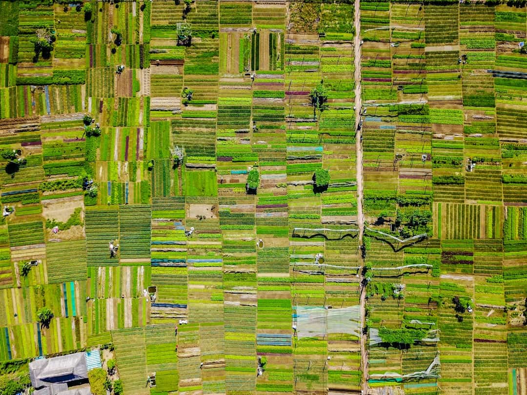
Monitoring and Mapping of Forests
One of the primary applications of drones in reforestation is the monitoring and mapping of forested areas. Traditional methods of forest assessment often involve labor-intensive ground surveys that can be time-consuming and costly. Drones equipped with high-resolution cameras and sensors can cover vast areas in a fraction of the time, capturing detailed images that reveal critical information about forest structure, species composition, and health.
This aerial perspective allows researchers to create accurate maps that highlight changes in forest cover over time, enabling them to identify areas in need of restoration. For instance, in regions affected by logging or natural disasters, drones can quickly assess the extent of damage and provide data that informs reforestation strategies. By utilizing multispectral imaging, drones can detect variations in vegetation health that are invisible to the naked eye.
This capability is particularly useful for identifying stressed or diseased trees, allowing conservationists to prioritize interventions. Furthermore, the data collected can be integrated into Geographic Information Systems (GIS), facilitating sophisticated analyses that support long-term forest management planning.
Seed Bombing and Planting

Seed bombing is an innovative technique that has gained traction in reforestation efforts, and drones play a pivotal role in its execution. This method involves encasing seeds in nutrient-rich balls of clay or compost, which are then dispersed from the air over targeted areas. Drones can efficiently cover large tracts of land, ensuring that seeds reach remote or inaccessible locations where traditional planting methods would be impractical.
This approach not only saves time but also minimizes soil disturbance and reduces the risk of seed predation by animals. The effectiveness of seed bombing is enhanced by the precision with which drones can operate. Equipped with GPS technology, drones can be programmed to release seed bombs at specific intervals and altitudes, optimizing the chances of successful germination.
For example, in regions where deforestation has led to soil degradation, seed bombs can be designed to include species that are particularly resilient to harsh conditions. This targeted approach increases the likelihood of establishing diverse and robust ecosystems that can thrive in challenging environments.
Aerial Spraying of Fertilizers and Pesticides
In addition to planting seeds, drones are increasingly being utilized for aerial spraying of fertilizers and pesticides in reforestation projects. This application is particularly beneficial in large-scale operations where manual spraying would be inefficient and labor-intensive. Drones equipped with spraying systems can deliver precise amounts of nutrients or pest control agents directly to the target areas, ensuring that resources are used efficiently while minimizing environmental impact.
The ability to conduct aerial spraying with drones allows for timely interventions that can significantly enhance tree growth and survival rates. For instance, when newly planted saplings are at risk from pests or nutrient deficiencies, drones can quickly apply protective measures without disturbing the surrounding ecosystem. Moreover, advancements in drone technology have led to the development of smart spraying systems that utilize sensors to detect plant health and adjust application rates accordingly.
This level of precision not only conserves resources but also reduces the risk of chemical runoff into surrounding habitats.
Detecting and Combating Deforestation
Drones are proving to be invaluable allies in the ongoing battle against deforestation. Their ability to monitor vast landscapes in real-time allows for early detection of illegal logging activities and other forms of environmental degradation. Equipped with high-resolution cameras and thermal imaging sensors, drones can identify changes in forest cover that may indicate unauthorized land clearing or encroachment.
This capability enables authorities and conservation organizations to respond swiftly to threats before they escalate. In addition to monitoring deforestation, drones can also assist in enforcement efforts by providing evidence for legal actions against violators. High-quality aerial imagery captured by drones can serve as documentation for illegal activities, supporting investigations and prosecutions.
Furthermore, community engagement is enhanced through drone technology; local populations can be trained to operate drones for monitoring purposes, fostering a sense of ownership over their natural resources while empowering them to take action against deforestation.
Wildlife Monitoring and Conservation

The intersection of drone technology and wildlife conservation is another area where significant advancements are being made. Drones offer a non-intrusive means of monitoring wildlife populations and their habitats without disturbing their natural behaviors. By capturing aerial footage and employing thermal imaging, researchers can track animal movements, assess population densities, and identify critical habitats that require protection.
For example, in regions where endangered species are at risk from habitat loss or poaching, drones can be deployed to conduct surveillance over large areas.
Additionally, drones can be used to survey nesting sites or breeding grounds, allowing conservationists to gather essential information on reproductive success rates and habitat conditions.
Fire Detection and Management
Forest fires pose a significant threat to ecosystems worldwide, exacerbated by climate change and human activities. Drones have emerged as a crucial tool for fire detection and management due to their ability to cover extensive areas quickly and provide real-time data on fire behavior. Equipped with thermal imaging cameras, drones can detect hotspots that may indicate potential fire outbreaks long before they become uncontrollable.
In addition to early detection, drones play a vital role in fire management strategies by assisting firefighting teams with situational awareness. Aerial imagery captured during active fires provides critical information on fire spread patterns, allowing responders to make informed decisions about containment strategies.
Challenges and Future Opportunities for Drones in Reforestation
Despite the numerous advantages that drones offer in reforestation efforts, several challenges remain that must be addressed for their full potential to be realized. Regulatory hurdles pose significant obstacles; many countries have strict regulations governing drone usage that can limit their deployment in conservation projects. Navigating these regulations requires collaboration between conservation organizations, government agencies, and technology developers to create frameworks that facilitate responsible drone use while ensuring safety.
Moreover, technical limitations such as battery life, payload capacity, and data processing capabilities can hinder the effectiveness of drone operations in large-scale reforestation initiatives. As technology continues to advance, there is an opportunity for innovation in drone design that could enhance their capabilities for environmental applications. The integration of artificial intelligence (AI) and machine learning algorithms could further improve data analysis processes, enabling more sophisticated insights into forest dynamics.
The future opportunities for drones in reforestation are vast. As awareness grows regarding climate change and biodiversity loss, there is an increasing demand for efficient reforestation solutions. Drones could play a pivotal role in scaling up restoration efforts globally by providing cost-effective methods for monitoring ecosystems, planting trees, and managing resources sustainably.
Collaborative initiatives that combine drone technology with community engagement will likely yield significant benefits as local populations become active participants in reforestation efforts. In conclusion, the integration of drone technology into reforestation practices represents a transformative shift in how we approach environmental conservation. From monitoring forests to combating deforestation and enhancing wildlife conservation efforts, drones are proving to be indispensable tools in our quest for a sustainable future.
As we continue to explore the potential of this technology, it is essential to address existing challenges while fostering innovation that will enable us to harness the full power of drones for reforestation on a global scale.
A related article to How Drones Are Supporting Reforestation Efforts Globally is “Uncovering the Best Order Flow Trading Software: In-Depth Reviews and Analysis” which discusses the importance of utilizing advanced software tools in various industries. To read more about the best software for project management, visit this link.
FAQs
What are drones?
Drones, also known as unmanned aerial vehicles (UAVs), are aircraft that are operated without a human pilot on board. They can be controlled remotely by a human operator or autonomously by onboard computers.
How are drones used in reforestation efforts?
Drones are used in reforestation efforts to survey and map areas for planting, to plant seeds, and to monitor the growth and health of newly planted trees. They can cover large areas quickly and efficiently, making them a valuable tool for reforestation projects.
What are the benefits of using drones for reforestation?
Using drones for reforestation efforts can significantly reduce the time and cost involved in surveying, planting, and monitoring trees. Drones can access hard-to-reach areas, collect high-resolution data, and operate in challenging environmental conditions, making them a valuable asset for reforestation projects.
Where are drones being used for reforestation efforts?
Drones are being used for reforestation efforts globally, in a variety of environments including forests, wetlands, and degraded landscapes. They have been deployed in countries such as Brazil, Australia, Canada, and the United States to support reforestation initiatives.
What are the challenges of using drones for reforestation?
Challenges of using drones for reforestation include regulatory restrictions, limited payload capacity for carrying seeds and planting equipment, and the need for skilled operators and maintenance. Additionally, weather conditions and terrain can impact the effectiveness of drone operations in reforestation efforts.