The rapid urbanization of the 21st century has led to an unprecedented increase in vehicular traffic, creating a pressing need for effective traffic management systems. Smart cities, characterized by their use of technology to enhance urban living, have begun to adopt real-time traffic monitoring as a critical component of their infrastructure. This approach not only aims to alleviate congestion but also seeks to improve safety, reduce emissions, and enhance the overall quality of life for residents.
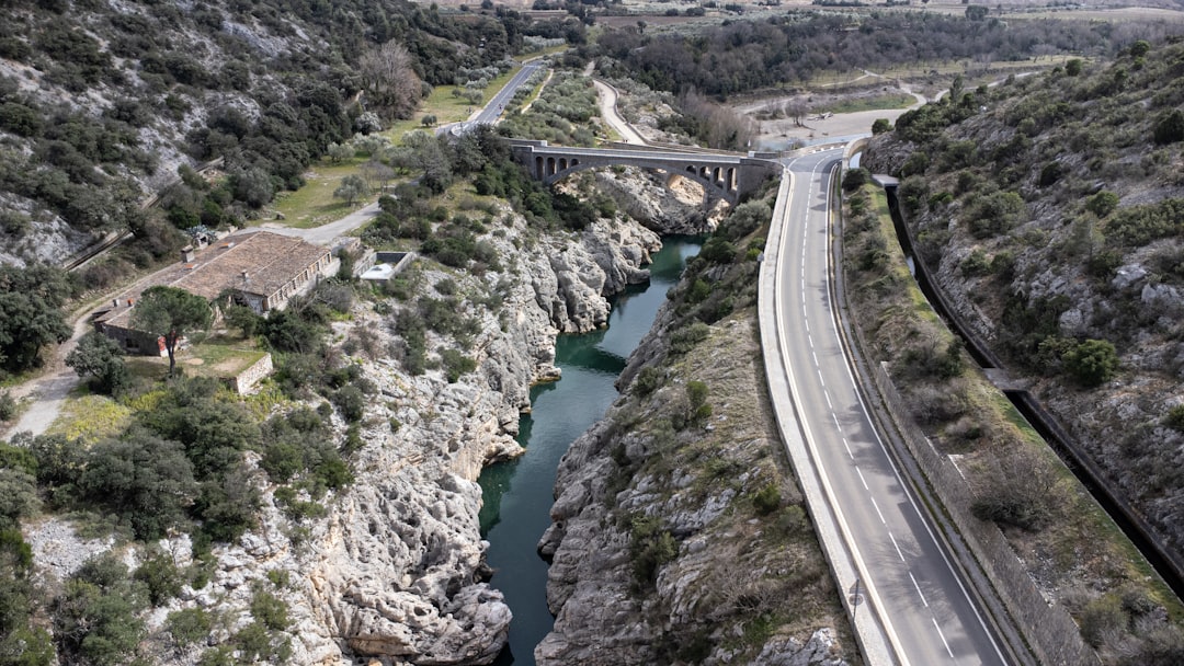
Real-time traffic monitoring systems leverage various technologies, including sensors, cameras, and data analytics, to provide immediate insights into traffic conditions, enabling city planners and traffic management authorities to make informed decisions. In this context, the integration of advanced technologies such as drones has emerged as a transformative solution. Drones offer a unique aerial perspective that can capture real-time data over large areas, providing a comprehensive view of traffic patterns and behaviors.
This capability is particularly valuable in urban environments where traditional monitoring methods may fall short due to physical obstructions or limited coverage. As cities continue to evolve into smart ecosystems, the role of drones in real-time traffic monitoring is becoming increasingly significant, paving the way for innovative approaches to urban mobility and infrastructure management.
Key Takeaways
- Real-time traffic monitoring is crucial for smart cities to manage traffic flow and improve overall transportation efficiency.
- Drones play a significant role in real-time traffic monitoring by providing aerial views and collecting data in a cost-effective and efficient manner.
- Using drones for traffic monitoring offers advantages such as flexibility, accessibility to hard-to-reach areas, and reduced operational costs.
- Challenges and limitations of drone-based traffic monitoring include regulatory restrictions, privacy concerns, and limitations in adverse weather conditions.
- Integrating drone data with smart city traffic management systems can enhance decision-making processes and improve overall traffic management efficiency.
The Role of Drones in Real-Time Traffic Monitoring
Enhanced Traffic Monitoring Capabilities
This aerial perspective enables the observation of traffic flow, vehicle density, and even driver behavior in ways that ground-based systems cannot achieve. Drones can be deployed quickly and cover vast areas in a fraction of the time it would take traditional monitoring methods, such as ground patrols or fixed cameras.
Real-Time Traffic Insights and Adaptability
Moreover, drones can be programmed to follow specific flight paths or respond dynamically to changing traffic conditions. For instance, during peak hours or special events, drones can be dispatched to monitor congested areas and provide real-time feedback to traffic management centers.
Proactive Traffic Management Solutions
This capability not only enhances situational awareness but also allows for proactive measures to be taken, such as rerouting traffic or deploying additional resources where needed. The agility and adaptability of drones make them an invaluable asset in the ongoing quest for smarter traffic management solutions.
Advantages of Using Drones for Traffic Monitoring

The advantages of employing drones for traffic monitoring are manifold. One of the most significant benefits is their ability to provide real-time data that is both accurate and comprehensive. Traditional traffic monitoring systems often rely on fixed sensors that may miss critical information during peak congestion times or in areas with limited coverage.
Drones, on the other hand, can be deployed at strategic locations to capture data from multiple angles and perspectives, ensuring a more holistic understanding of traffic dynamics. Additionally, drones can significantly reduce operational costs associated with traffic monitoring. The deployment of ground-based personnel and equipment can be resource-intensive, requiring substantial investment in infrastructure and maintenance.
Drones, however, can operate autonomously or with minimal human intervention, reducing labor costs and allowing for more efficient allocation of resources. Furthermore, the data collected by drones can be processed using advanced analytics tools, enabling city planners to identify trends and patterns that inform long-term traffic management strategies. Another advantage lies in the ability of drones to enhance public safety.
By providing real-time information about accidents or hazardous conditions, drones can facilitate quicker responses from emergency services. For example, if a drone detects a collision on a busy highway, it can relay this information instantly to traffic management centers, allowing for immediate action to be taken to mitigate further incidents.
Challenges and Limitations of Drone-Based Traffic Monitoring
Despite their numerous advantages, the use of drones for traffic monitoring is not without challenges. One significant limitation is regulatory compliance. Many countries have stringent regulations governing the use of drones, particularly in urban areas where airspace is crowded and complex.
Navigating these regulations can pose hurdles for city planners and traffic management authorities looking to implement drone-based solutions. Additionally, concerns about privacy and data security must be addressed, as drones equipped with cameras can inadvertently capture sensitive information about individuals and properties. Another challenge is the technical limitations associated with drone operations.
Factors such as battery life, weather conditions, and signal interference can impact the effectiveness of drone deployments. For instance, adverse weather conditions like heavy rain or strong winds can hinder a drone’s ability to fly safely and collect data accurately. Furthermore, while drones can cover large areas quickly, they may still require coordination with other monitoring systems to ensure comprehensive coverage across an entire city.
Moreover, integrating drone technology into existing traffic management frameworks can be complex. Many cities rely on legacy systems that may not be compatible with the data formats or communication protocols used by drones. This lack of interoperability can create silos of information that hinder effective decision-making.
To fully realize the potential of drone-based traffic monitoring, cities must invest in upgrading their infrastructure and ensuring seamless integration between various technologies.
Integration of Drone Data with Smart City Traffic Management Systems
The successful integration of drone data into smart city traffic management systems is crucial for maximizing the benefits of aerial monitoring. By combining drone-collected data with existing traffic information from sensors and cameras, cities can create a more comprehensive picture of traffic conditions. This integration allows for enhanced data analytics capabilities, enabling city planners to identify trends and make informed decisions based on real-time insights.
For instance, when drone data is combined with historical traffic patterns from fixed sensors, it becomes possible to predict congestion hotspots before they occur. This predictive capability allows for proactive measures to be implemented, such as adjusting traffic signal timings or deploying additional public transport options during peak hours. Furthermore, integrating drone data with geographic information systems (GIS) can provide valuable insights into how urban design impacts traffic flow, helping planners make more informed decisions about infrastructure development.
Additionally, the integration process requires robust communication networks capable of handling large volumes of data in real time. As cities increasingly adopt Internet of Things (IoT) technologies, establishing reliable connectivity between drones and traffic management systems becomes essential. This connectivity not only facilitates data transfer but also enables remote control and monitoring of drone operations, enhancing overall efficiency.
Case Studies of Successful Drone-Based Traffic Monitoring in Smart Cities

Several cities around the world have successfully implemented drone-based traffic monitoring systems that serve as exemplary models for others to follow.
The Dubai Police Department utilizes drones equipped with high-definition cameras to survey major roadways and gather real-time data on vehicle movement.
This information is then analyzed to optimize traffic signal timings and improve overall road safety. Another notable case is Los Angeles, where city officials have experimented with drone technology to monitor traffic during major events such as concerts and sports games. By deploying drones over key areas during these events, officials can assess crowd movement and adjust traffic management strategies accordingly.
The insights gained from these operations have proven invaluable in reducing congestion and enhancing public safety during high-traffic situations. In Singapore, the Land Transport Authority has embraced drone technology as part of its broader smart mobility strategy. Drones are used not only for real-time traffic monitoring but also for conducting aerial surveys that inform urban planning decisions.
By analyzing drone-collected data alongside other transportation metrics, Singapore has been able to implement targeted interventions that improve overall mobility within the city-state.
Future Developments and Innovations in Drone-Based Traffic Monitoring
As technology continues to advance at a rapid pace, the future of drone-based traffic monitoring holds exciting possibilities. One area poised for innovation is the development of autonomous drones capable of operating without human intervention. These drones could be programmed to follow predetermined flight paths or respond dynamically to changing traffic conditions based on real-time data analysis.
Additionally, advancements in artificial intelligence (AI) and machine learning could enhance the analytical capabilities of drone-collected data. By employing sophisticated algorithms to analyze patterns in traffic behavior, cities could gain deeper insights into factors contributing to congestion or accidents. This knowledge could inform more effective traffic management strategies tailored to specific urban environments.
Furthermore, the integration of drones with other emerging technologies such as 5G networks could revolutionize real-time data transmission capabilities. With faster communication speeds and lower latency, drones could relay information instantaneously to traffic management centers, enabling quicker decision-making processes during critical situations. Moreover, as public acceptance of drone technology grows, there may be opportunities for community engagement initiatives that involve citizens in the monitoring process.
For instance, residents could be encouraged to report incidents or provide feedback through mobile applications linked to drone operations. This collaborative approach could foster a sense of ownership among citizens while enhancing the effectiveness of drone-based monitoring efforts.
The Impact of Drones on Real-Time Traffic Monitoring in Smart Cities
The integration of drones into real-time traffic monitoring represents a significant advancement in urban mobility management within smart cities. By providing accurate and timely data from an aerial perspective, drones enhance situational awareness for city planners and traffic authorities alike. While challenges remain regarding regulatory compliance and technical limitations, successful case studies demonstrate the potential for drones to transform how cities approach traffic management.
As technology continues to evolve, the future holds promise for even greater innovations in drone-based monitoring systems. With advancements in AI, autonomous operations, and enhanced connectivity through 5G networks on the horizon, cities are poised to leverage these developments for improved urban mobility solutions. Ultimately, the impact of drones on real-time traffic monitoring will play a crucial role in shaping smarter cities that prioritize efficiency, safety, and quality of life for their residents.
One related article that complements the discussion on how drones are enhancing real-time traffic monitoring in smart cities is “Discover the Best Free Software for Translation Today.” This article explores the various software options available for translation purposes, which can be crucial for ensuring effective communication and data analysis in smart city initiatives. By utilizing the best translation software, smart cities can enhance their ability to process and understand data collected by drones for traffic monitoring. To learn more about the best free software for translation, check out the article here.
FAQs
What are drones?
Drones, also known as unmanned aerial vehicles (UAVs), are aircraft that are operated without a human pilot on board. They can be controlled remotely by a human operator or autonomously by onboard computers.
How are drones being used for real-time traffic monitoring in smart cities?
Drones are being used in smart cities to provide real-time traffic monitoring by capturing aerial footage of traffic patterns, congestion, and accidents. This data is then used to improve traffic management, optimize road infrastructure, and enhance public safety.
What are the benefits of using drones for real-time traffic monitoring?
Using drones for real-time traffic monitoring in smart cities offers several benefits, including the ability to gather data from unique vantage points, cover large areas quickly and efficiently, and provide real-time updates on traffic conditions. This can lead to more effective traffic management and improved overall transportation systems.
What technologies are used in conjunction with drones for real-time traffic monitoring?
In addition to drones, technologies such as high-resolution cameras, sensors, GPS, and data analytics are often used to enhance real-time traffic monitoring in smart cities. These technologies help to capture and analyze traffic data, identify patterns, and make informed decisions for traffic management.
What are the challenges of using drones for real-time traffic monitoring?
Challenges of using drones for real-time traffic monitoring include regulatory restrictions, privacy concerns, weather conditions, and the need for skilled operators. Additionally, integrating drone data with existing traffic management systems and ensuring data accuracy and reliability are also important considerations.