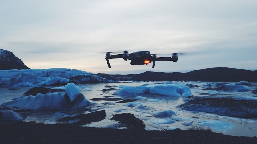
Aerial surveying has undergone a significant transformation in recent years, primarily due to the advent of drone technology. Traditionally, aerial surveys were conducted using manned aircraft, which involved considerable costs, logistical challenges, and safety concerns. The introduction of unmanned aerial vehicles (UAVs), commonly known as drones, has revolutionized this field by providing a more accessible, efficient, and versatile means of capturing high-resolution aerial imagery and data.
Drones equipped with advanced sensors and cameras can cover vast areas in a fraction of the time it would take conventional methods, making them an invaluable tool for various industries, including agriculture, construction, mining, and environmental monitoring.
Smaller companies and organizations that previously could not afford traditional aerial survey methods can now leverage drone technology to obtain precise data for their projects.
This shift has opened up new opportunities for innovation and collaboration across sectors, as stakeholders can now utilize real-time data to make informed decisions. As drone technology continues to evolve, the potential applications for aerial surveying are expanding, paving the way for more sophisticated analyses and insights.
Key Takeaways
- Aerial surveying with drones is revolutionizing the way data is collected for mapping, monitoring, and modeling of landscapes and structures.
- Drones offer advantages such as accessibility to hard-to-reach areas, reduced time and cost, and improved safety for surveying tasks.
- Precision mapping and 3D modeling with drones enable accurate and detailed representations of terrain, infrastructure, and environmental features.
- The use of drones in aerial surveying improves efficiency and cost-effectiveness by streamlining data collection and analysis processes.
- Environmental benefits of using drones for aerial surveying include reduced carbon emissions, minimized disturbance to ecosystems, and improved monitoring of environmental changes.
Advantages of Using Drones for Aerial Surveying
One of the most significant advantages of using drones for aerial surveying is their ability to capture high-resolution imagery from various altitudes and angles. Drones can be equipped with a range of sensors, including RGB cameras, multispectral cameras, and LiDAR systems, allowing them to gather diverse types of data tailored to specific surveying needs. This flexibility enables surveyors to create detailed maps and models that are crucial for planning and decision-making processes.
For instance, in agriculture, drones can capture multispectral images that help farmers assess crop health by analyzing vegetation indices, leading to more targeted interventions. Moreover, drones can operate in challenging environments where traditional surveying methods may be impractical or hazardous. For example, surveying remote or rugged terrains can pose significant risks to human surveyors and require extensive resources for access.
Drones can easily navigate these areas, capturing data without putting personnel at risk. This capability is particularly beneficial in disaster response scenarios, where rapid assessments are needed to evaluate damage and plan recovery efforts. The ability to deploy drones quickly in such situations can significantly enhance the effectiveness of emergency response teams.
Precision Mapping and 3D Modeling with Drones

Drones have become synonymous with precision mapping and 3D modeling due to their ability to collect vast amounts of geospatial data with remarkable accuracy. Using photogrammetry techniques, drones can stitch together thousands of images taken from different angles to create detailed 2D maps and 3D models of the surveyed area. This process involves sophisticated software that analyzes overlapping images to generate accurate representations of terrain features, structures, and vegetation.
The resulting maps can be used for various applications, including urban planning, infrastructure development, and environmental assessments. The accuracy of drone-based mapping is further enhanced by the use of ground control points (GCPs), which are physical markers placed on the ground that provide reference points for georeferencing the aerial imagery. By incorporating GCPs into the surveying process, surveyors can achieve centimeter-level accuracy in their maps and models.
This level of precision is crucial for projects that require detailed planning and analysis, such as construction projects where precise measurements are essential for compliance with regulations and design specifications. Additionally, the ability to update maps and models quickly allows stakeholders to monitor changes over time, facilitating better management of resources and infrastructure.
Improved Efficiency and Cost-Effectiveness in Aerial Surveying
The efficiency gains associated with drone technology are one of its most compelling advantages in aerial surveying. Drones can cover large areas in a fraction of the time it would take traditional methods, significantly reducing the duration of survey projects. For example, a drone can survey a 100-acre site in a matter of hours, while a manned aircraft might take days to achieve similar results.
This rapid data collection not only accelerates project timelines but also allows for quicker decision-making processes. In industries where time is critical—such as construction or disaster response—this efficiency can translate into substantial cost savings. Cost-effectiveness is another key benefit of using drones for aerial surveying.
The operational costs associated with drones are generally lower than those of manned aircraft or ground-based surveying methods. Drones require less fuel, fewer personnel, and reduced equipment maintenance costs. Furthermore, the initial investment in drone technology has decreased significantly as the market has matured, making it more accessible for businesses of all sizes.
As a result, organizations can allocate resources more effectively and invest in other critical areas of their operations while still obtaining high-quality survey data.
Environmental Benefits of Using Drones for Aerial Surveying
The environmental benefits of using drones for aerial surveying are becoming increasingly recognized as sustainability becomes a priority across various sectors. Drones are inherently more environmentally friendly than traditional surveying methods that rely on manned aircraft or extensive ground vehicles. The lower carbon footprint associated with drone operations is a significant advantage in an era where reducing greenhouse gas emissions is crucial for combating climate change.
By minimizing fuel consumption and reducing the need for extensive ground access, drones contribute to more sustainable surveying practices. Additionally, drones can play a vital role in environmental monitoring and conservation efforts. For instance, they can be used to assess deforestation rates, monitor wildlife populations, and track changes in land use over time.
By providing accurate and timely data on environmental conditions, drones enable researchers and conservationists to make informed decisions about resource management and habitat protection. In agriculture, drones equipped with multispectral sensors can help farmers implement precision farming techniques that optimize resource use while minimizing environmental impact. This approach not only enhances productivity but also promotes sustainable practices that benefit ecosystems.
Regulatory and Safety Considerations for Drone Aerial Surveying

As drone technology continues to advance and its applications expand, regulatory frameworks governing their use have become increasingly important. In many countries, aviation authorities have established guidelines that dictate how drones can be operated safely and legally. These regulations often include requirements for pilot certification, operational limits (such as altitude restrictions), and no-fly zones near airports or populated areas.
Compliance with these regulations is essential for ensuring the safety of both drone operators and the public. Safety considerations also extend beyond regulatory compliance; they encompass risk management practices that drone operators must adopt to mitigate potential hazards during aerial surveys. This includes conducting thorough pre-flight checks to ensure equipment functionality, assessing weather conditions before flights, and implementing fail-safe measures such as return-to-home features in case of signal loss or battery depletion.
Additionally, operators should be trained in emergency response protocols to address any unforeseen incidents during operations. By prioritizing safety and adhering to regulatory guidelines, drone operators can minimize risks while maximizing the benefits of aerial surveying.
Future Innovations in Drone Aerial Surveying Technology
The future of drone aerial surveying is poised for remarkable innovations that will further enhance capabilities and applications across various industries. One area of development is the integration of artificial intelligence (AI) and machine learning algorithms into drone systems. These technologies can enable drones to analyze data in real-time during flights, allowing for immediate insights and decision-making based on the collected information.
For instance, AI-powered drones could identify anomalies in crop health or detect structural issues in buildings as they survey an area. Another promising innovation is the advancement of autonomous flight capabilities. While many drones currently require manual piloting or pre-programmed flight paths, future models may operate entirely autonomously using advanced navigation systems and obstacle avoidance technologies.
This would allow drones to conduct complex surveys without direct human intervention while ensuring safety through real-time adjustments based on environmental conditions. Additionally, improvements in battery technology could extend flight times significantly, enabling drones to cover larger areas without needing frequent recharges.
Case Studies: Successful Applications of Drones in Aerial Surveying
Numerous case studies illustrate the successful application of drones in aerial surveying across various sectors. In agriculture, a notable example is the use of drones by precision agriculture companies like DroneDeploy and AgEagle Aerial Systems. These companies have implemented drone technology to help farmers monitor crop health through multispectral imaging.
By analyzing vegetation indices derived from drone imagery, farmers can identify areas requiring irrigation or fertilization adjustments, leading to increased yields and reduced resource waste. In the construction industry, companies like Skanska have adopted drone technology for site surveys and progress monitoring. By utilizing drones equipped with high-resolution cameras and LiDAR sensors, Skanska can create accurate 3D models of construction sites that facilitate better project management and communication among stakeholders.
This approach not only enhances efficiency but also helps identify potential issues early in the construction process, ultimately saving time and costs. These case studies exemplify how drone technology is transforming aerial surveying practices across diverse fields by providing innovative solutions that enhance data collection accuracy, efficiency, and overall project outcomes. As more organizations recognize the potential benefits of integrating drones into their operations, it is likely that we will see an even broader range of applications emerge in the coming years.
If you are interested in technology and innovation, you may also enjoy reading about the com/best-laptops-for-kids-2023/’>best laptops for kids in 2023.
Just like drones are revolutionizing aerial surveying, laptops are essential tools for education and entertainment for children. Check out this article to find the perfect laptop for your young ones.
FAQs
What is aerial surveying?
Aerial surveying is the process of collecting geospatial data from the air using various technologies such as cameras, LiDAR, and GPS to create maps, 3D models, and other geographic information.
How are drones used in aerial surveying?
Drones are used in aerial surveying to capture high-resolution imagery and LiDAR data from the air. They can fly at low altitudes and cover large areas quickly, making them ideal for surveying projects.
What are the benefits of using drones for aerial surveying?
Using drones for aerial surveying offers several benefits, including cost-effectiveness, efficiency, safety, and the ability to capture high-quality data with precision.
How do drones enhance precision in aerial surveying?
Drones enhance precision in aerial surveying by capturing high-resolution imagery and LiDAR data, which can be used to create highly accurate maps and 3D models. They also allow for more frequent and consistent data collection, leading to better overall precision.
What industries benefit from the use of drones in aerial surveying?
Several industries benefit from the use of drones in aerial surveying, including construction, agriculture, mining, environmental monitoring, and infrastructure inspection.
Are there any regulations or restrictions for using drones in aerial surveying?
Yes, there are regulations and restrictions for using drones in aerial surveying, including obtaining the necessary permits and following airspace regulations set by aviation authorities. It’s important to comply with these regulations to ensure safe and legal operation of drones for aerial surveying.